11425
Sold Out
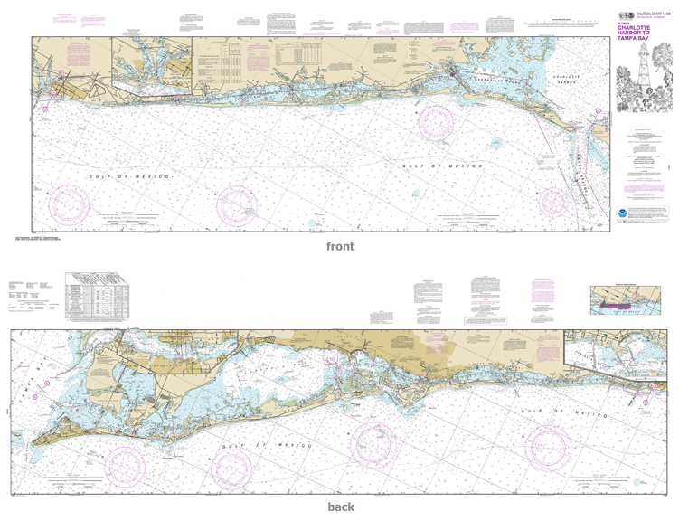
Official NOAA chart for Intracoastal Waterway Charlotte Harbor to Tampa Bay (a two sided chart)
These popular NOAA small craft charts are printed front and back. By default we ship them rolled on our heavy, durable, cruising paper with waterproof ink. They fold nicely in quarters or thirds if you have the space.
If, however, you would like them printed on lighter, water resistant, paper and have Frugal Navigator fold them "road map" style, as they were originally designed, please choose that option from the drop down menu. Alternatively, you could have them shipped in a five panel fold to fit our Small Craft Chart Case.
(Note: The slightly higher price for the folded charts does reflect an increase in labor costs since, we've found, folding machines destroy as many maps as they fold.)
This chart meets the requirements for mandatory carriage of nautical charts established by the U.S. Coast Guard and published in Titles 33 and 46, Code of Federal Regulations, including requirements for updating.
If you plan to use this chart for wall mounting or other artistic purposes, CLICK HERE
© 2025 FrugalNavigator.com. POS and Ecommerce by Shopify