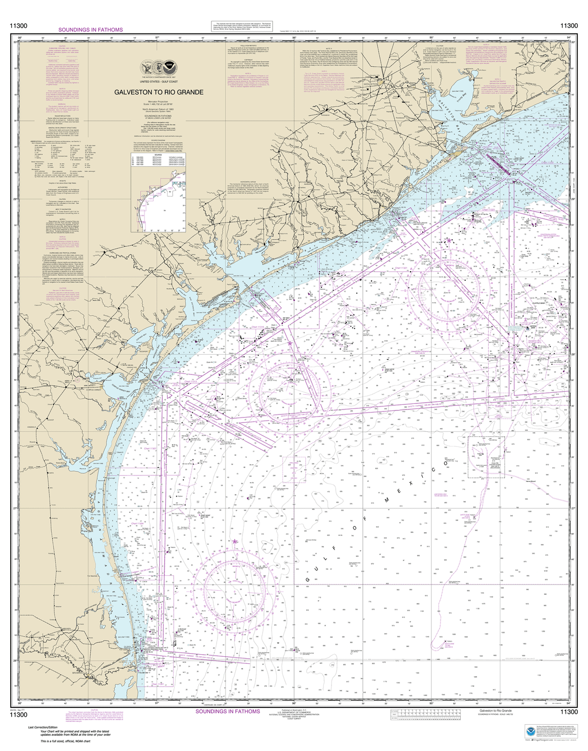
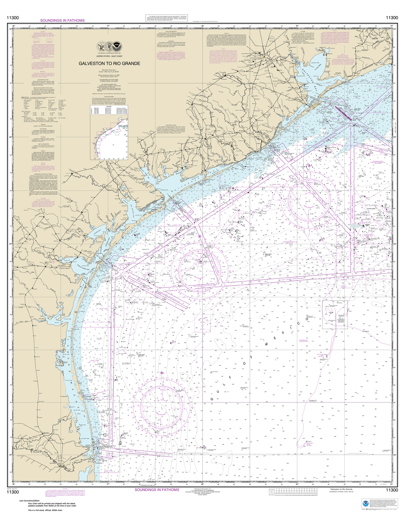
Large Area Charts For Eastern US

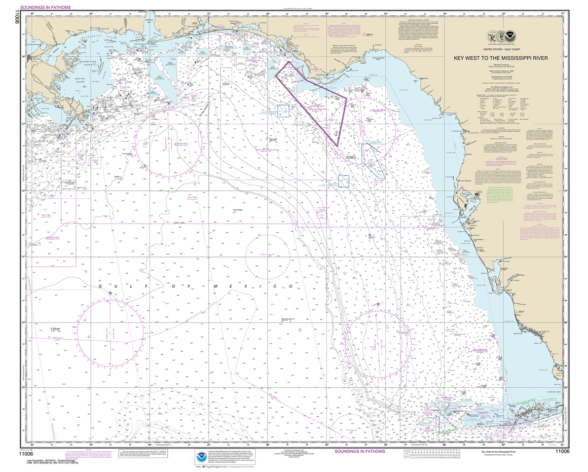

11006
$ 18.95 $ 27.00
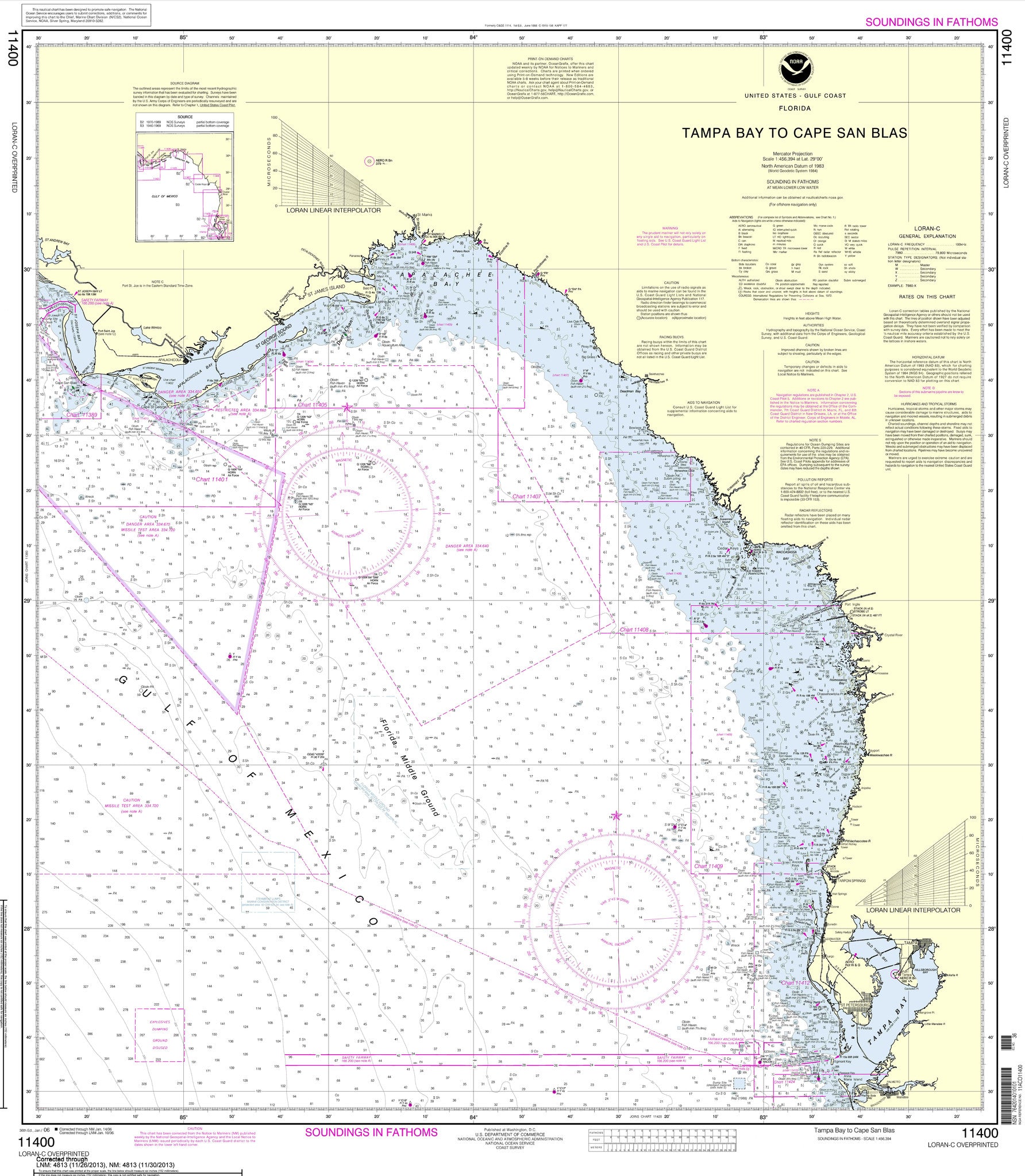
Official NOAA Chart of the Gulf Coast from Key West to Mississippi River Standard Chart is 36" tall by 45" wide If you would prefer a smaller, lighter and less...


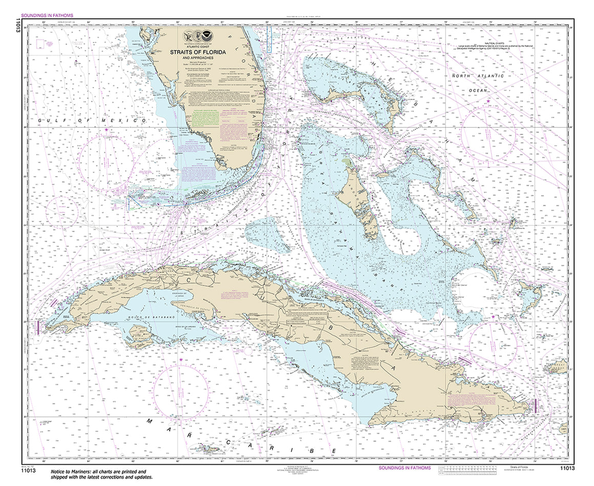
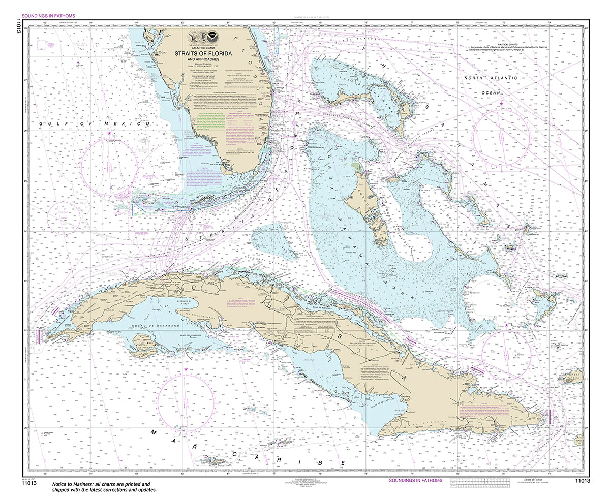
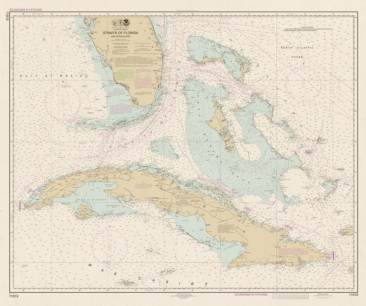
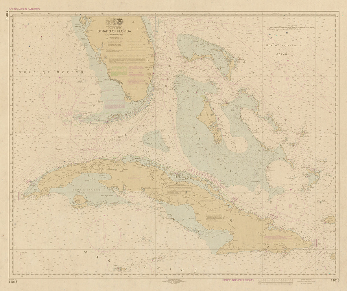
11013
$ 18.95 $ 27.00
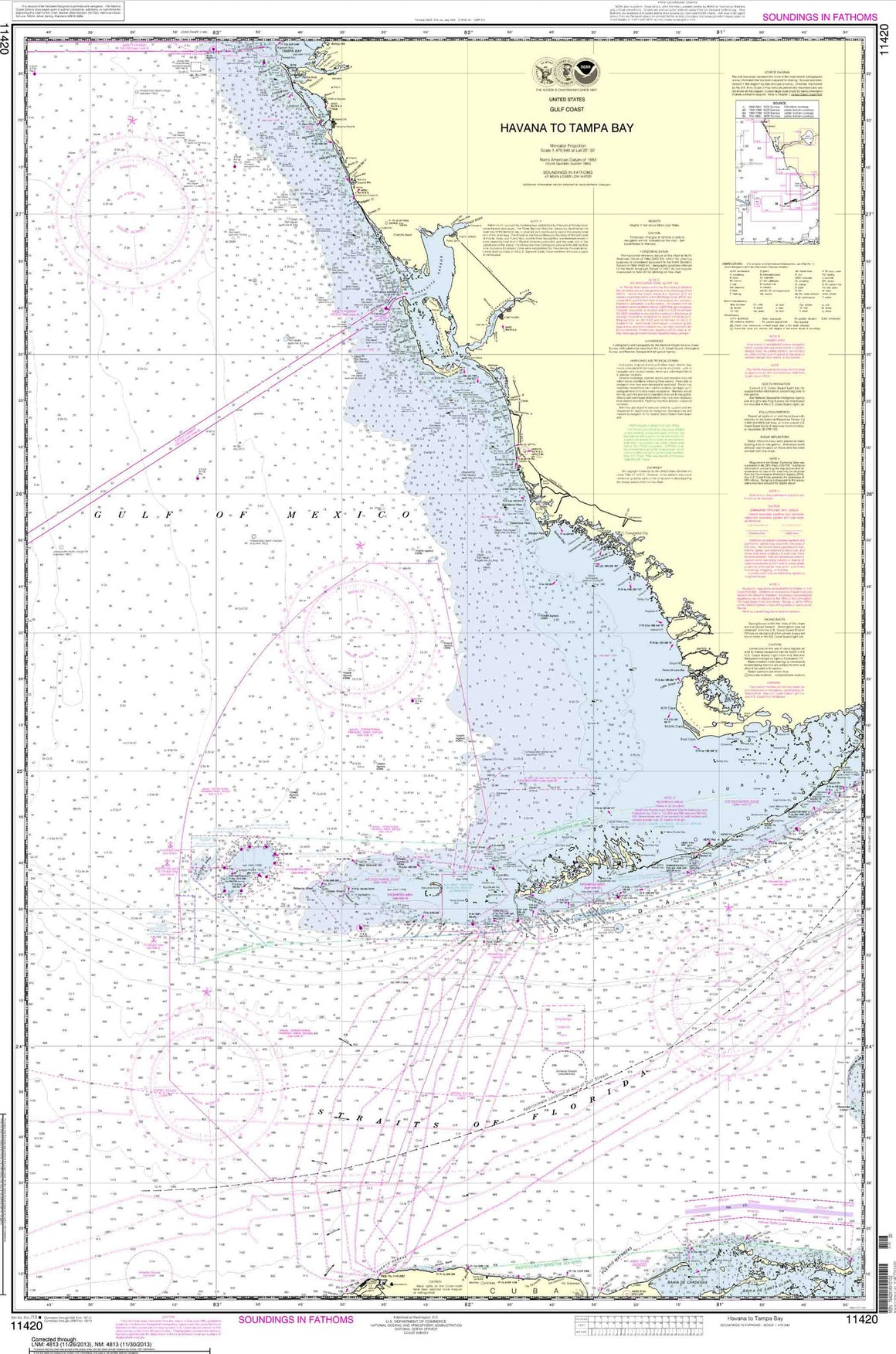
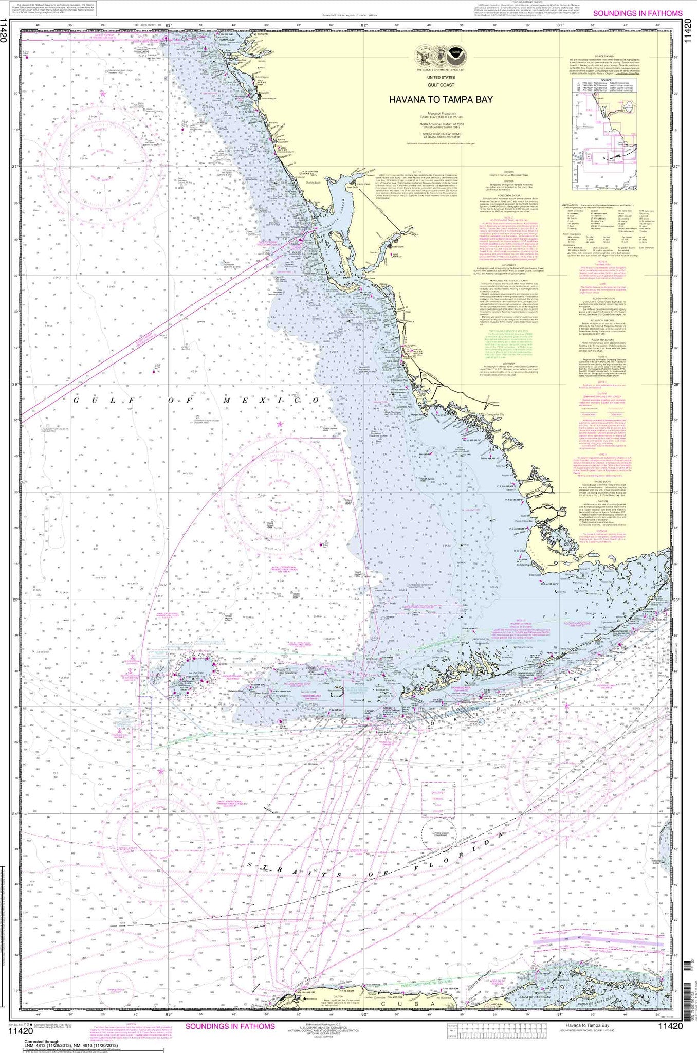
Official NOAA Chart for the Straits of Florida and Approaches Standard size: 43" wide by 36" tall If you plan to use this chart for wall mounting or other artistic...


11013 Wall Chart Options
$ 18.95
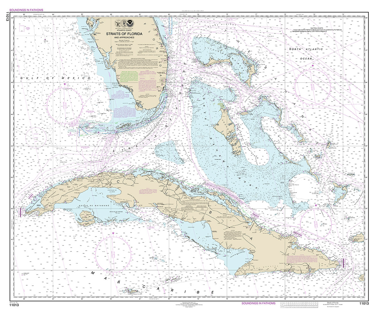
Straits of Florida and Approaches (not intended for navigation) Full Size: 43" wide by 36" tall Poster Size: 30" wide by 24" tall If you do not see the size...


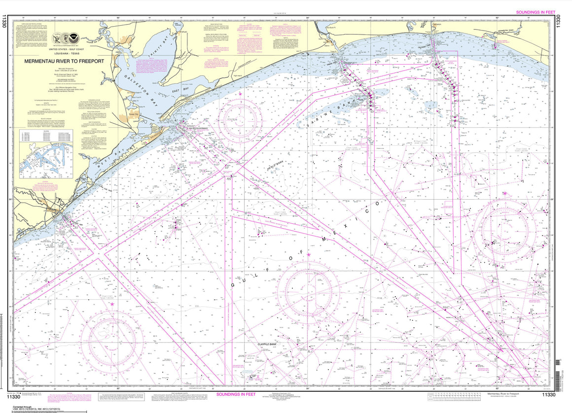
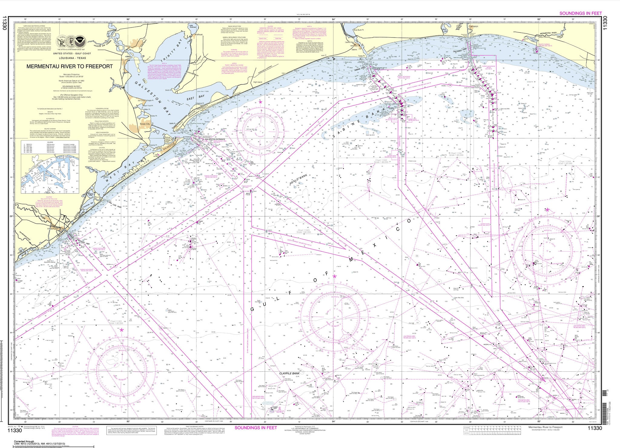

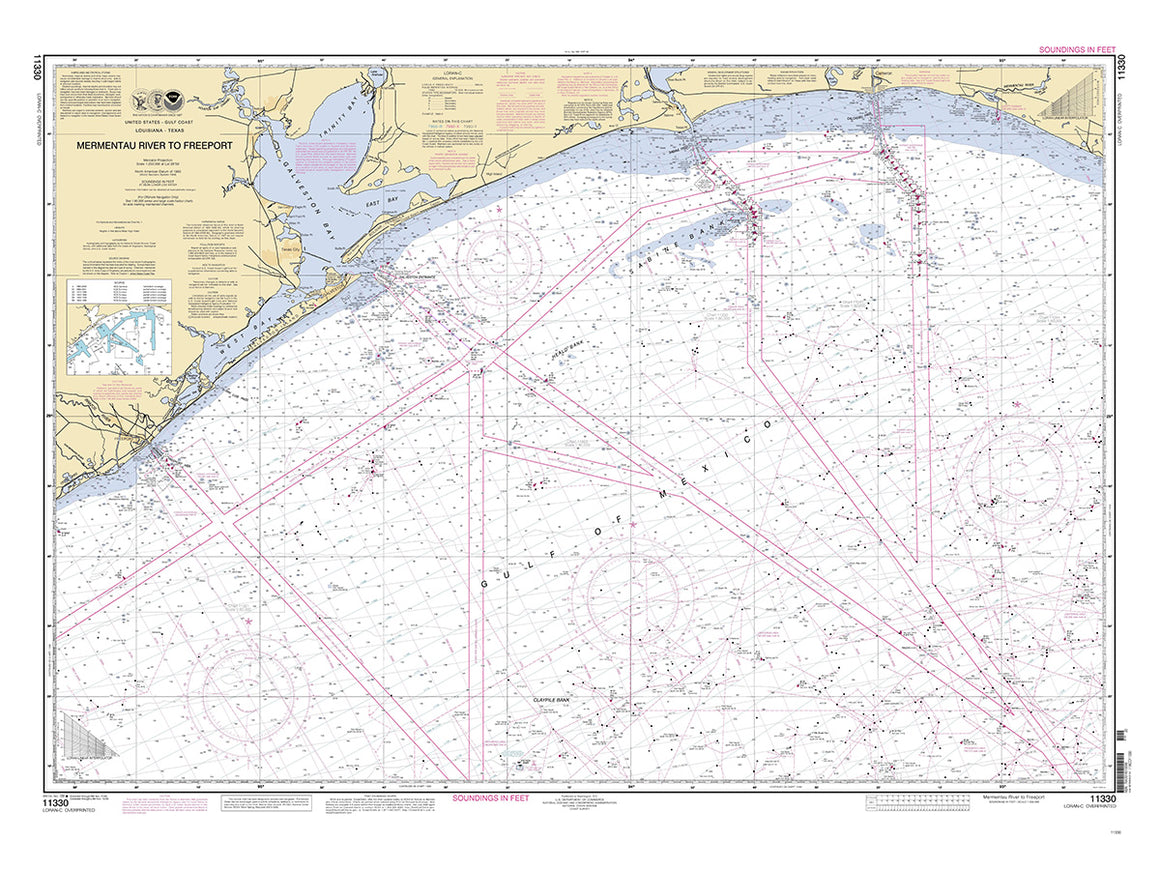

11330 with Loran C (Historical Chart)
$ 18.95
This is a historical chart that is not intended for navigation 36" tall by 48" wide 20th edition 2009


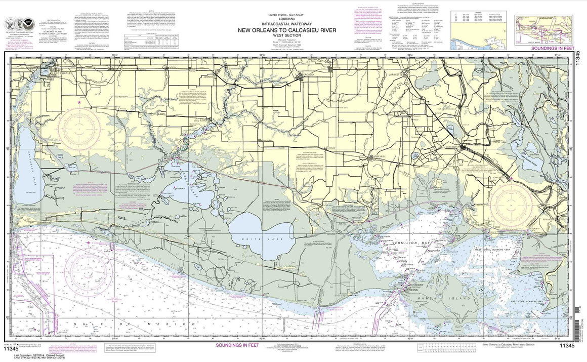
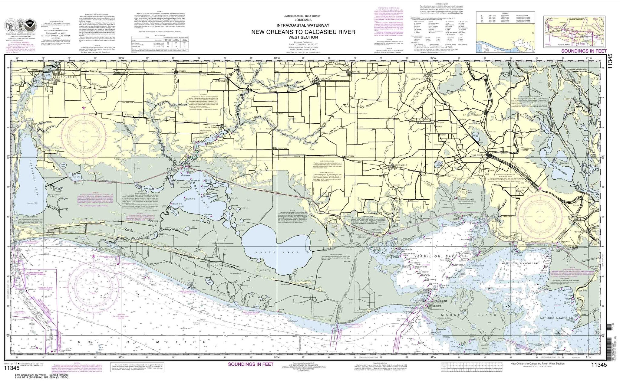
11345
$ 18.95 $ 27.00
Intracoastal Waterway New Orleans to Calcasieu River West Section

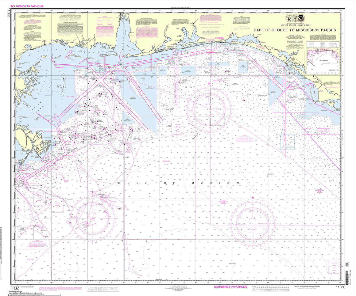
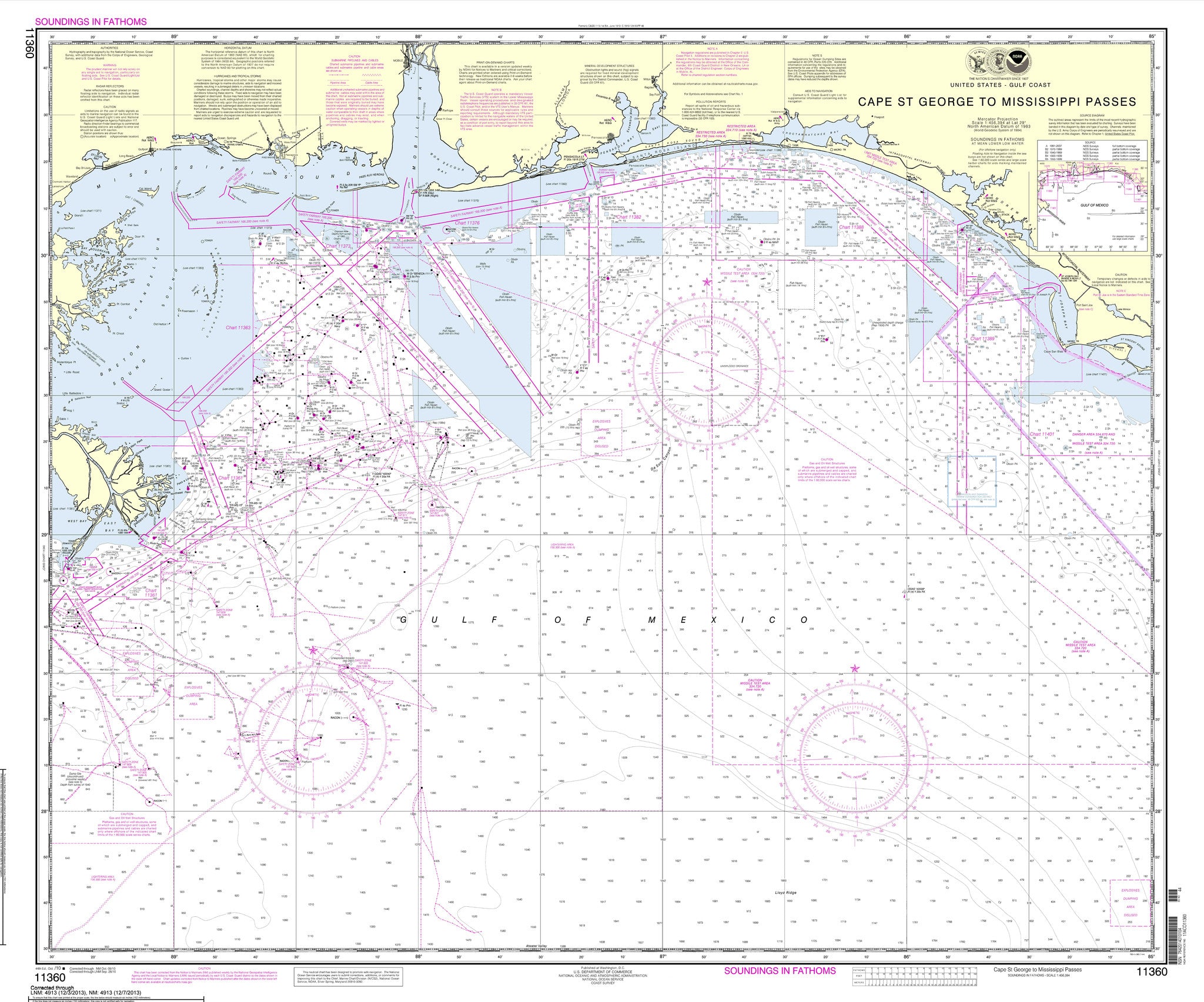
11360
$ 18.95 $ 27.00
Official NOAA Chart of the Gulf Coast from Cape St. George to Mississippi Passes 42 inches wide by 36 inches tall


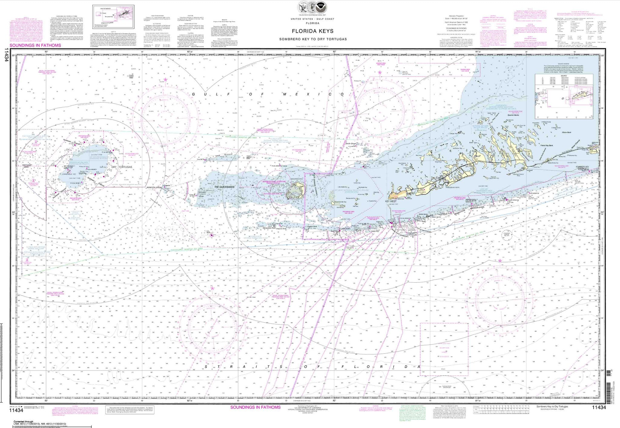
11434
$ 18.95 $ 27.00
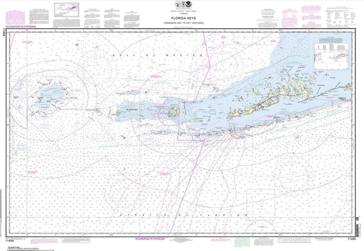
Florida Keys Sombrero Key to Dry Tortugas 48 inches wide by 35 inches tall

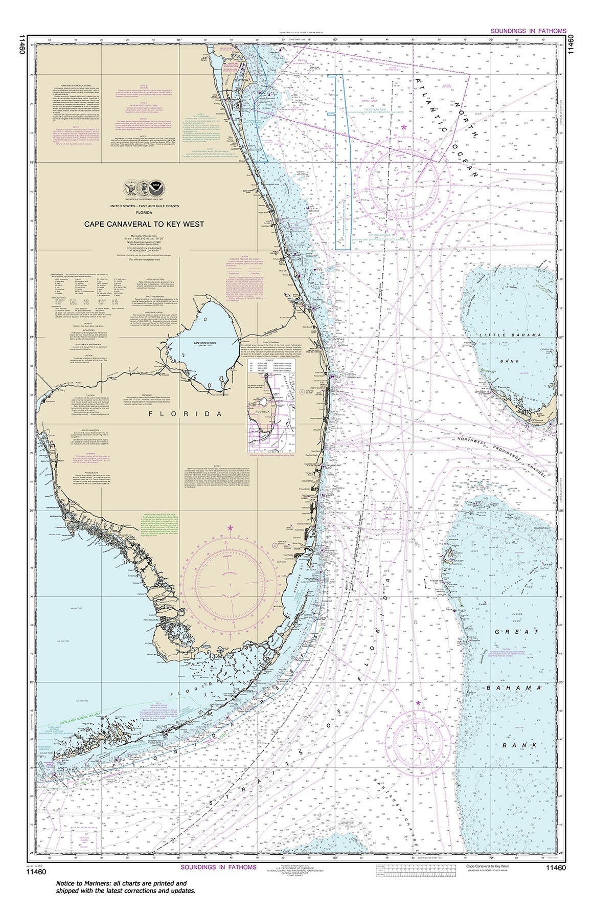

11460
$ 18.95 $ 27.00
Official NOAA chart for Cape Canaveral to Key West Standard size: 36" wide x 50" tall If you plan to use this chart for wall mounting or other artistic purposes,...

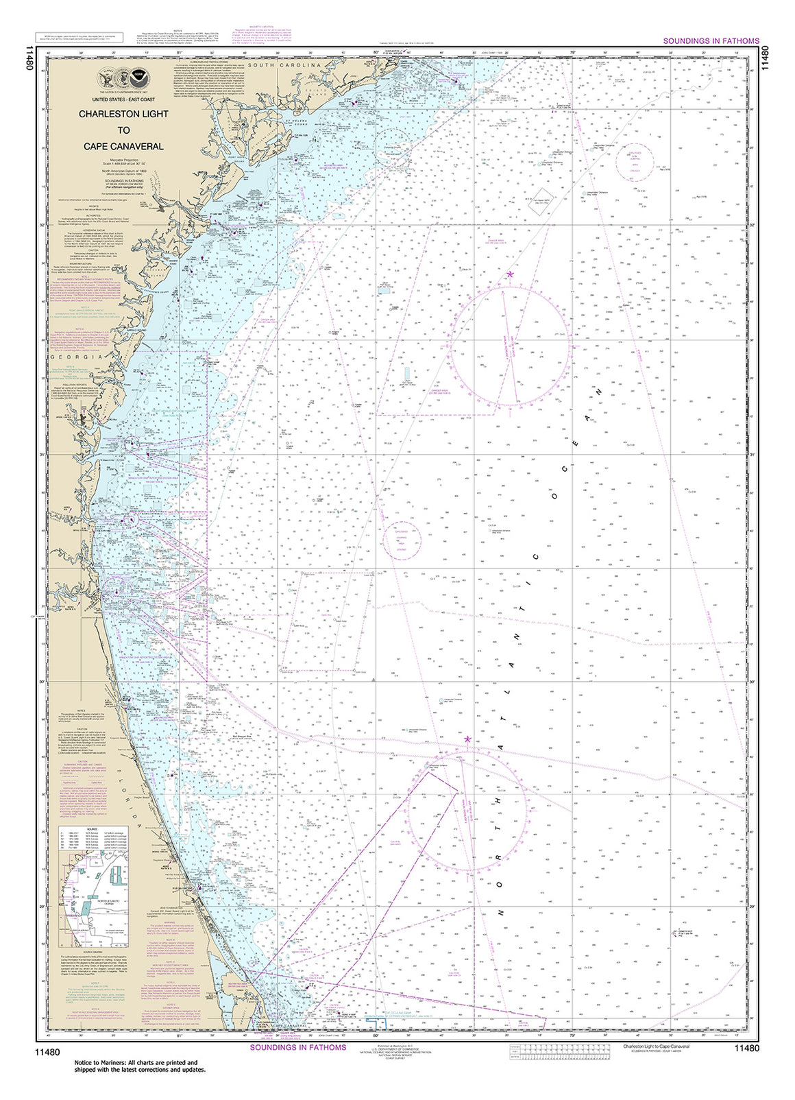
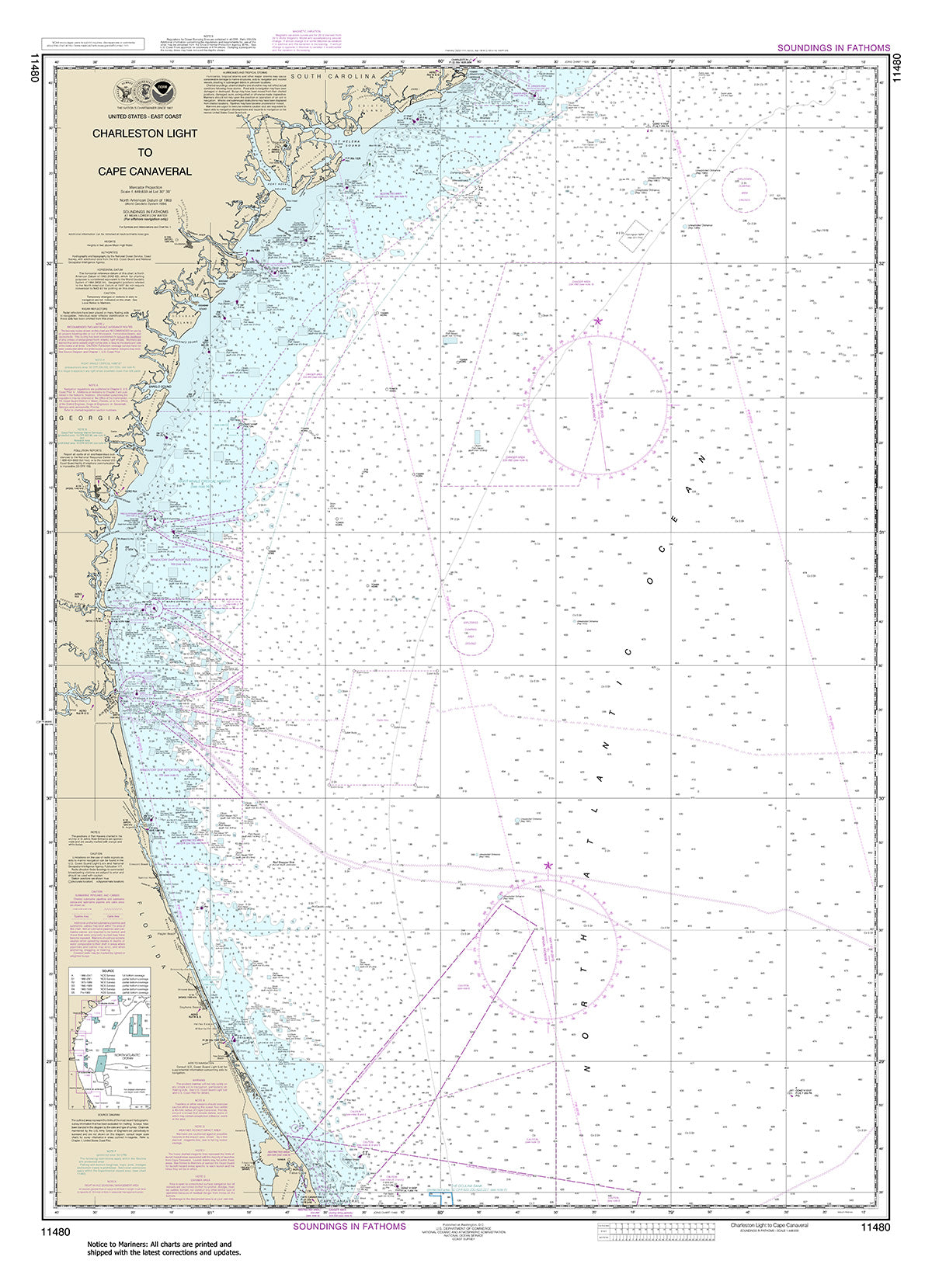
11480
$ 18.95 $ 27.00
Official NOAA Chart from Charleston Light to Cape Canaveral Standard size: 34" wide by 47" tall If you would prefer a smaller, lighter and less bulky format, you may want...

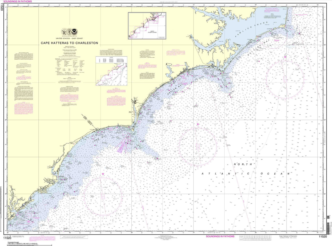


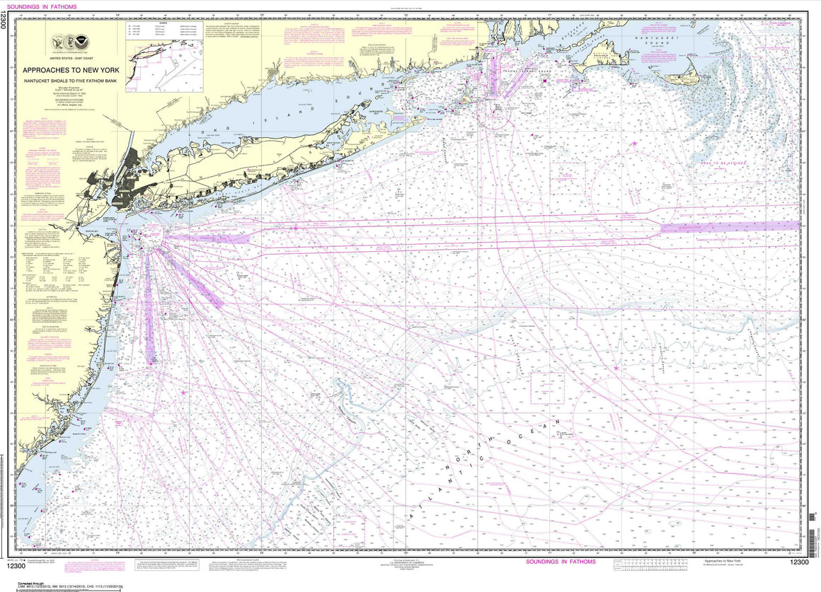

12300
$ 18.95 $ 27.00
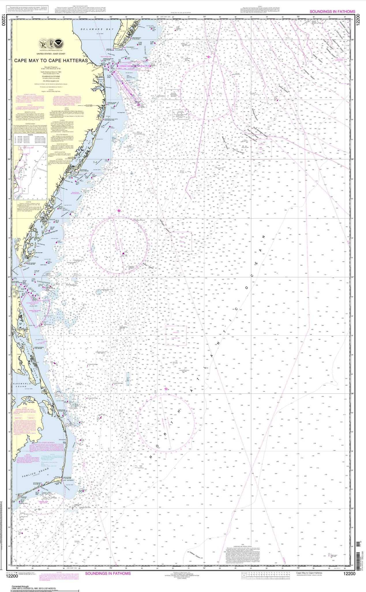
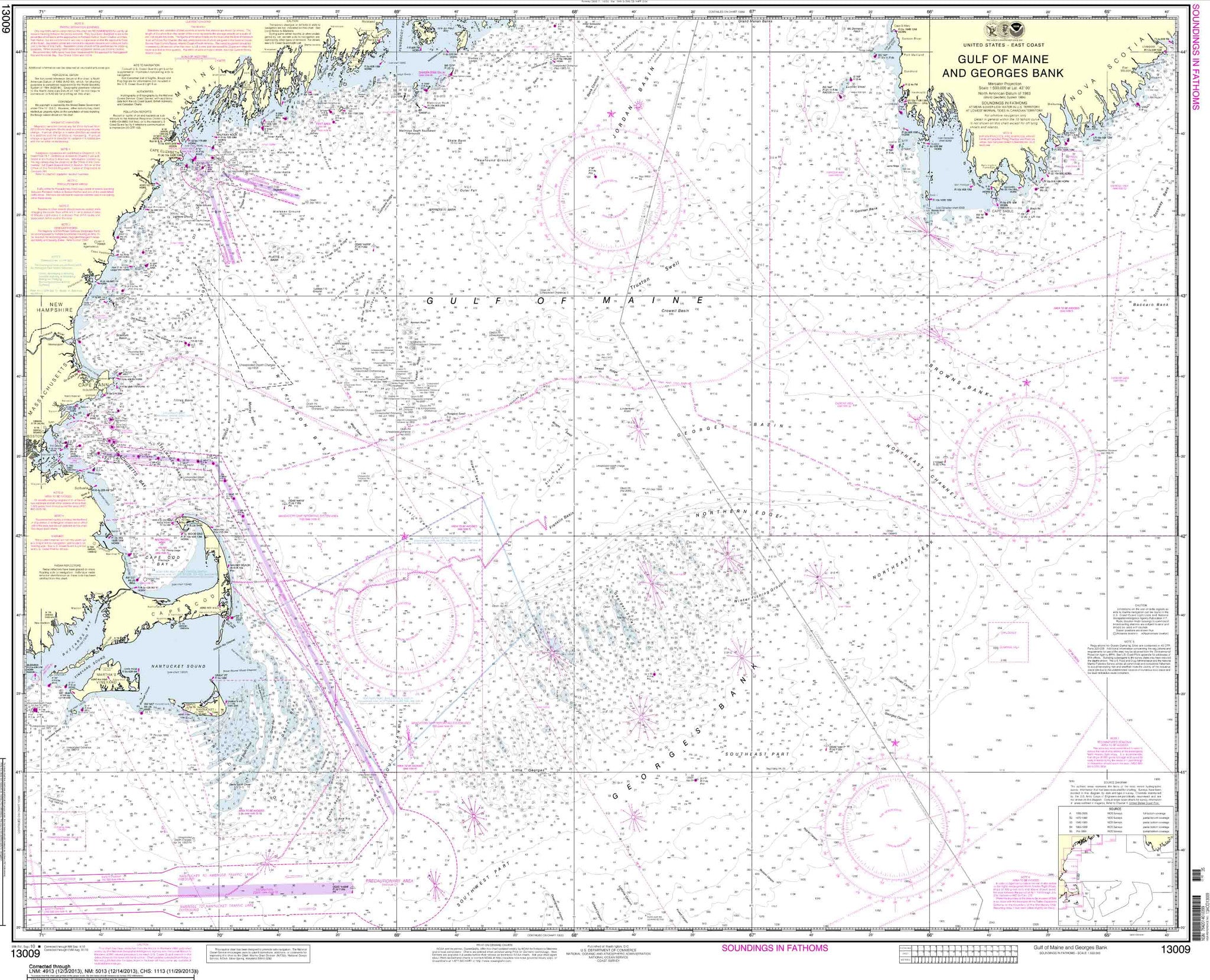
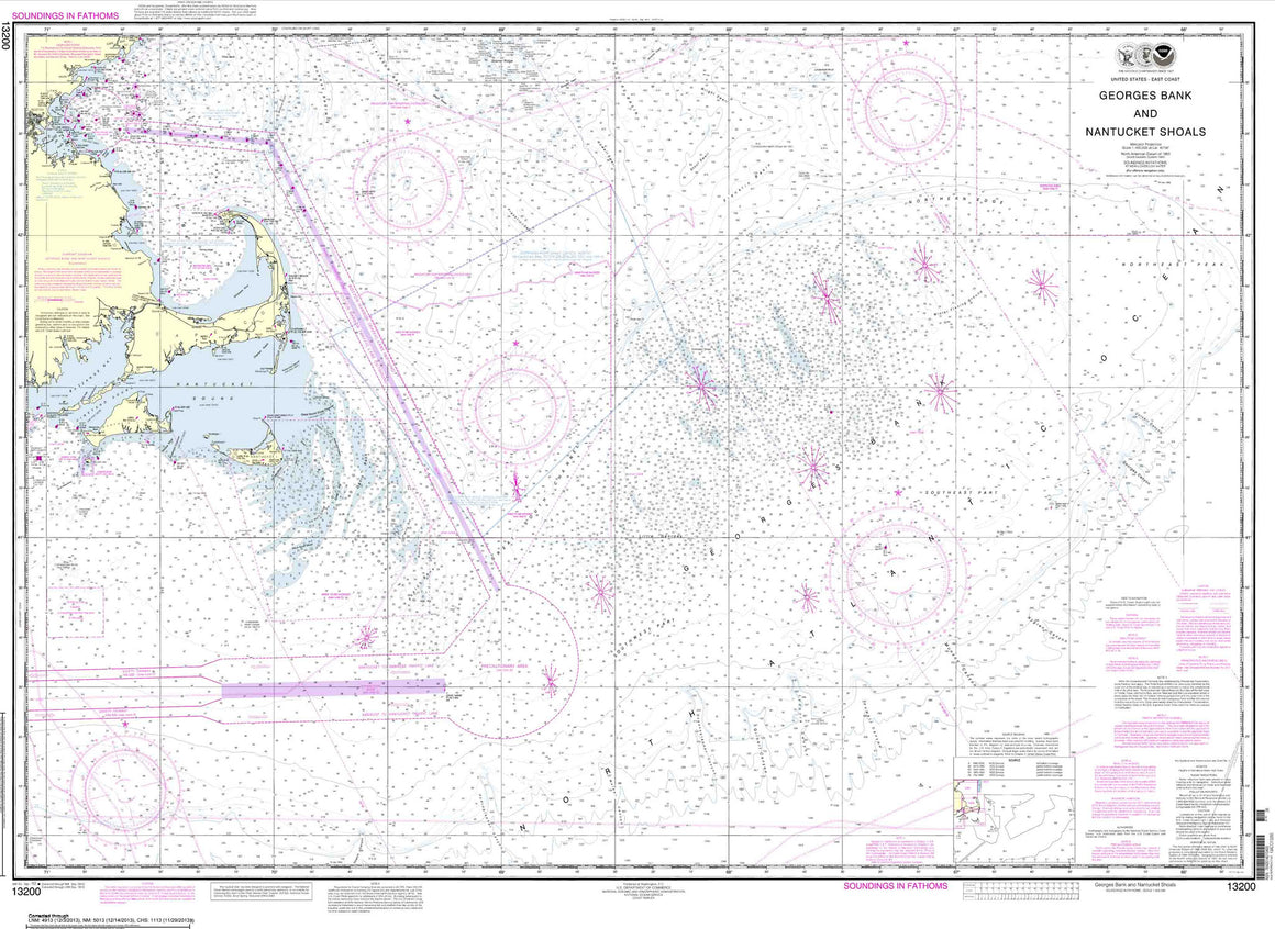
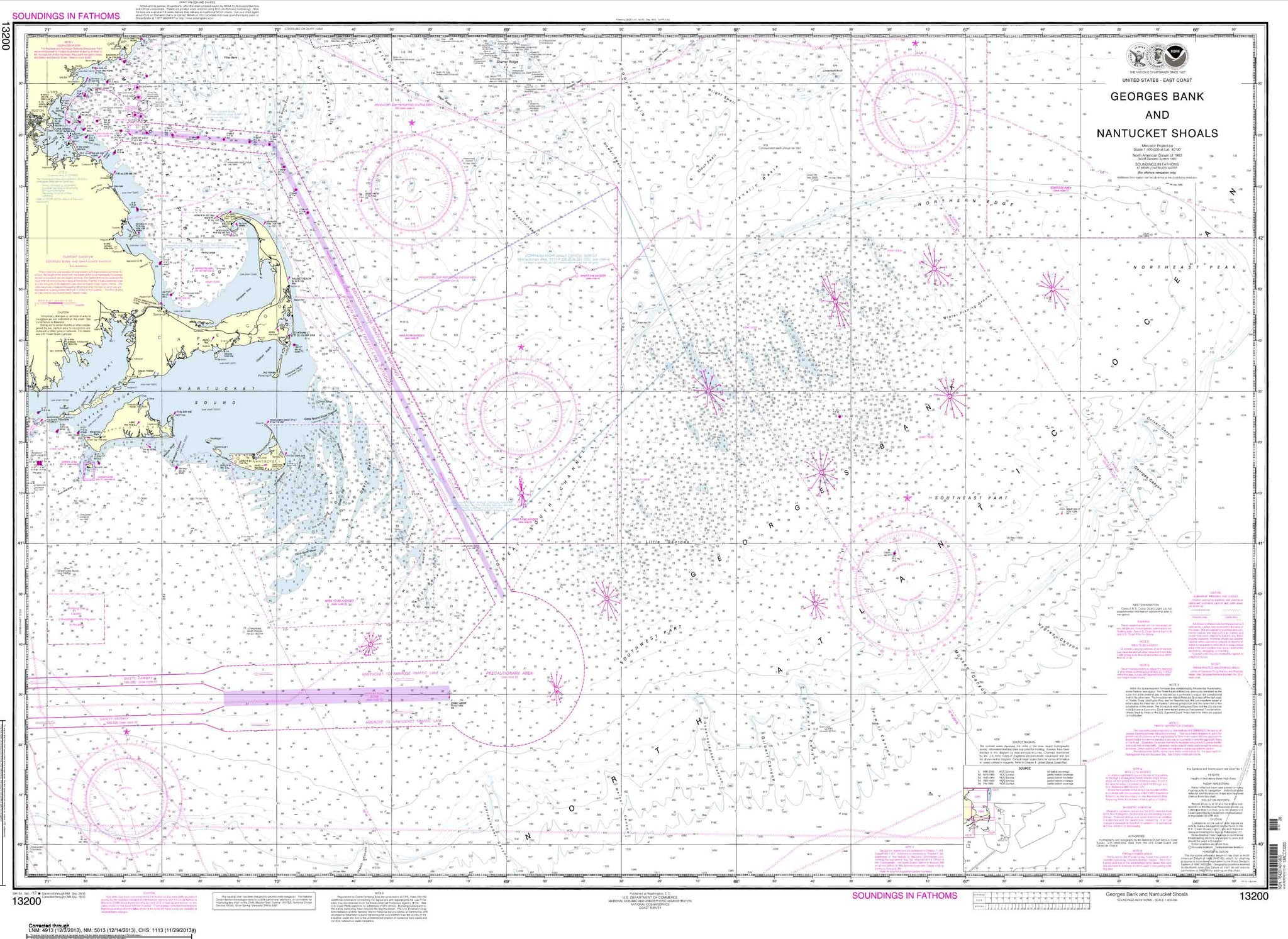
Approaches to New York, Nantucket Shoals to Five Fathom Bank


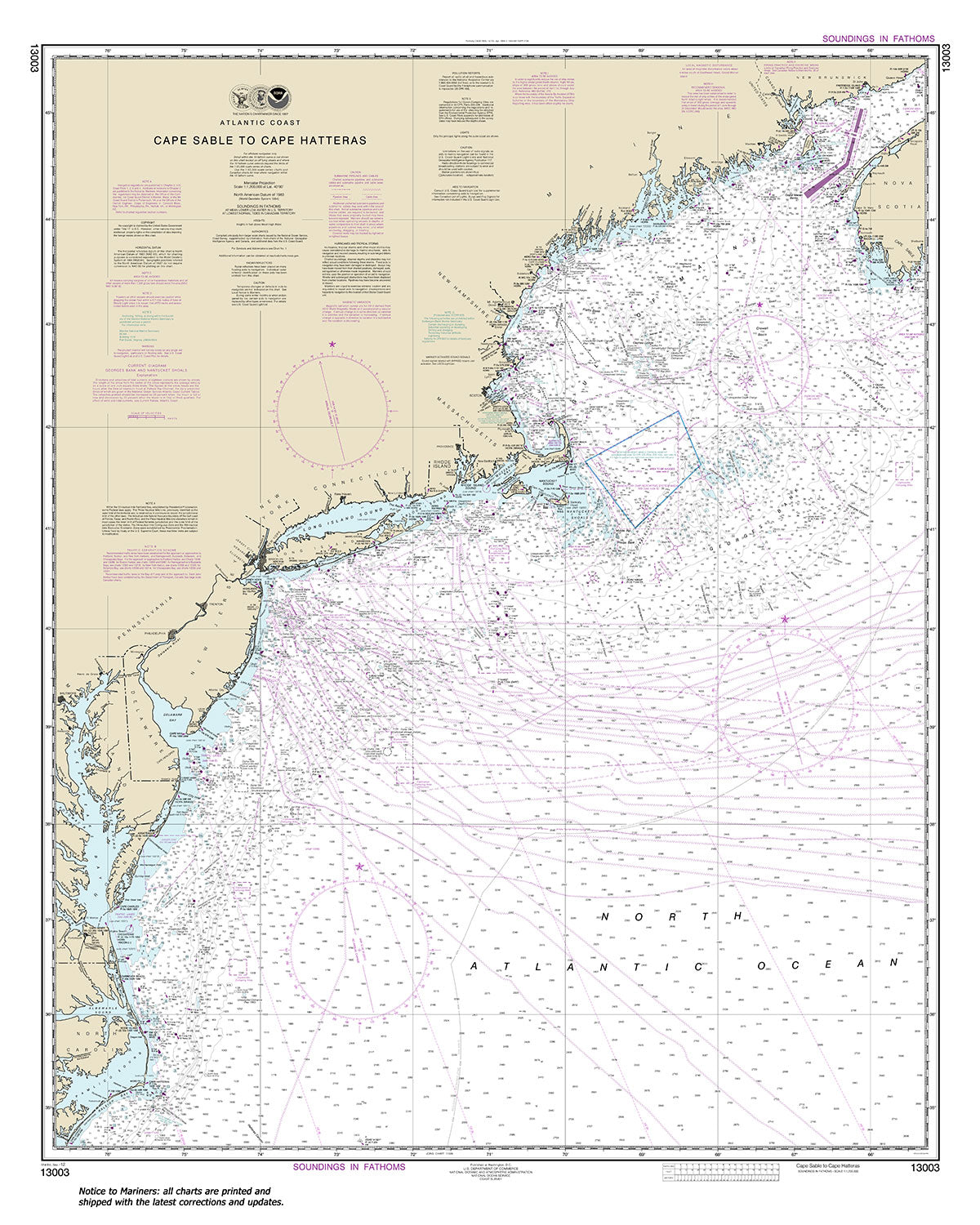
13003
$ 18.95 $ 27.00
Official NOAA Chart : Cape Sable to Cape Hatteras Standard Chart : 36" wide by 45" tall If you would prefer a smaller, lighter and less bulky format for navigating,...


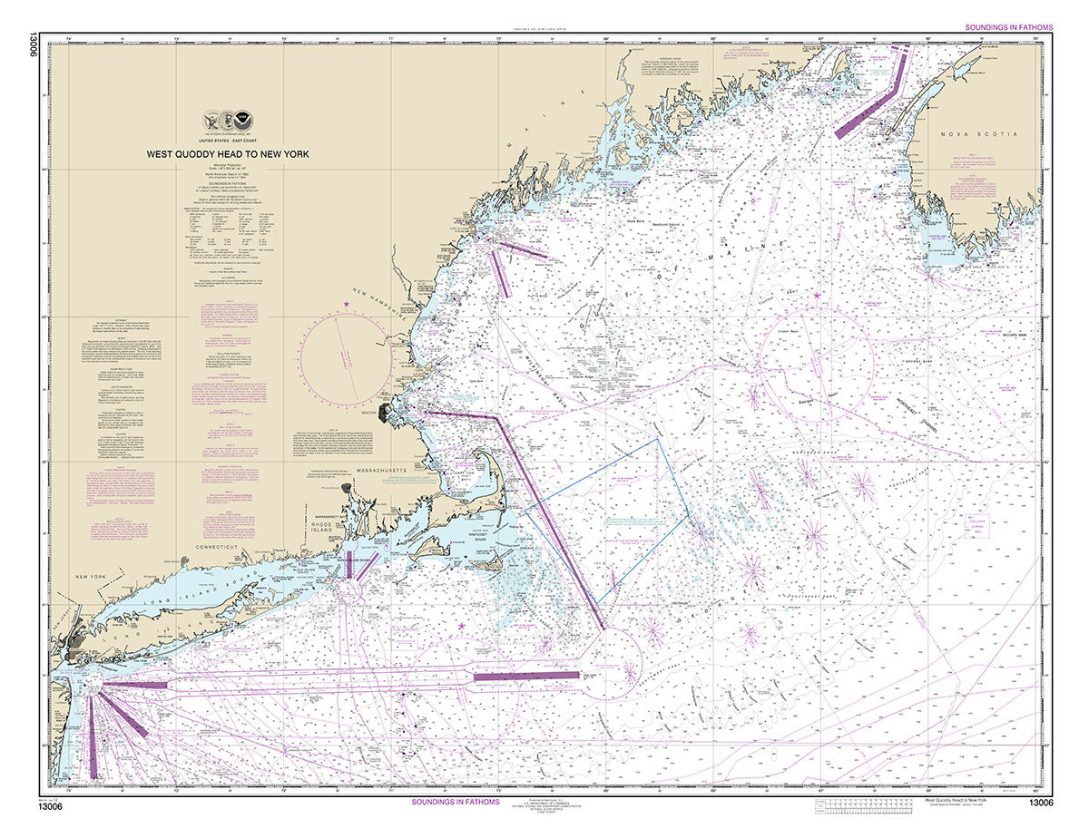
13006
$ 18.95 $ 27.00
West Quoddy Head to New York 47" wide by 36" tall If you would prefer a smaller, lighter and less bulky format, you may want to choose the SMALL CRAFT...


© 2026 FrugalNavigator.com. POS and Ecommerce by Shopify