1 to 100000


18765
$ 18.95 $ 27.00
Official NOAA Chart : Approaches to San Diego Bay, including Mission Bay Standard Chart : 48" wide by 32" tall If you would prefer a smaller, lighter and less bulky...


18774
$ 18.95 $ 27.00
Official NOAA Chart : Gulf of Santa Catalina ; Delmar Boat Basin to Camp Pendleton Standard Chart : 47" wide by 36" tall If you would prefer a smaller, lighter...


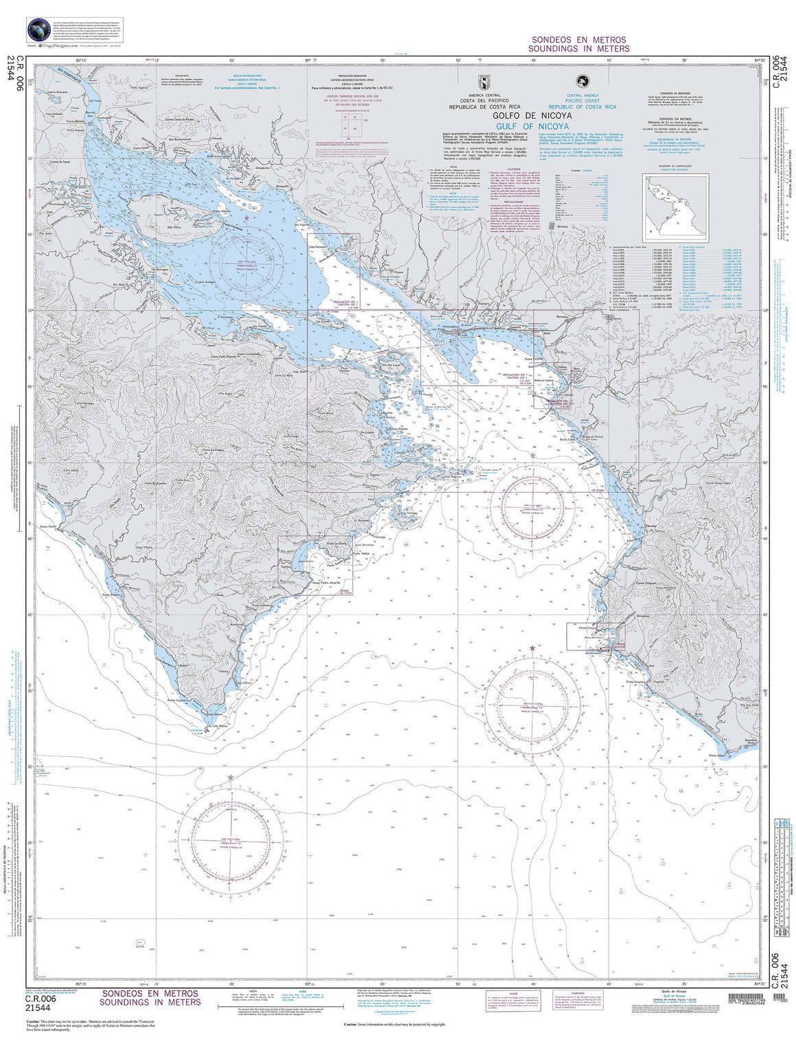

21544
$ 18.95 $ 27.00
Central America, Costa Rica : Golfo De Nicoya 38" wide by 50" tall


25641
$ 18.95 $ 27.00
Official NOAA Chart of the U.S. Virgin Islands. This nautical chart is printed with the most recent NOAA ENC data. Standard Chart : single sheet, 35" by 46" Frugal Navigator uses...


25641 Wall Map
$ 18.95
Nautical chart of the Virgin Islands. This traditional NOAA chart has been discontinued and should not be used for navigation. We have made it available here with Artists and Decorators...


25668
$ 18.95 $ 27.00
North Coast of Puerto Rico Punta Penon to Punta Vacia Talega;Puerto Arecibo;Puerto Palmas Altas


25677
$ 18.95 $ 27.00
South Coast of Puerto Rico Guanica Light to Punta Tuna Light;Las Mareas

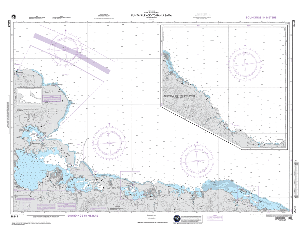

26244
$ 18.95 $ 27.00
Punta Silencio to Bahia de Sama and continuation of : Punta Silencio to Punta Guarico 48" wide by 36" tall Click here for information on international shipments


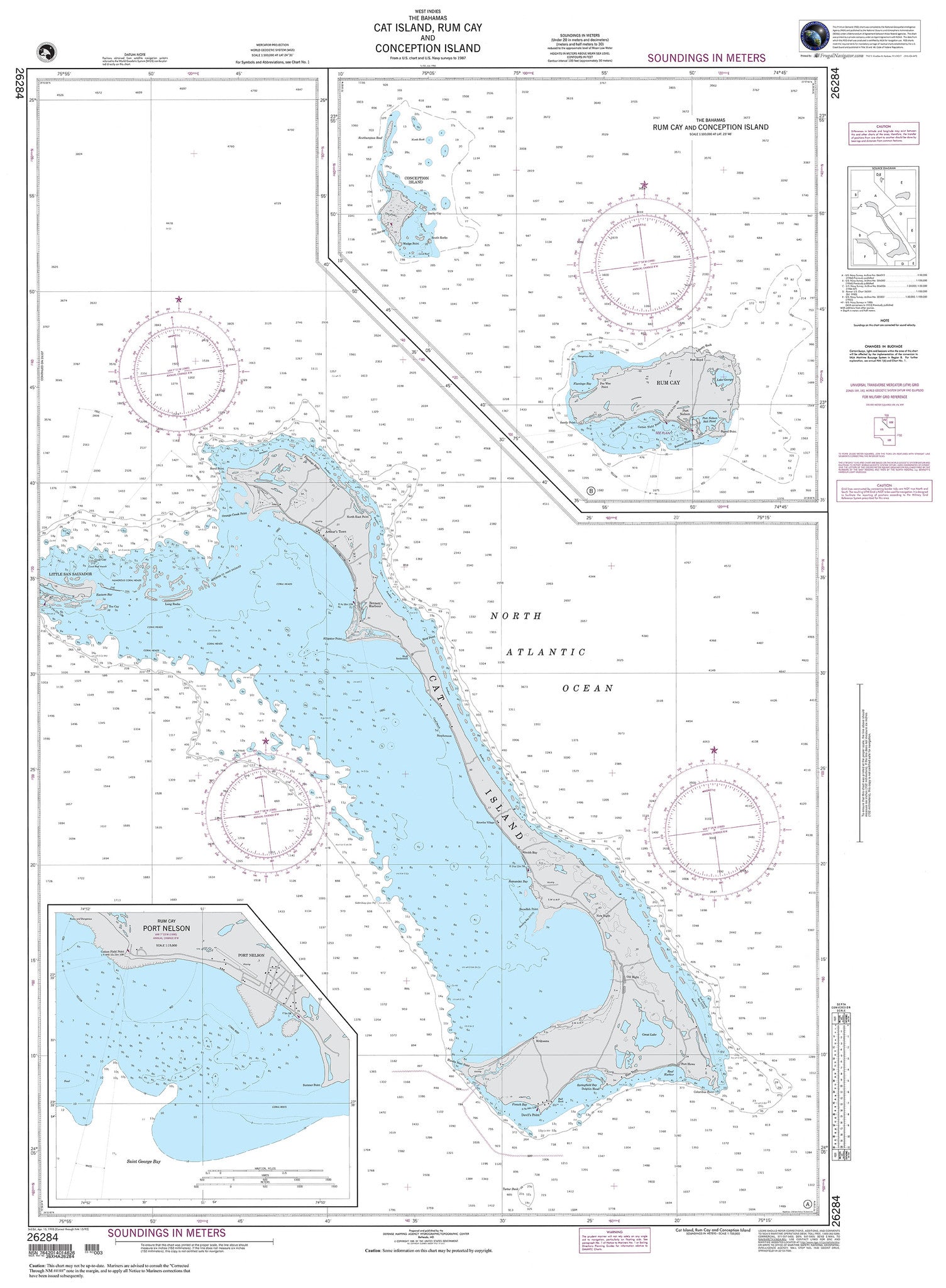
26284
$ 18.95 $ 270.00
The Bahamas : Cat Island, Rum Cay and Conception Island 36" wide by 49" tall

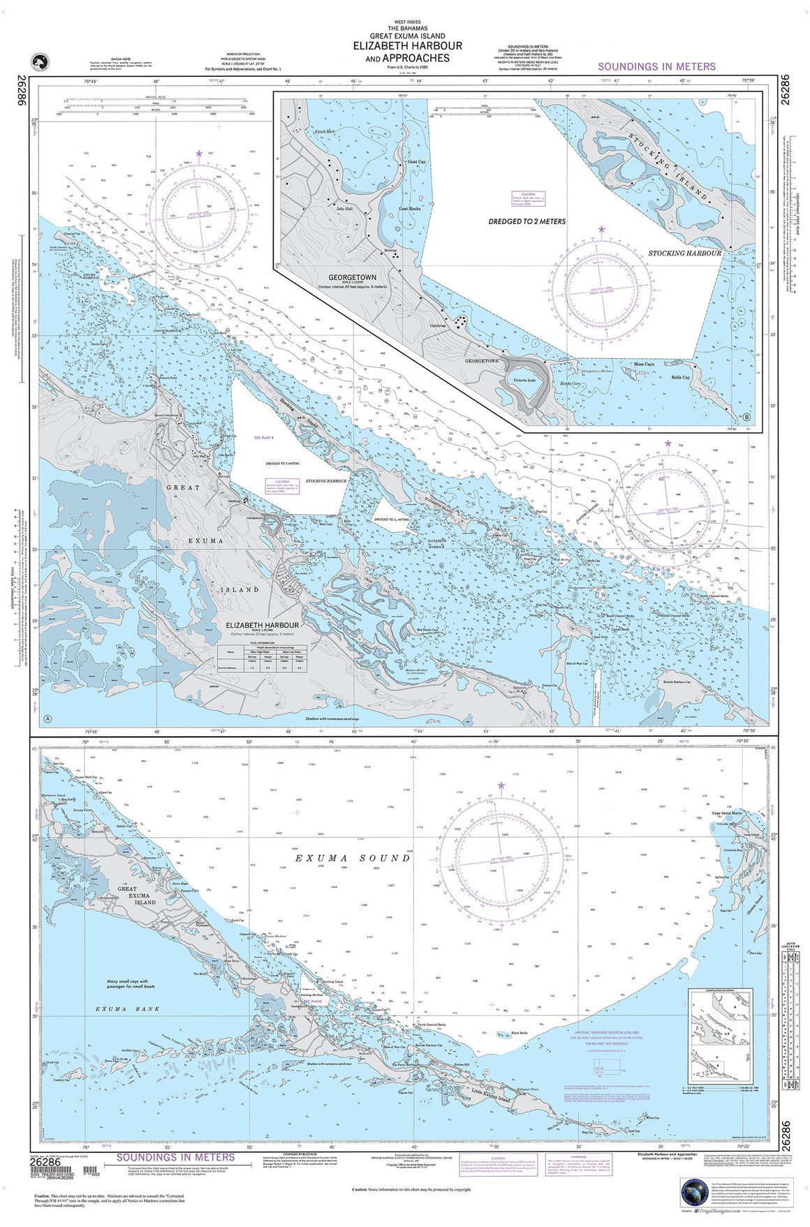

26286
$ 18.95 $ 27.00
The Bahamas : Great Exuma Island, Elizabeth Harbour and Approaches 33" wide x 50" tall

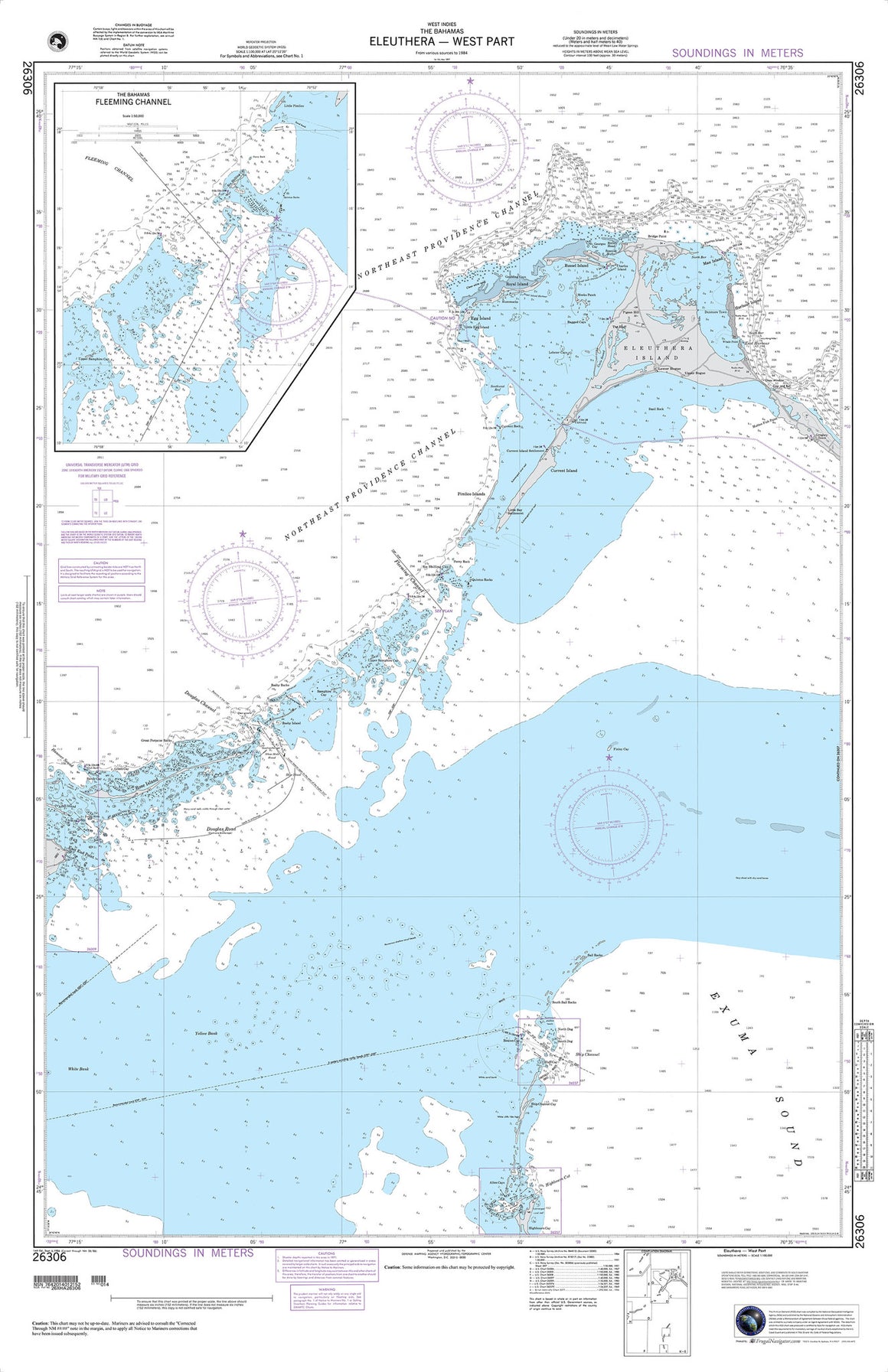
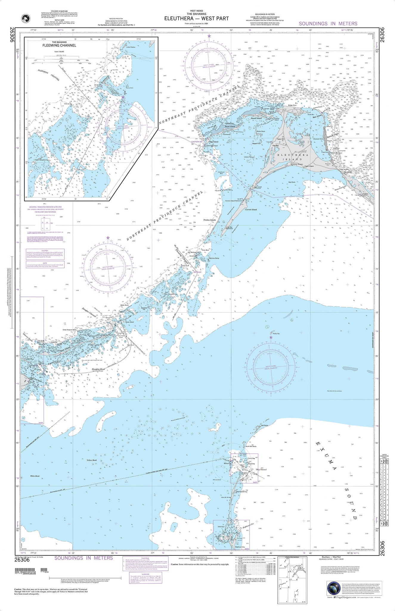
26306
$ 18.95 $ 27.00
The Bahamas : Eleuthera , West Part 33" wide by 51" tall

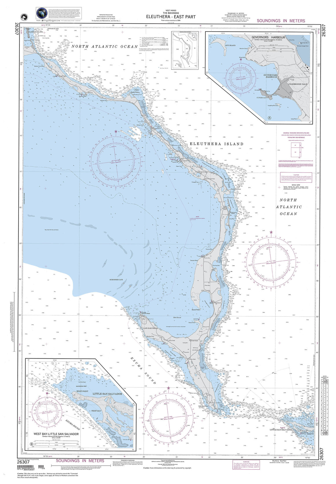

26307
$ 18.95 $ 27.00
The Bahamas : Eleuthera , East Part 34" wide by 49" tall


81048
$ 18.95 $ 27.00
Mariana Islands Island of Guam Territory of Guam;Cocos Lagoon


81251
$ 18.95 $ 27.00
Official NGA Chart of Lamotrek , Elato and Olimarao Atolls in the Caroline Islands Standard Chart : 48" wide by 36" tall


81435
$ 18.95 $ 27.00
Official NGA Chart of Senyavin Islands and Pohnpei Standard Chart : 50" wide by 35" tall


F-89 Ewing Bank N.E.
$ 18.95 $ 27.00
Bathymetric Fishing Map 41" wide by 31" tall


F-90 Ewing Bank N.W.
$ 18.95 $ 27.00
Bathymetric Fishing Map 41" wide by 31" tall


F-91 Ewing Bank S.E.
$ 18.95 $ 27.00
Bathymetric Fishing Map 43" wide by 31" tall


F-92 Ewing Bank S.W.
$ 18.95 $ 27.00
Bathymetric Fishing Map 41" wide by 31" tall


Salacia in the Virgin Islands
$ 18.95
This chart has been cropped and is not intended for navigation Height 28" by Width 36"


Virgin Islands Chart without St. Croix
$ 18.95
This chart has been cropped to fit a standard poster frame and is not intended for navigation Height 24" by Width 36"
© 2025 FrugalNavigator.com. POS and Ecommerce by Shopify