1 to 25000


18458
$ 18.95 $ 27.00
Official NOAA Chart : Hood Canal ; South Point to Quatsap Point including Dabob Bay Standard Chart : 34" wide by 42" tall If you would prefer a smaller, lighter...


18477
$ 18.95 $ 27.00
Official NOAA Chart : Puget Sound ; Entrance to Hood Canal Standard Chart : 33" wide by 49" tall If you would prefer a smaller, lighter and less bulky format...


18622
$ 18.95 $ 27.00
Official NOAA Chart of Humboldt Bay Standard size: 34" wide by 40" tall If you would prefer a smaller, lighter and less bulky format for navigating, you may want to...


18722
$ 18.95 $ 27.00
Point Arguello to Purisima Point 36" wide by 53" tall


18723
$ 18.95 $ 27.00
Point Conception to Point Arguello 50" wide by 36" tall


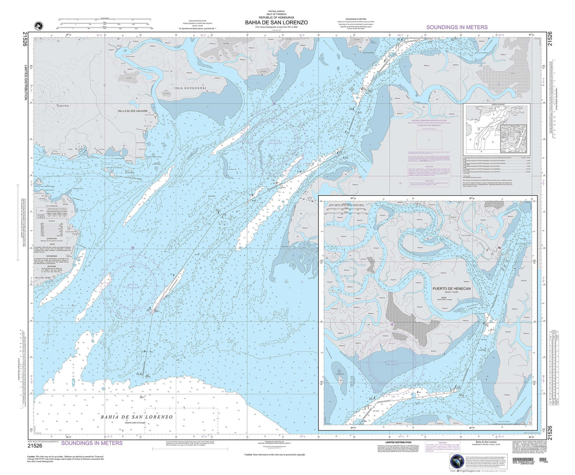

21526
$ 18.95 $ 27.00
Central America, Honduras : Gulf of Fonseca ; Bahia De San Lorenzo 46" wide by 38" tall


21621
$ 18.95 $ 27.00
Costa Rica : Isla Del Coco ( Cocos Island ) 42" wide by 33" tall


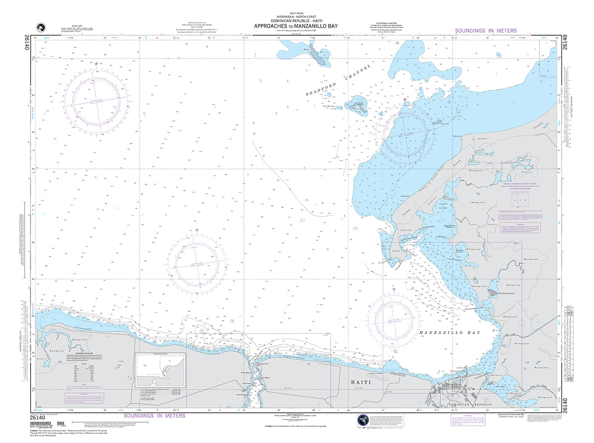
26140
$ 18.95 $ 27.00
Official NGA Chart for the Northern Coasts of Haiti and the Dominican Republic : Approaches to Manzanillo Bay 47" wide by 35" tall

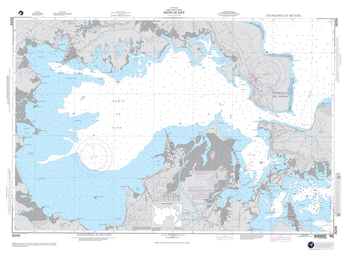

26259
$ 18.95 $ 27.00
Official NGA Chart covering Bahia de Nipe, Cuba 48" wide by 36" tall


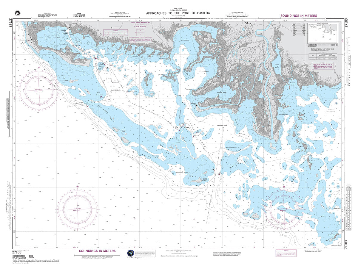
27183
$ 18.95 $ 27.00
Official NGA Chart of the South Coast of Cuba : Approaches to the Port of Casilda 47" wide by 35" tall


54267
$ 18.95 $ 27.00
Official NGA Chart of the Adriatic Sea, Albania : Durres and Approaches 31" wide by 20" tall


81148
$ 18.95 $ 27.00
Palau Islands : Toachel Mlengui (West Passage) 35" wide by 51" tall


81151
$ 18.95 $ 27.00
Palau Islands : Arangel Channel and Koror Road 43" wide by 34" tall


© 2025 FrugalNavigator.com. POS and Ecommerce by Shopify