1 to 30000

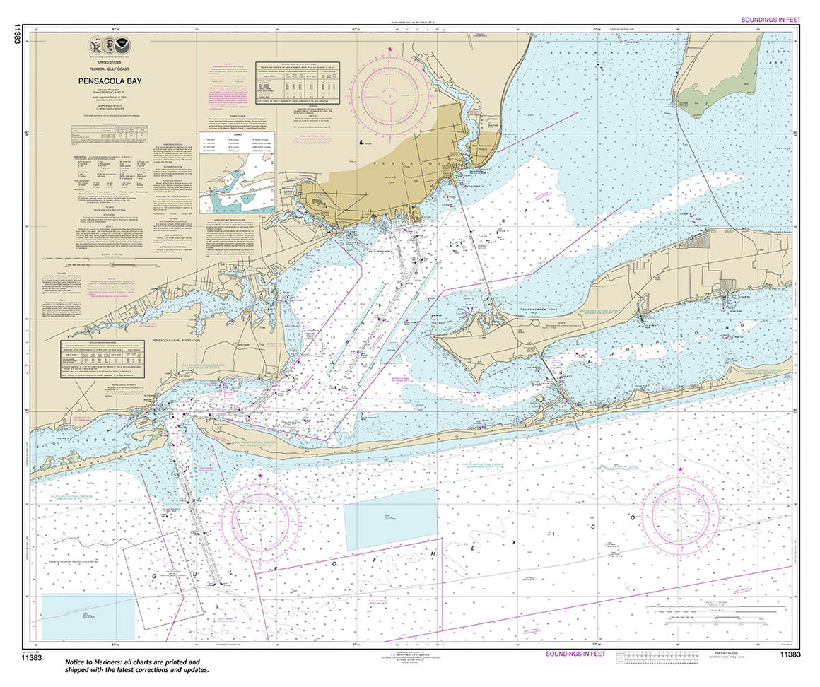
11383
$ 18.95 $ 27.00
Official NOAA Chart: Pensacola Bay Standard size: 43" wide by 36" tall If you would prefer a smaller, lighter and less bulky format for navigating, you may want to choose...


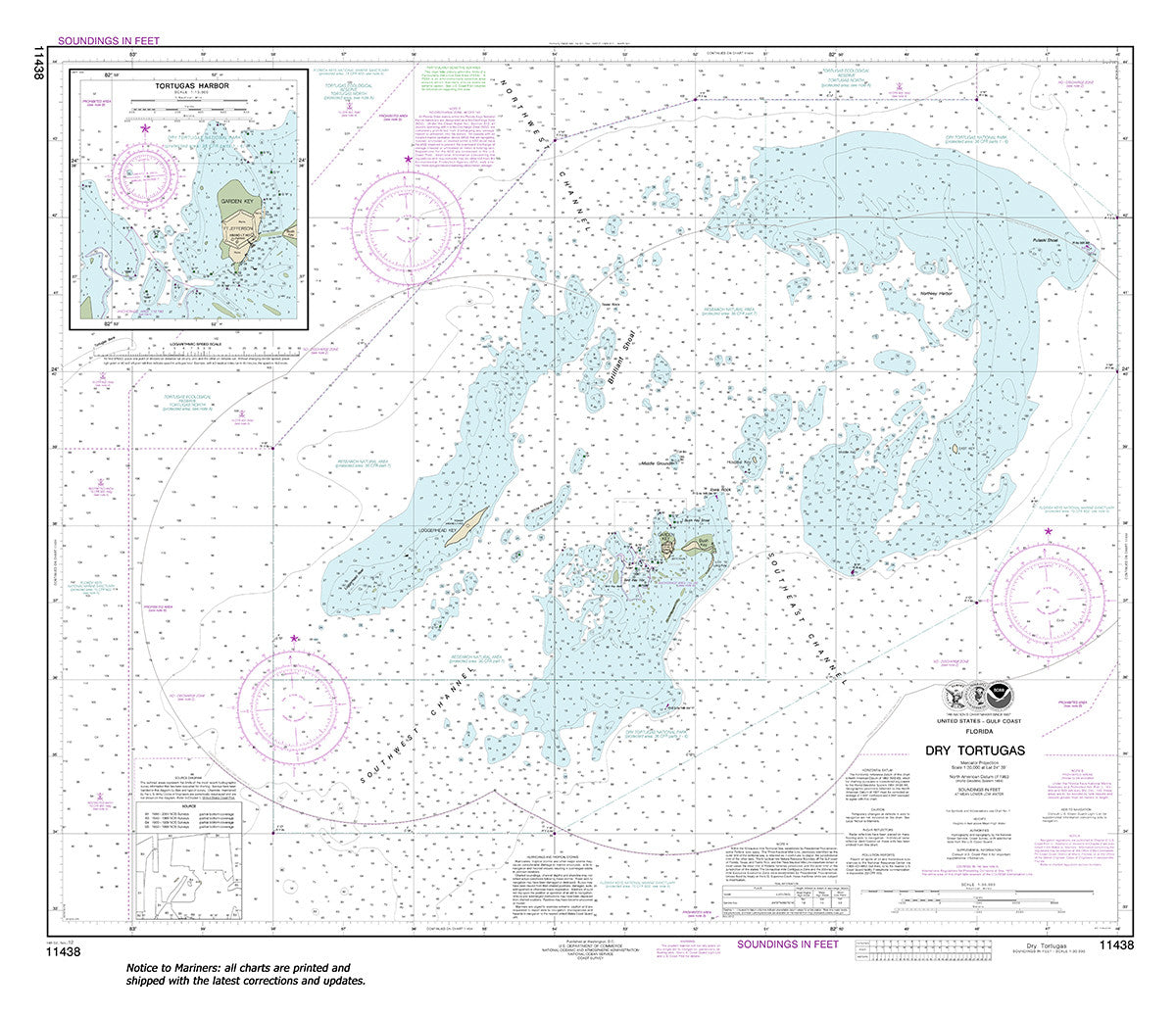
11438
$ 18.95 $ 27.00
Dry Tortugas;Tortugas Harbor Standard size: 36" wide by 32" tall If you would prefer a smaller, lighter and less bulky format, you may want to choose the SMALL CRAFT Chart...

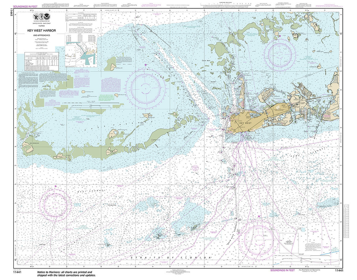
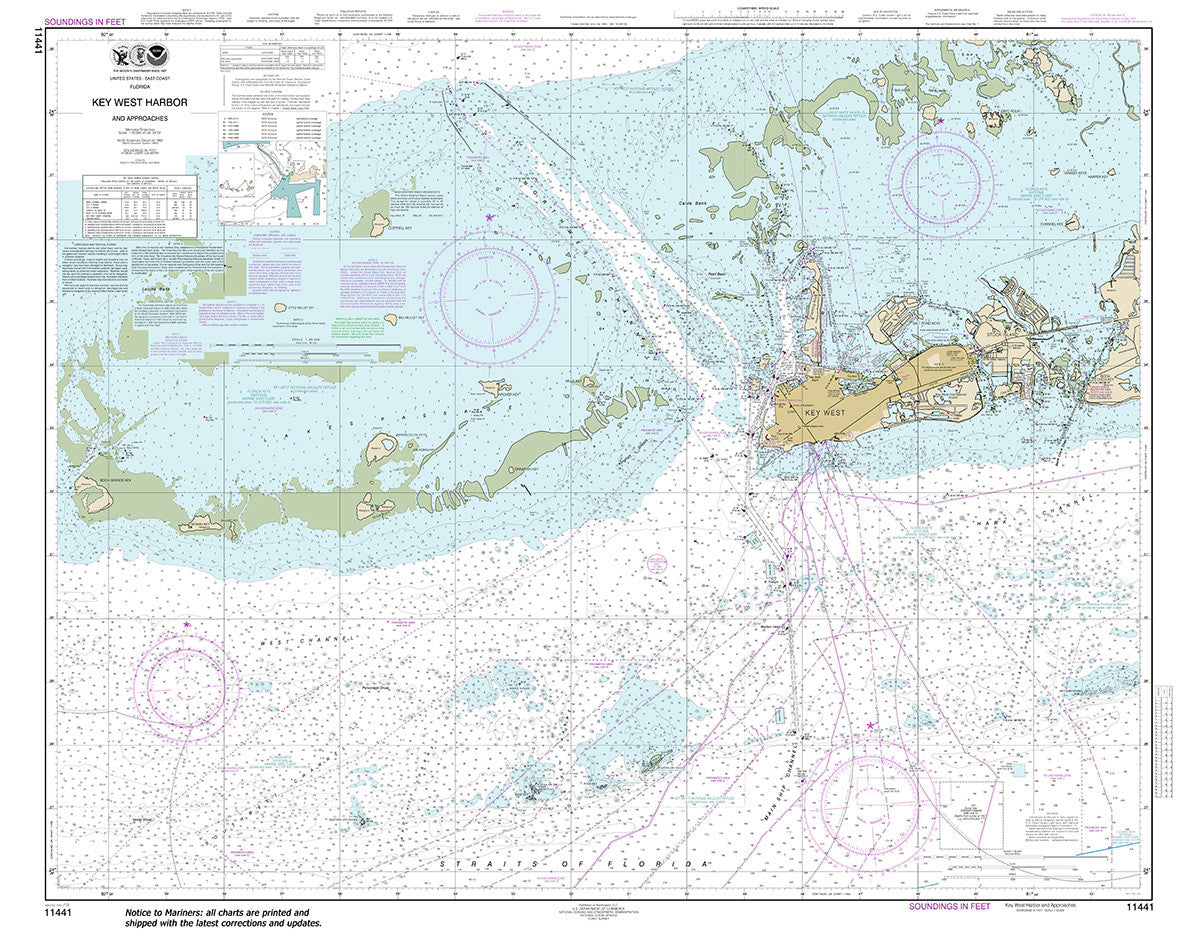
11441
$ 18.95 $ 27.00
Key West Harbor and Approaches Standard size: 46" wide by 36" tall If you would prefer a smaller, lighter and less bulky format, you may want to choose the SMALL...


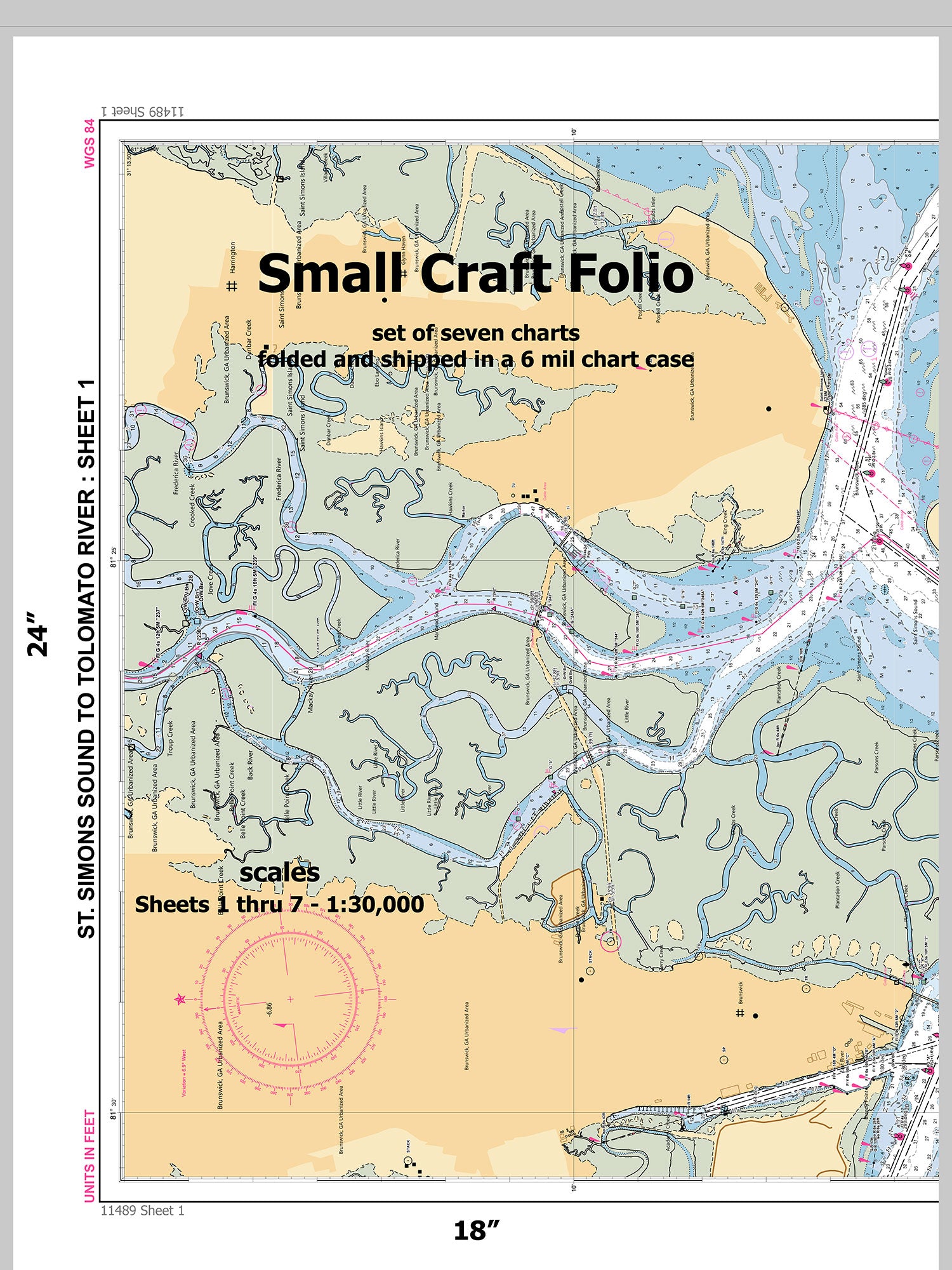
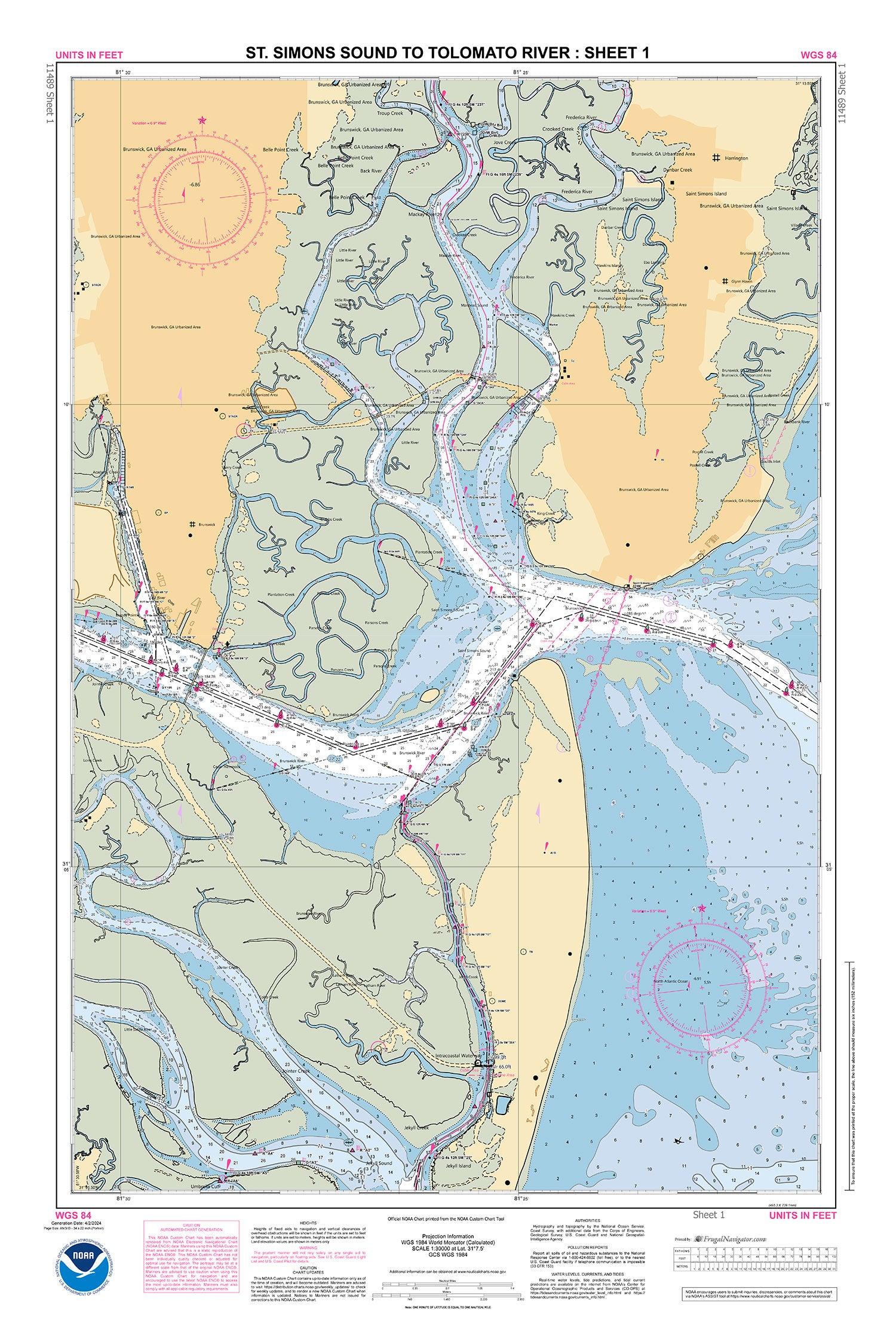
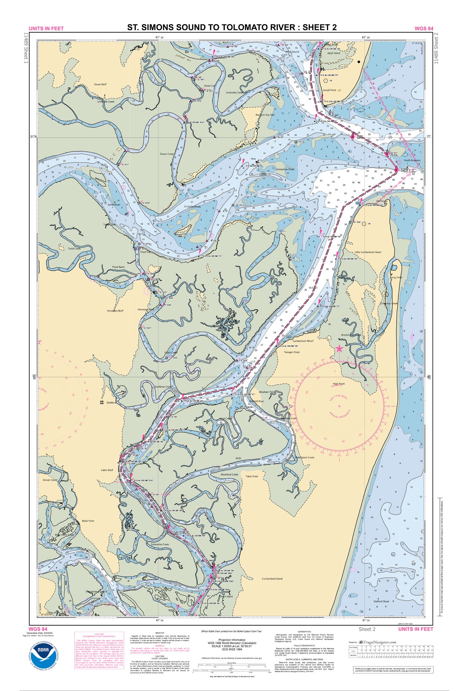
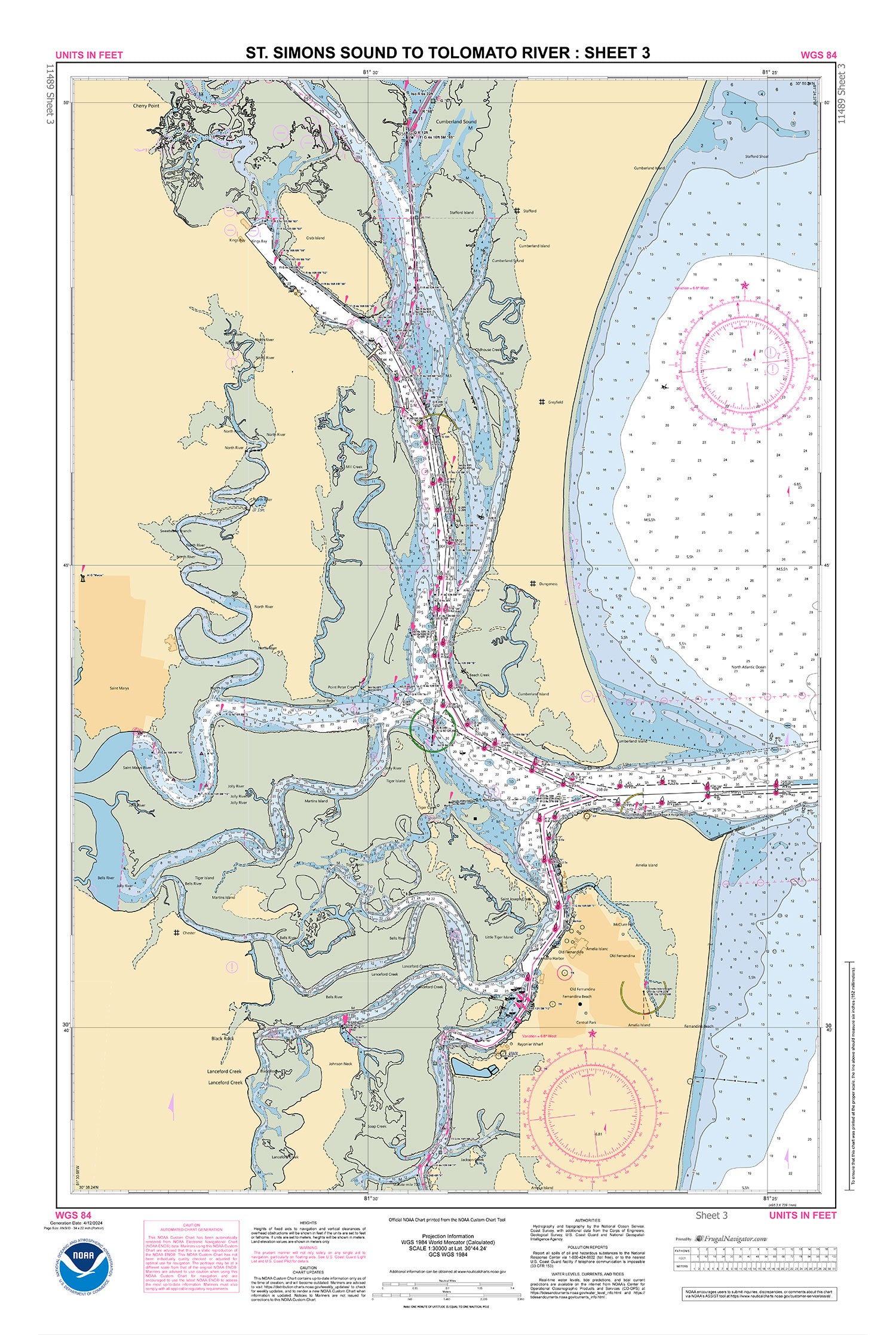
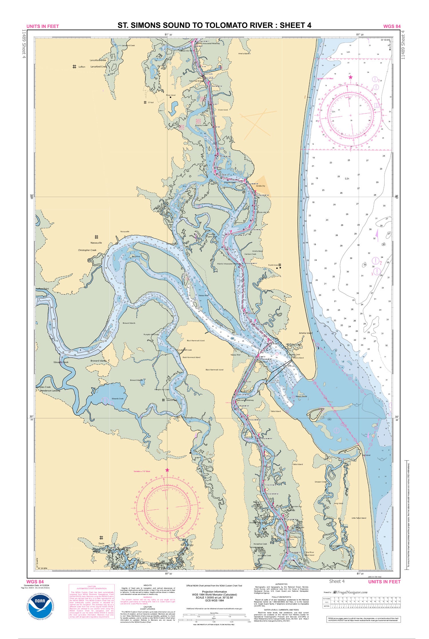
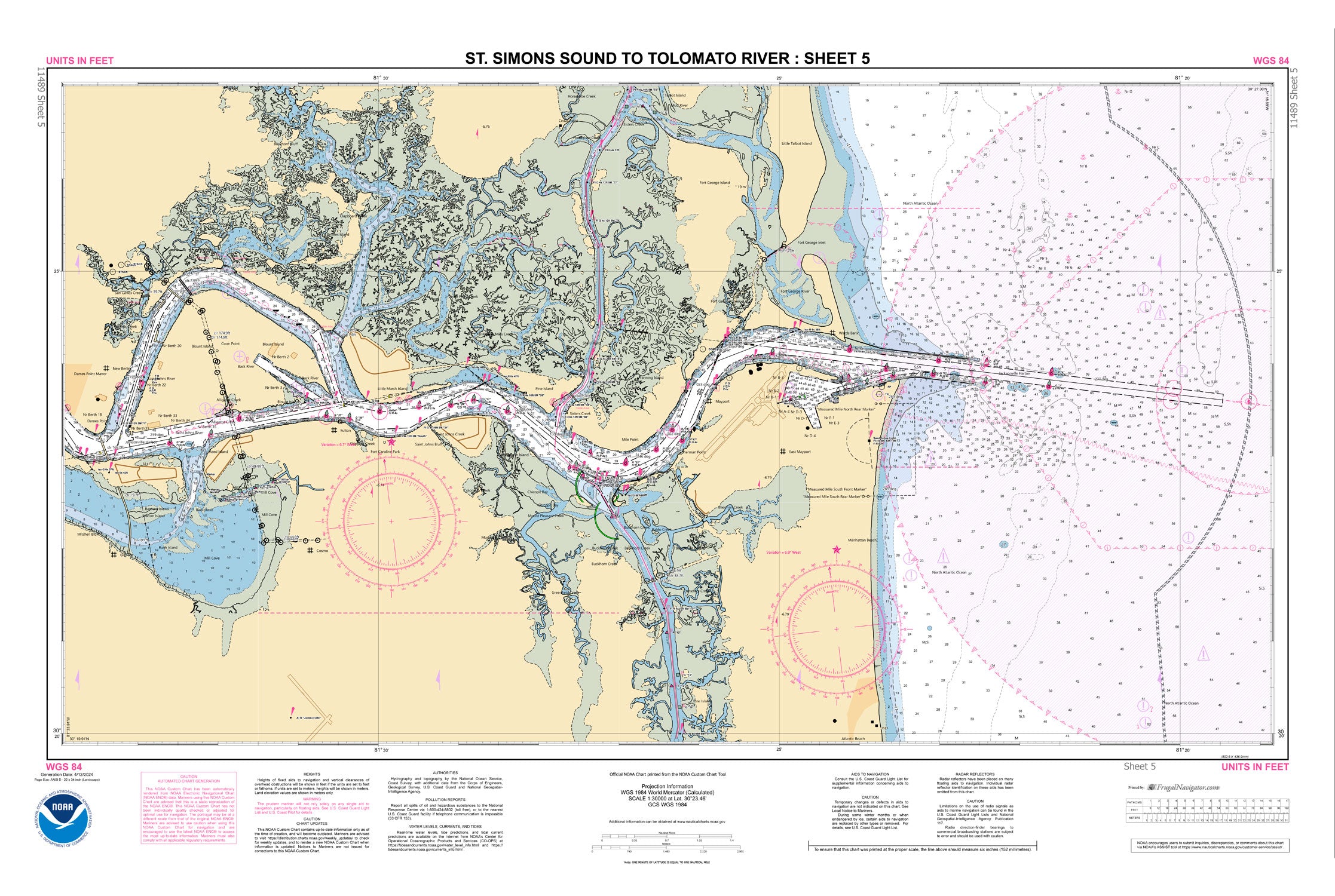
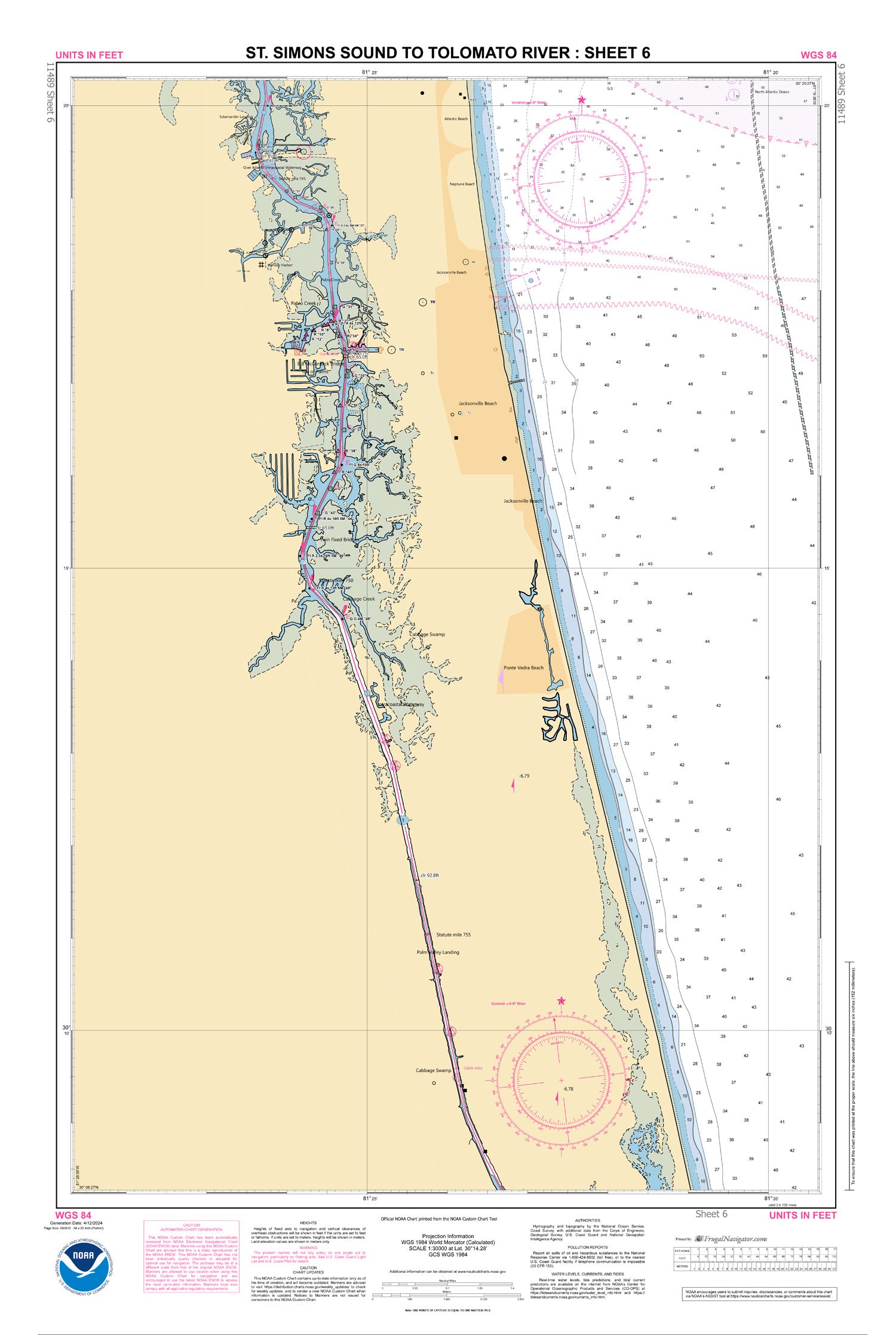
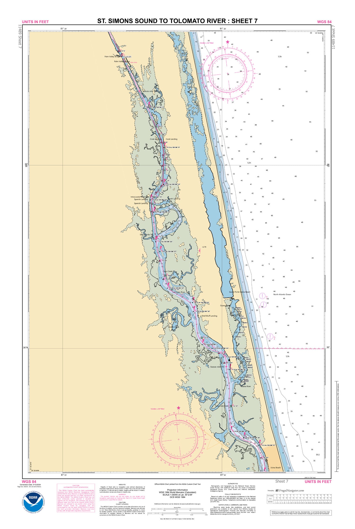
11489
$ 52.95
Official NOAA Chart for the Intracoastal Waterway : St. Simons Sound to Tolomato River. This Small Craft Folio Chart is printed from the most recent ENC data and consists of...


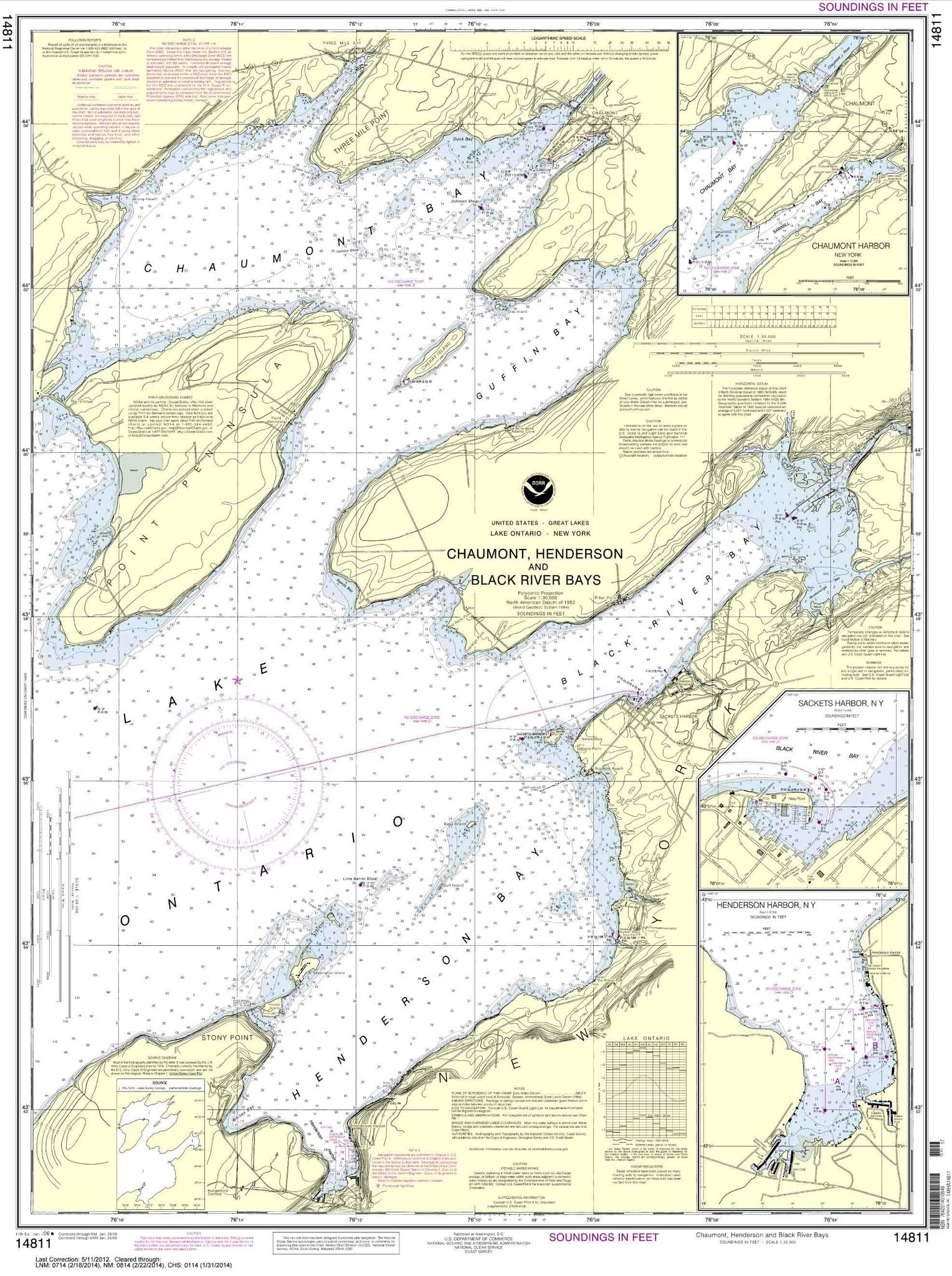
14811
$ 18.95 $ 27.00
Chaumont, Henderson and Black River Bays;Sackets Harbor;Henderson Harbor;Chaumont Harbor


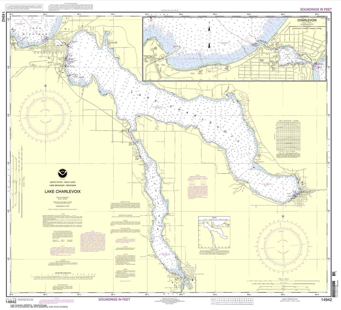

14942
$ 18.95 $ 27.00
Lake Charlevoix;Charlevoix, South Point to Round Lake

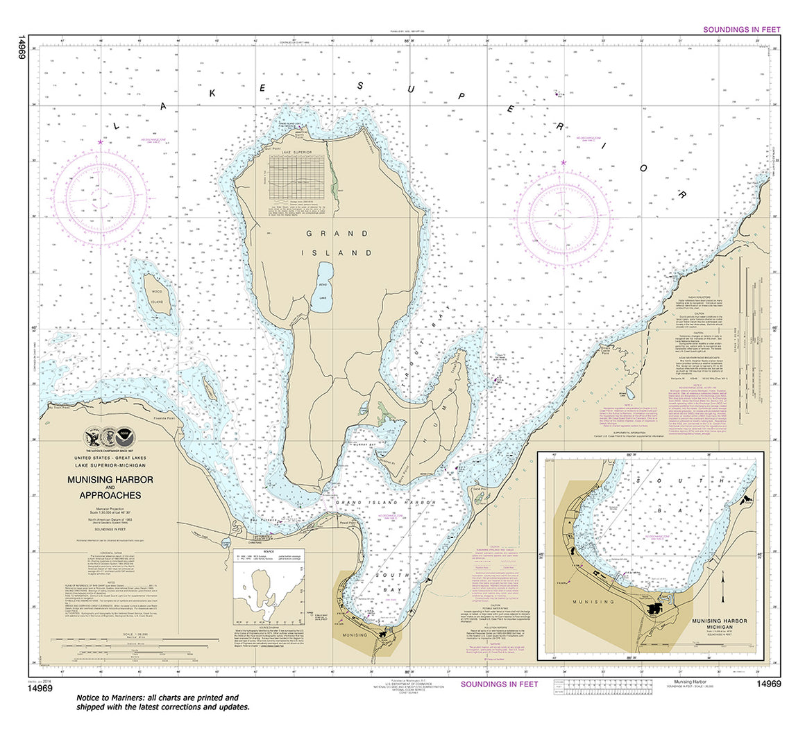
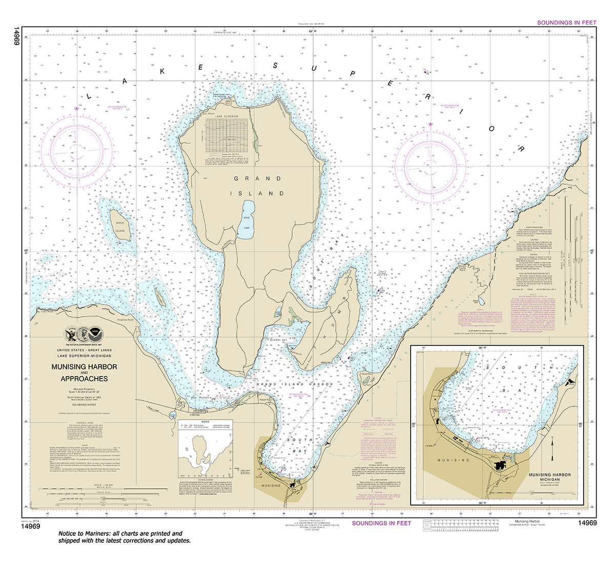
14969
$ 18.95 $ 27.00
Official NOAA Chart of Munising Harbor and Approaches, including Munising Harbor Standard Chart : 35" wide by 32" tall If you would prefer a smaller, lighter and less bulky format...


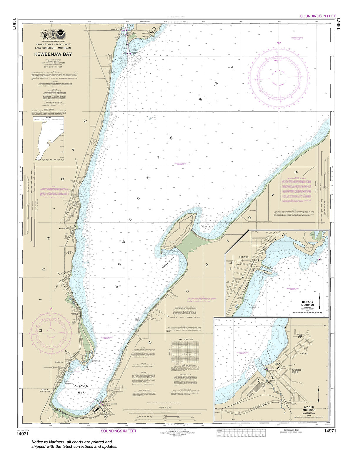
14971
$ 18.95 $ 27.00
Official NOAA Chart : Keweenaw Bay; L'Anse and Baraga Harbors Standard Chart : 31" wide by 40" tall If you would prefer a smaller, lighter and less bulky format for...

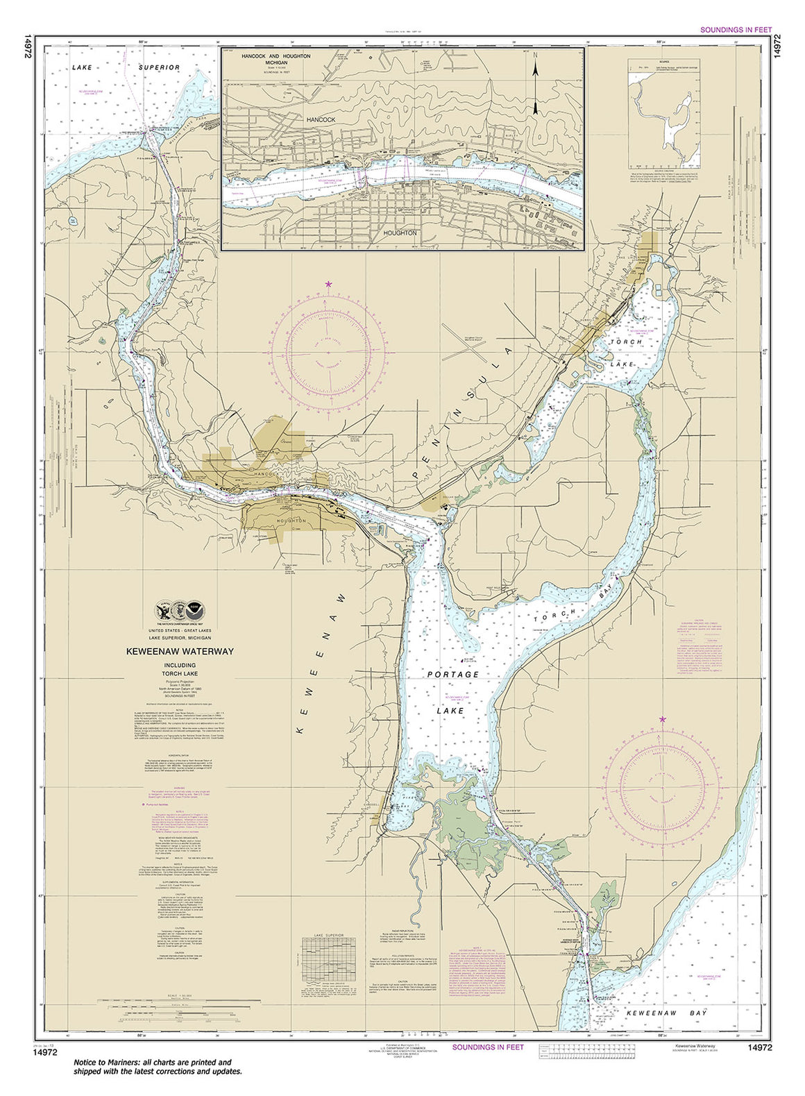

14972
$ 18.95 $ 27.00
Official NOAA Chart : Keweenaw Waterway, i ncluding Torch Lake; Hancock and Houghton Standard Chart : 36" wide by 49" tall If you would prefer a smaller, lighter and less...


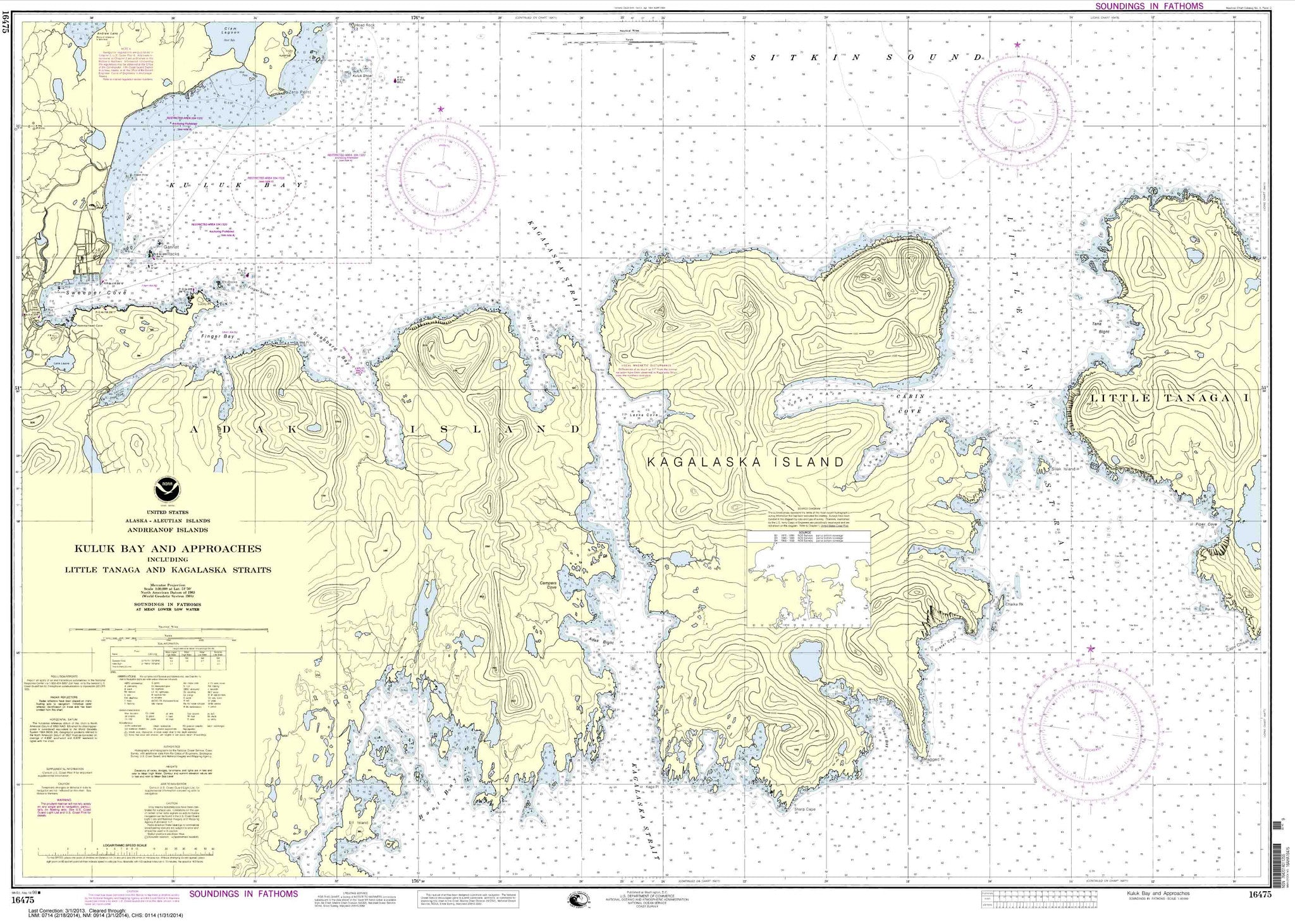
16475
$ 18.95 $ 27.00
Kuluk Bay and approaches, including Little Tanaga and Kagalaska Strs.

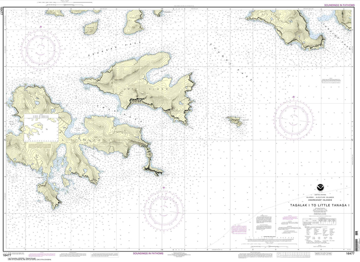
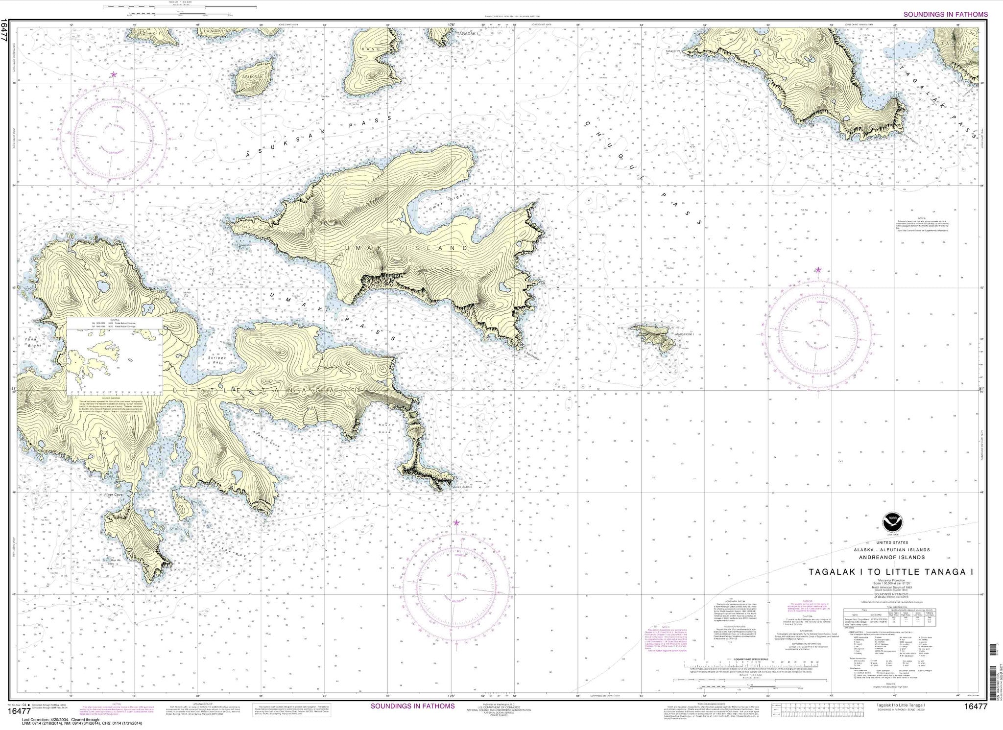

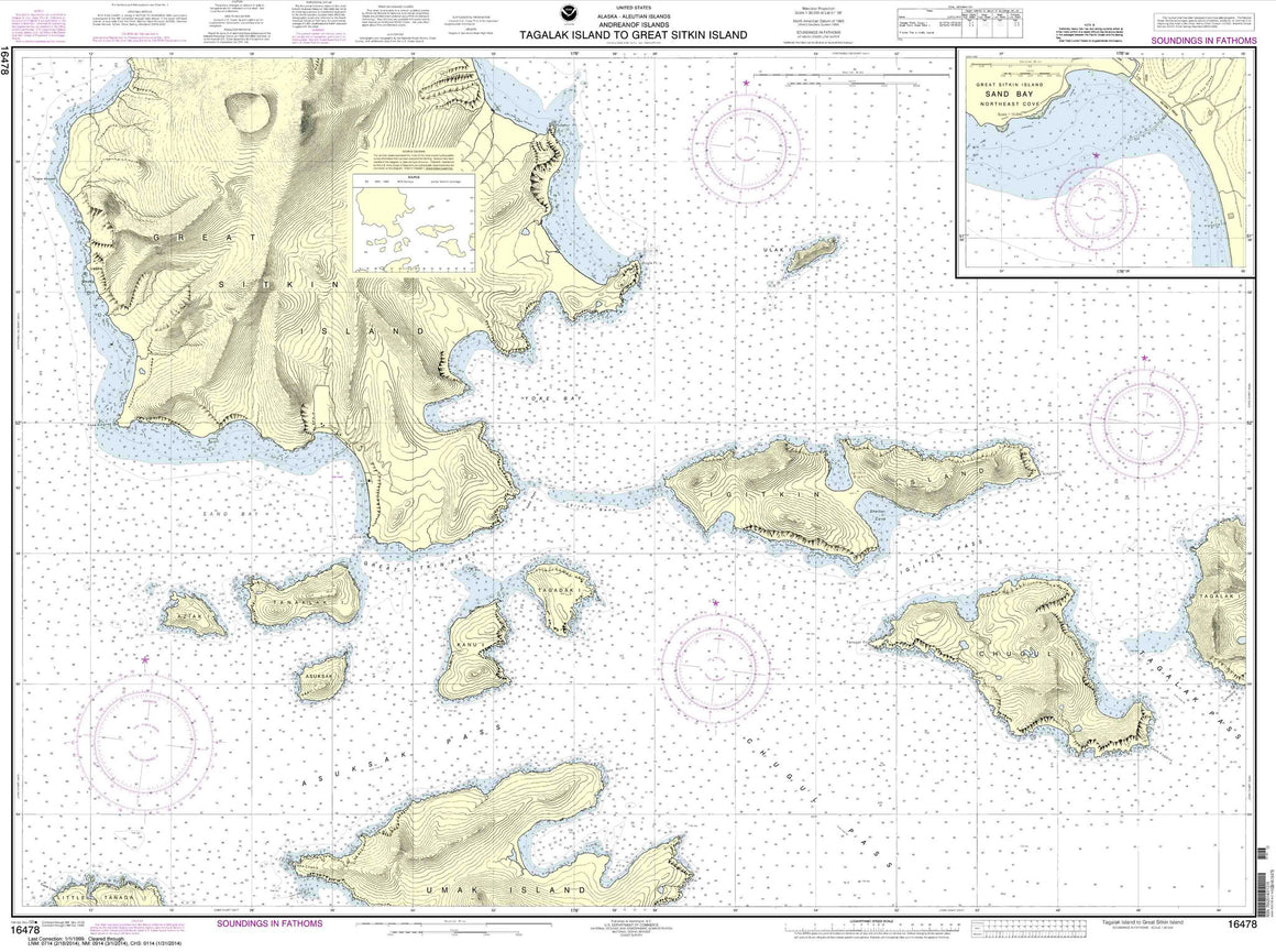

16478
$ 18.95 $ 27.00
Tagalak Island to Great Sitkin Island;Sand Bay-Northeast Cove


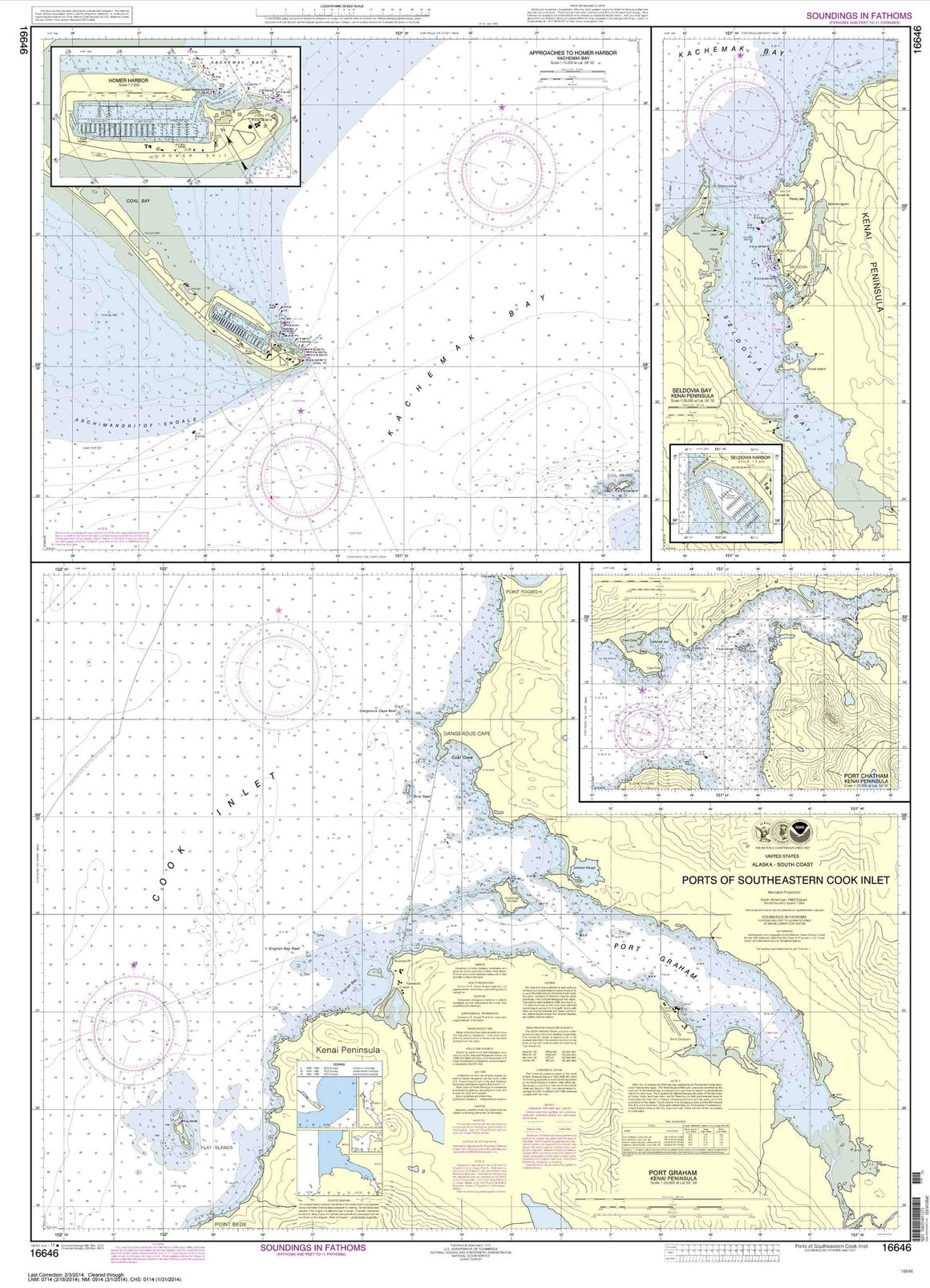

16646
$ 18.95 $ 27.00
Ports of Southeastern Cook Inlet Port Chatham;Port Graham;Seldovia Bay;Seldovia Harbor;Approaches to Homer Hbr;Homer Harbor


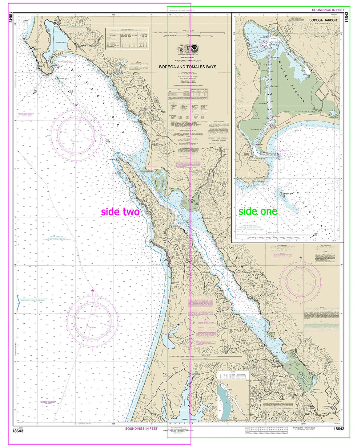
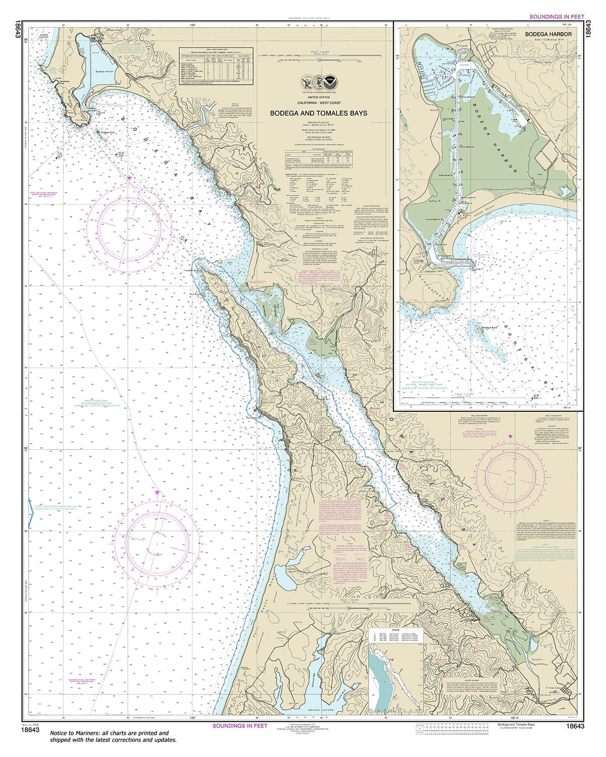
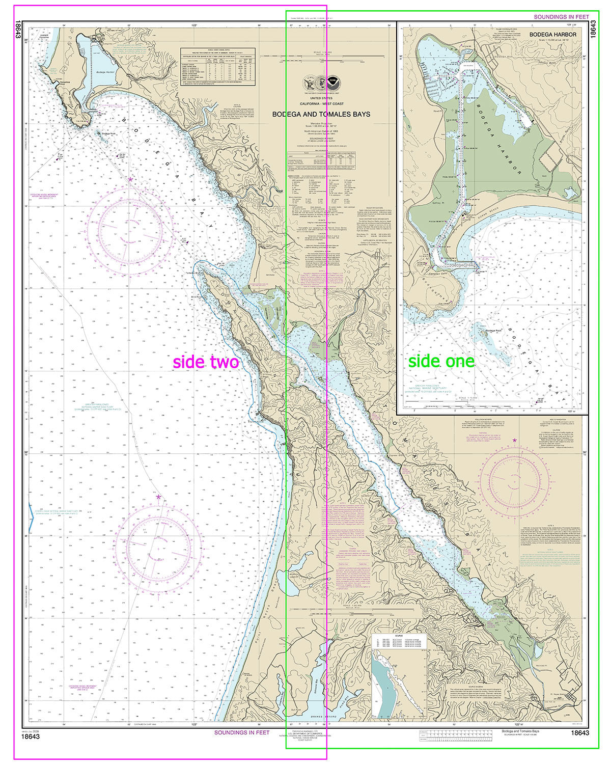
18643
$ 18.95 $ 27.00
Official NOAA Chart: Bodega and Tomales Bays; Bodega Harbor Standard size: 36" wide by 45" tall If you would prefer a smaller, lighter and less bulky format for navigating, you...
© 2024 FrugalNavigator.com. POS and Ecommerce by Shopify