1 to 40000

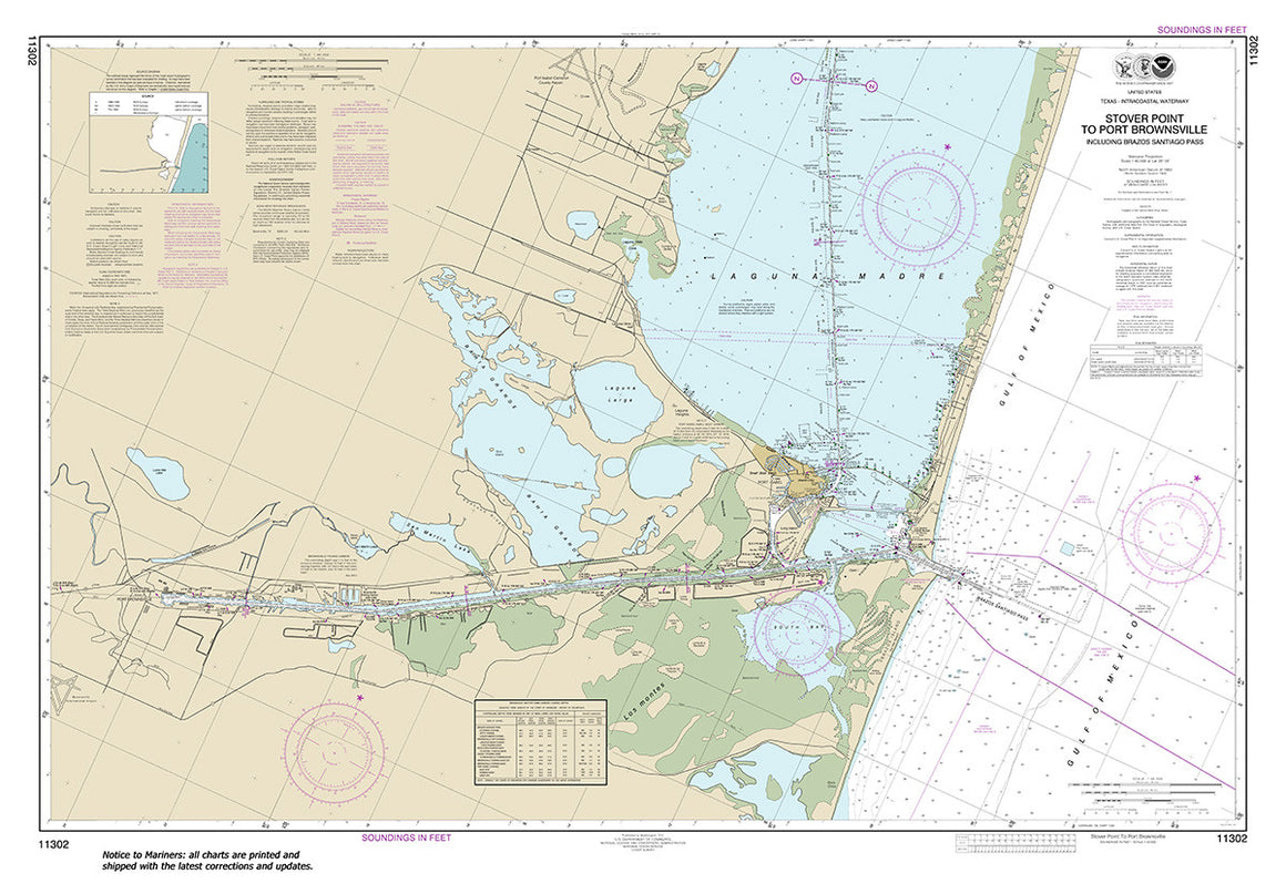

11302
$ 18.95 $ 27.00
Official NOAA Chart: Intracoastal Waterway Stover Point to Port Brownsville, including Brazos Santiago Pass Standard size: 46" wide by 32" tall If you would prefer a smaller, lighter and less...

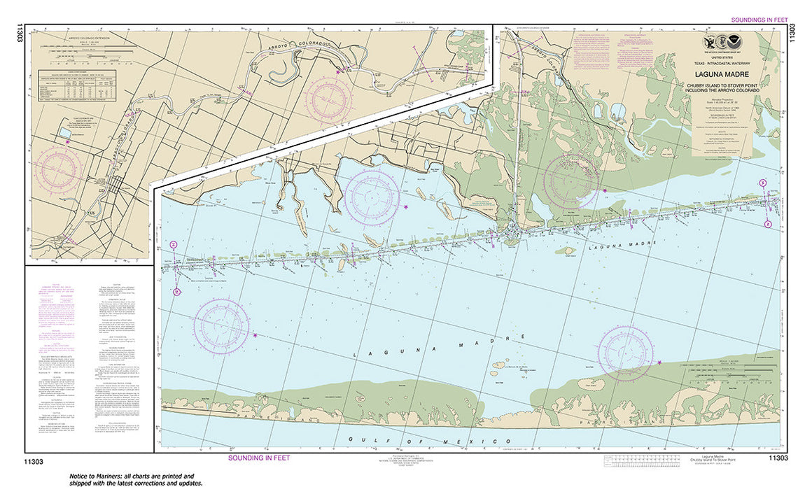

11303
$ 18.95 $ 27.00
Official NOAA Chart: Intracoastal Waterway Laguna Madre - Chubby Island to Stover Point, including The Arroyo Colorado Standard size: 46" wide by 28" tall If you would prefer a smaller,...

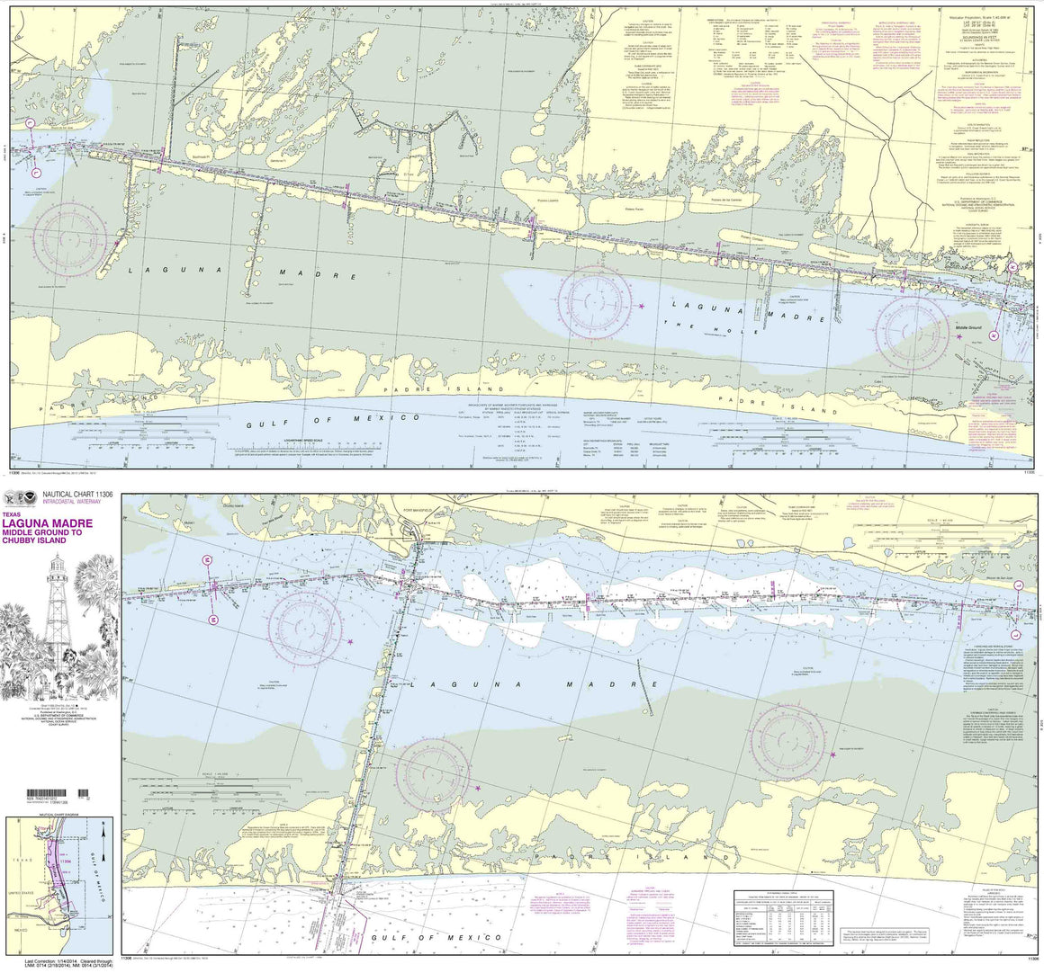
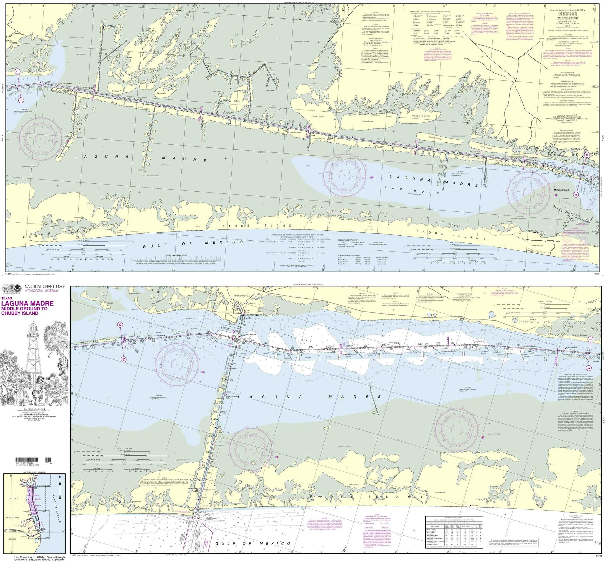
11306
$ 19.95 $ 27.00
Intracoastal Waterway Laguna Madre Middle Ground to Chubby Island These popular NOAA small craft charts are printed front and back. By default we ship them rolled on our heavy, durable,...

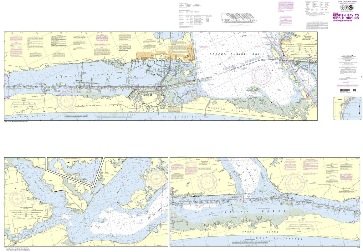
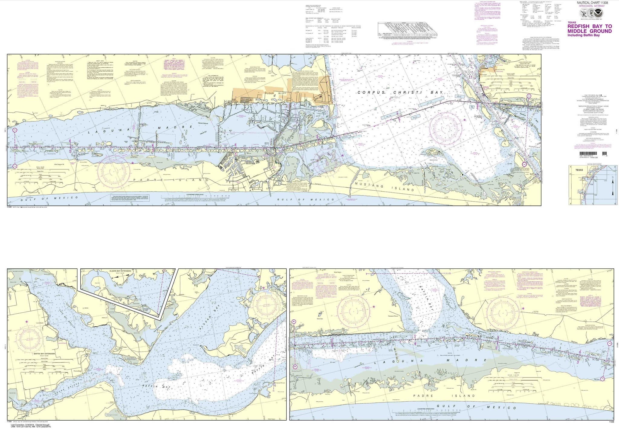
11308
$ 19.95 $ 27.00
Intracoastal Waterway Redfish Bay to Middle Ground These popular NOAA small craft charts are printed front and back. By default we ship them rolled on our heavy, durable, cruising paper...

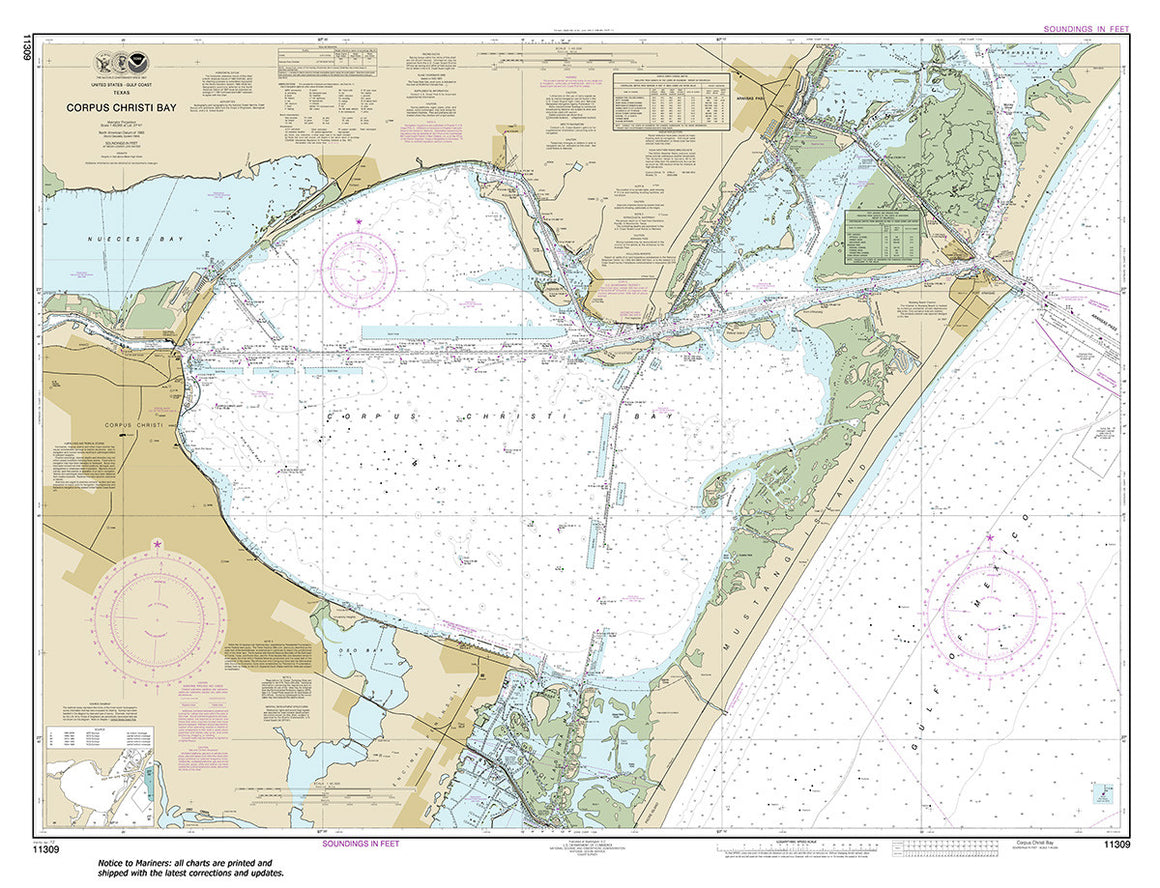
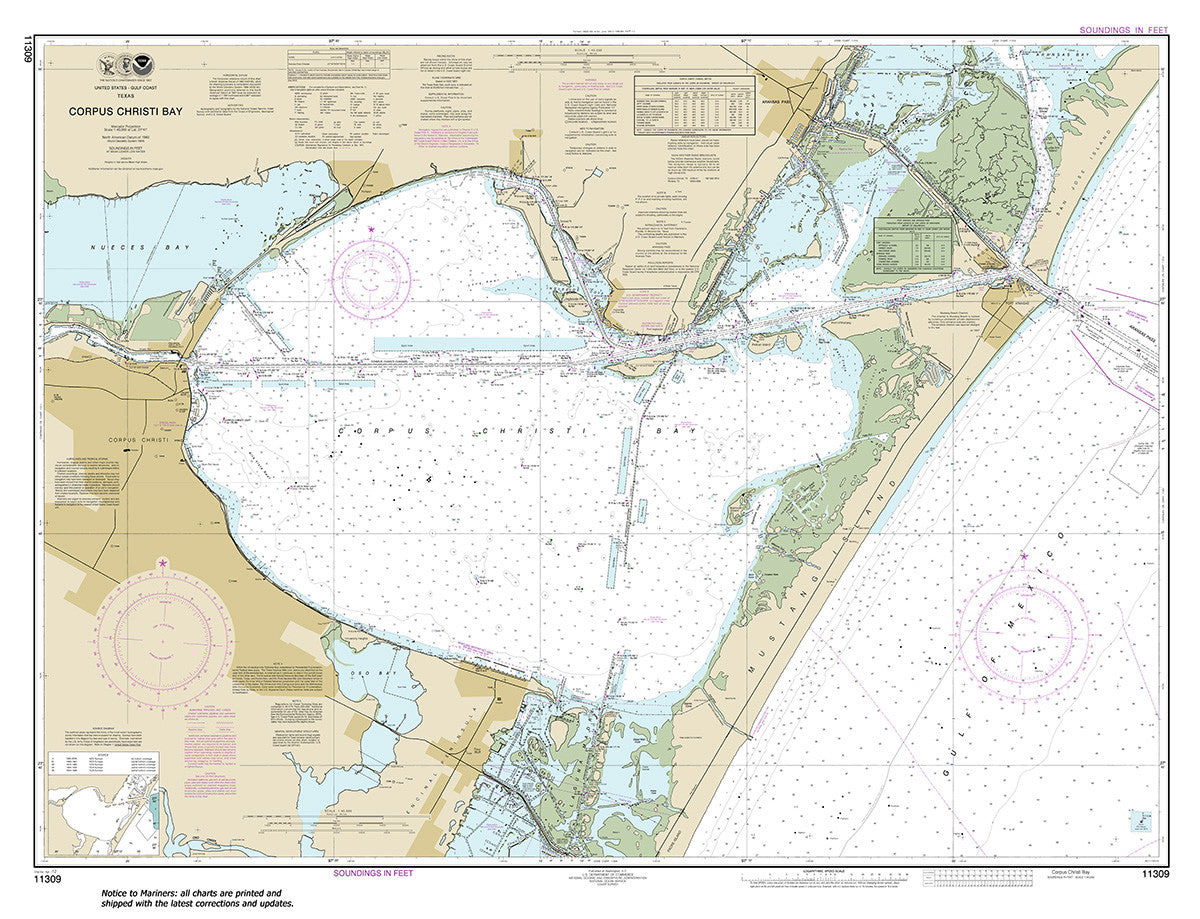
11309
$ 18.95 $ 27.00
Official NOAA Chart: Corpus Christi Bay Standard size: 47" wide by 36" tall If you would prefer a smaller, lighter and less bulky format for navigating, you may want to...

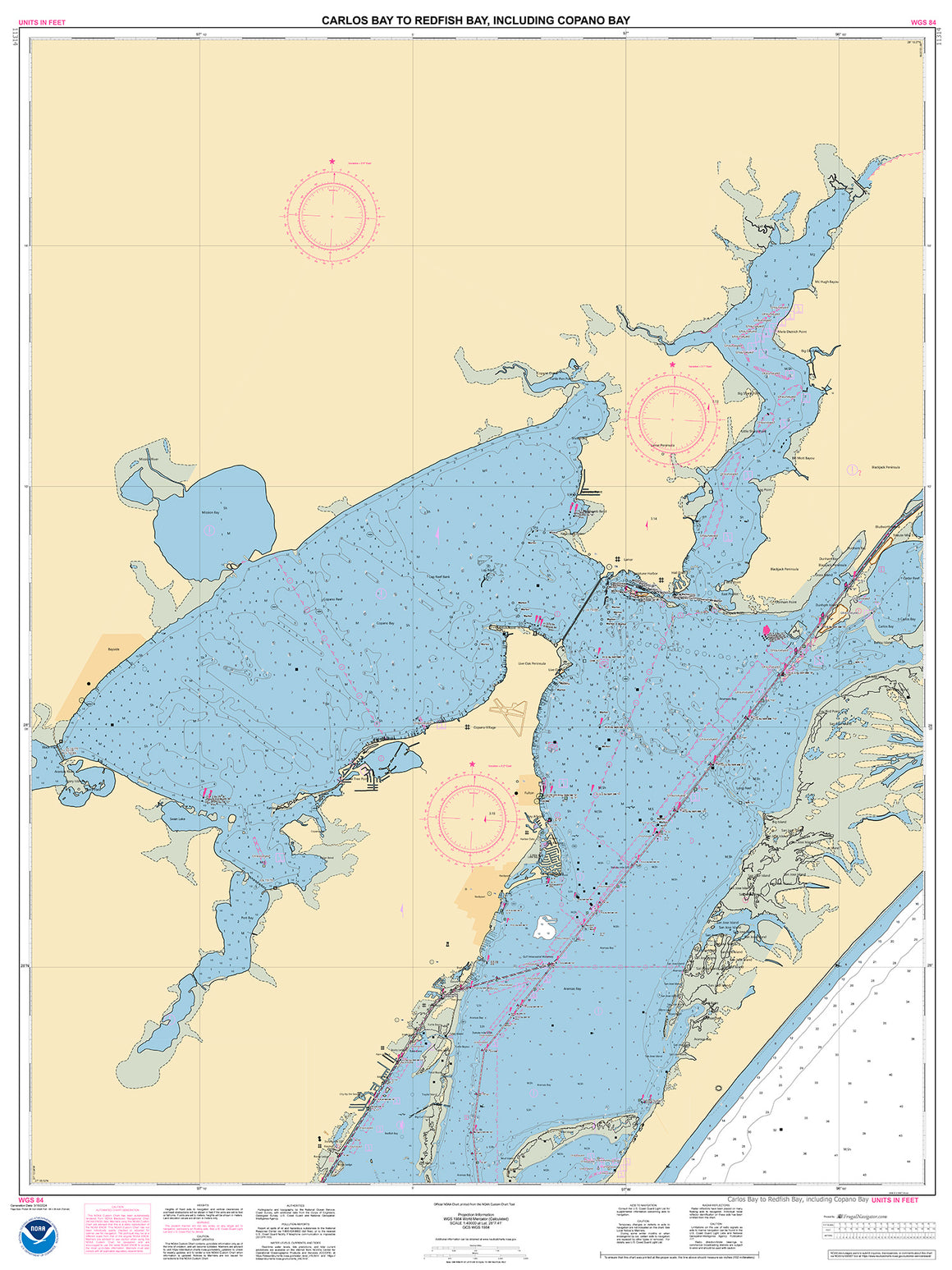

11314
$ 18.95
Official NOAA Chart of the Intracoastal Waterway : Carlos Bay to Redfish Bay, including Copano Bay. This chart is printed from the most recent NOAA ENC data. Standard size :...


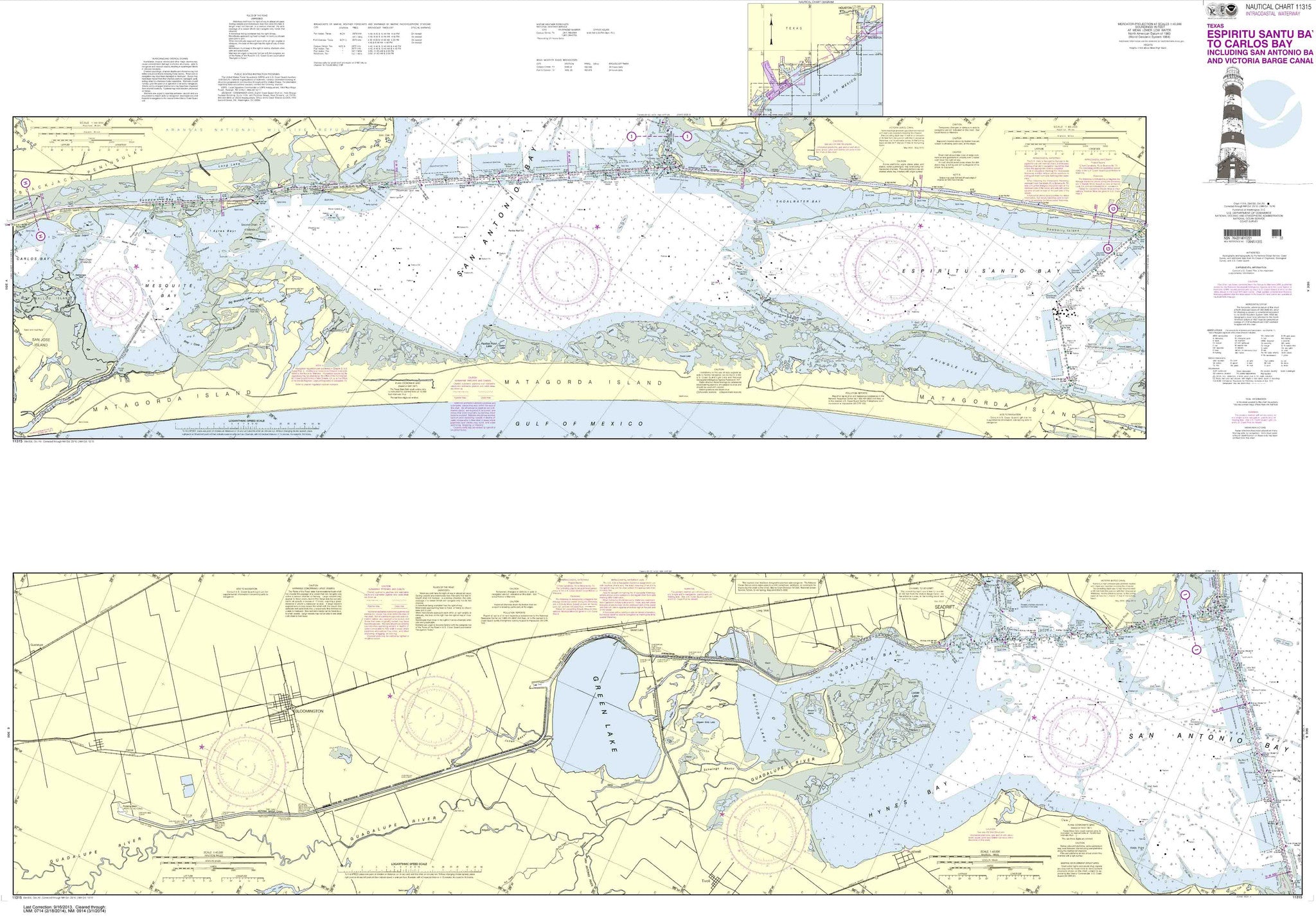
11315
$ 19.95 $ 27.00
Intracoastal Waterway Espiritu Santo Bay to Carlos Bay including San Antonio Bay and Victoria Barge Canal These popular NOAA small craft charts are printed front and back. By default we...


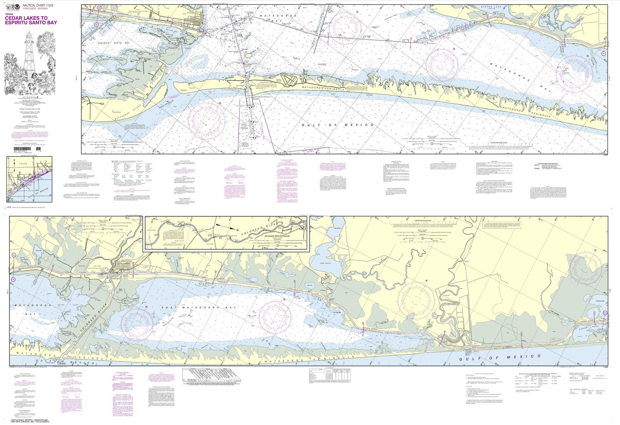
11319
$ 19.95 $ 27.00
Intracoastal Waterway Cedar Lakes to Espiritu Santo Bay These popular NOAA small craft charts are printed front and back. By default we ship them rolled on our heavy, durable, cruising...

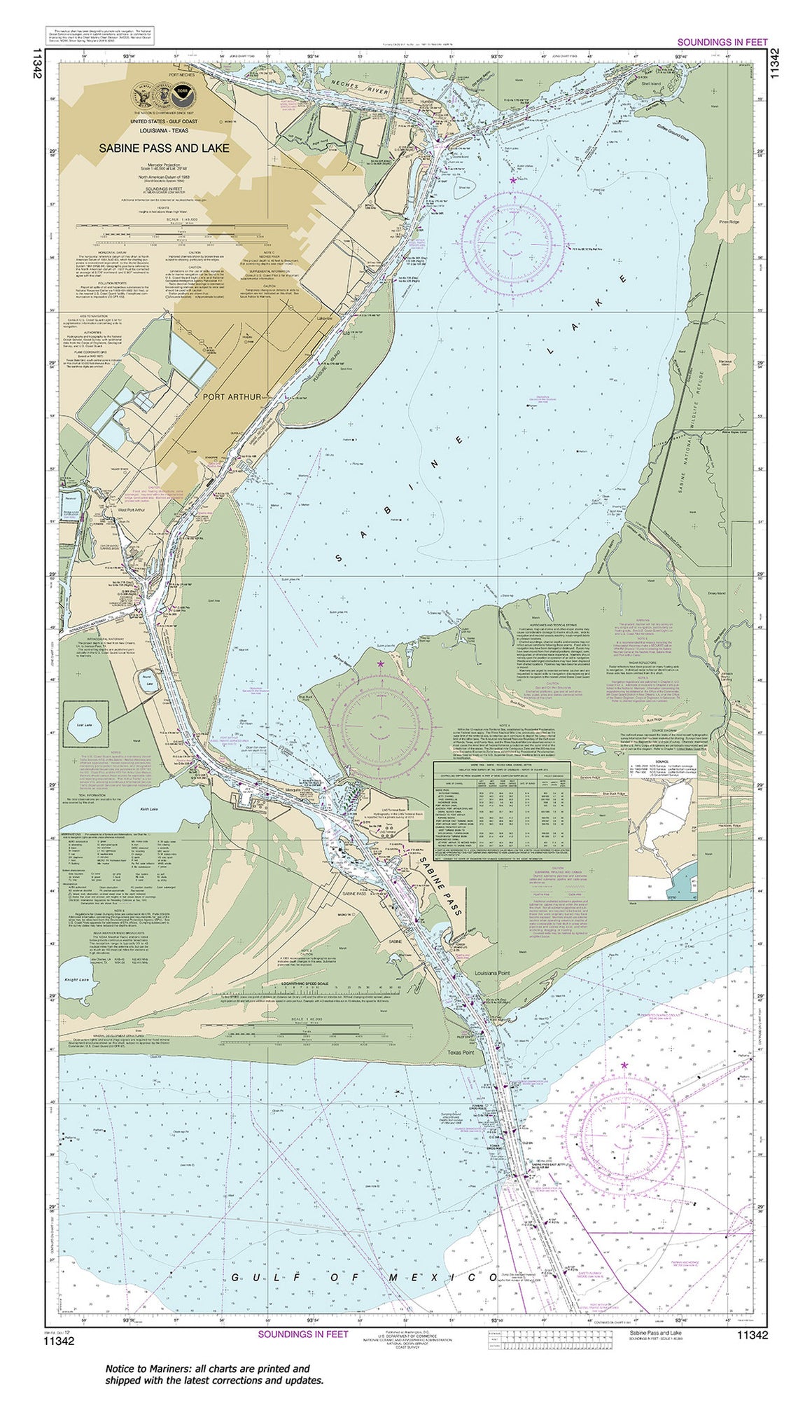

11342
$ 18.95 $ 27.00
Official NOAA Chart: Sabine Pass and Lake Standard size: 28" wide by 49" tall If you would prefer a smaller, lighter and less bulky format for navigating, you may want...

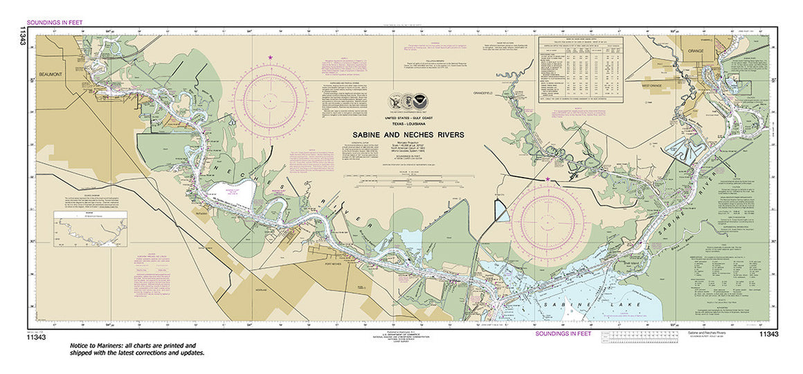
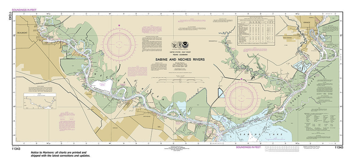
11343
$ 18.95 $ 27.00
Official NOAA Chart: Sabine and Neches Rivers Standard size: 45" wide by 21" tall If you would prefer a smaller, lighter and less bulky format for navigating, you may want...


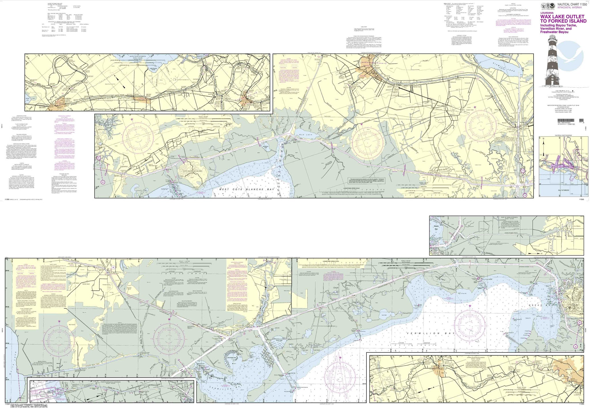
11350
$ 19.95 $ 27.00
Intracoastal Waterway Wax Lake Outlet to Forked Island including Bayou Teche, Vermilion River, and Freshwater Bayou These popular NOAA small craft charts are printed front and back. By default we...


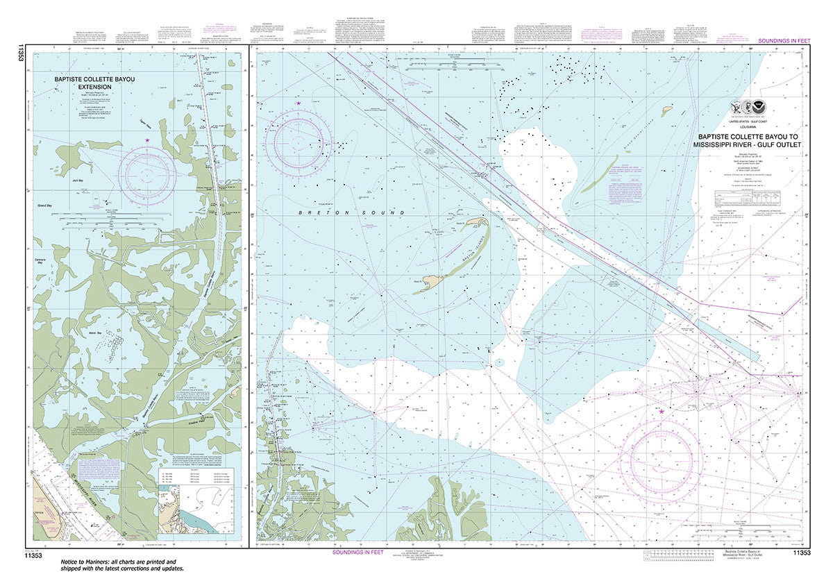
11353
$ 18.95 $ 27.00
Official NOAA Chart: Baptiste Collette Bayou to Mississippi River Gulf Outlet; Baptiste Collette Bayou Extension Standard size: 51" wide by 36" tall If you would prefer a smaller, lighter and...

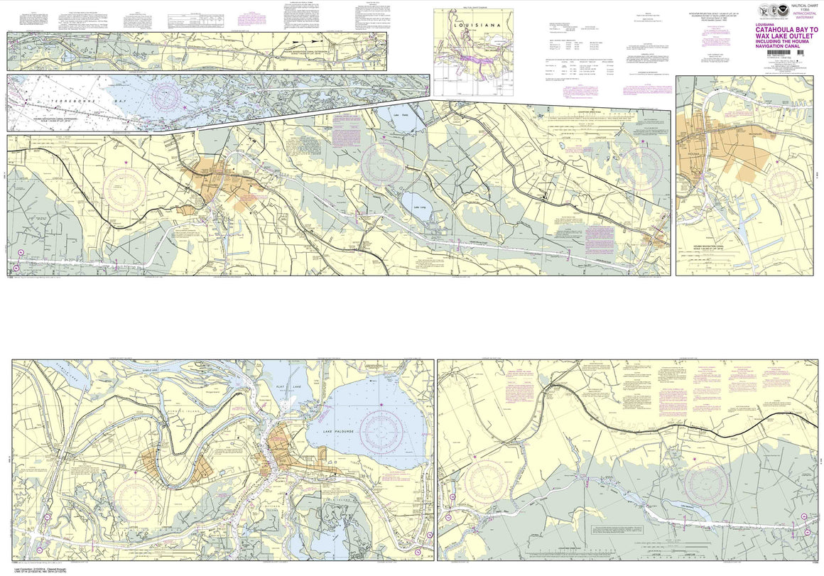
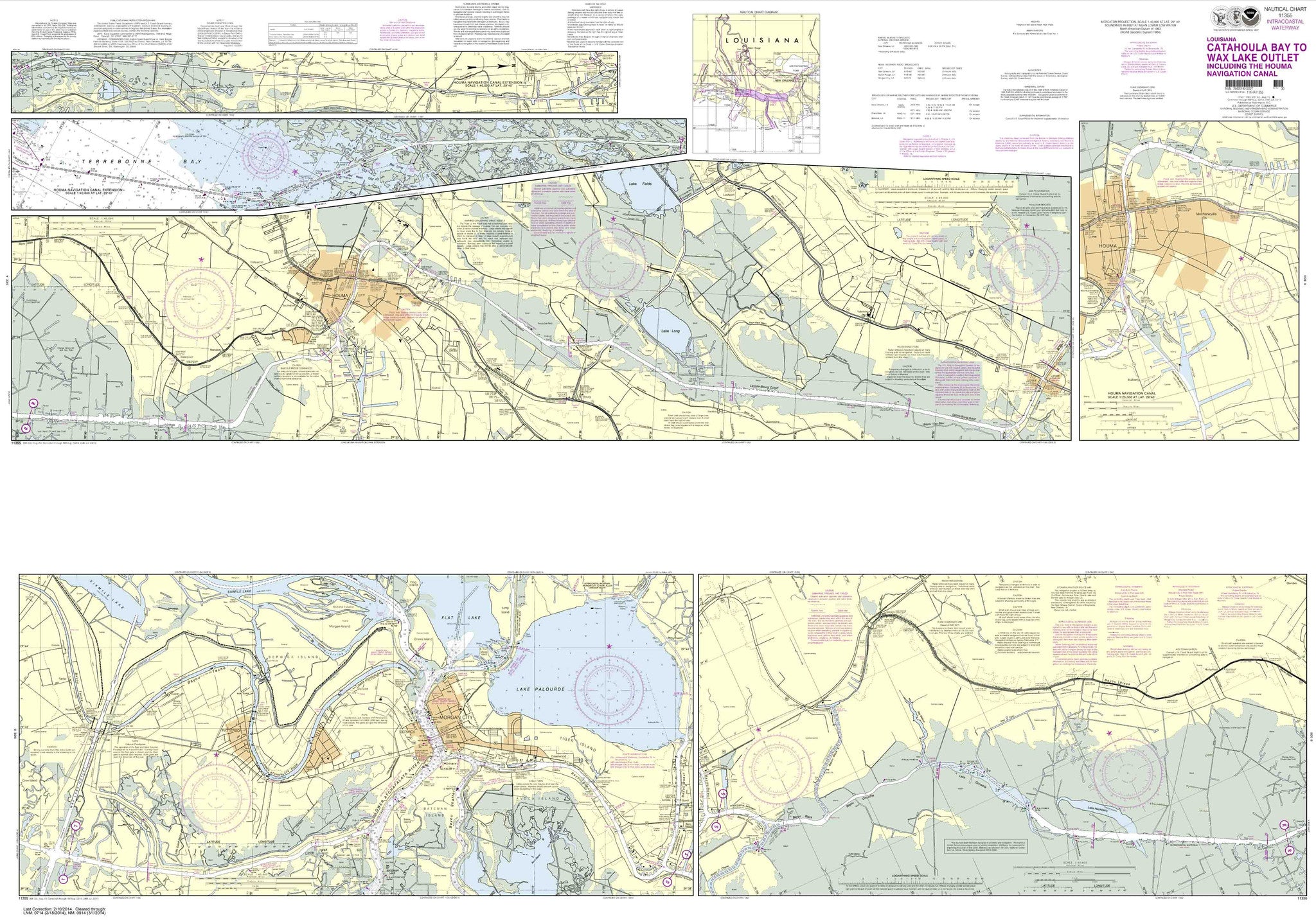
11355
$ 19.95 $ 27.00
Intracoastal Waterway Catahoula Bay to Wax Lake Outlet including the Houma Navigation canal These popular NOAA small craft charts are printed front and back. By default we ship them rolled...

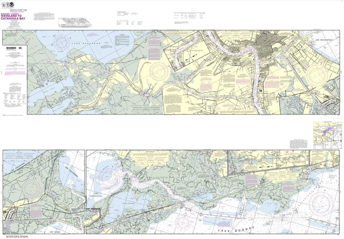
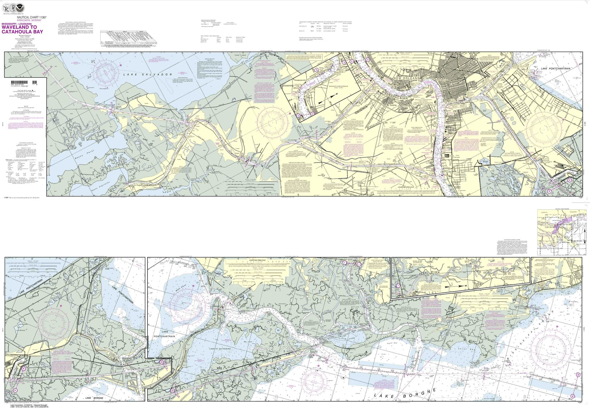
11367
$ 19.95 $ 27.00
Intracoastal Waterway Waveland to Catahoula Bay These popular NOAA small craft charts are printed front and back. By default we ship them rolled on our heavy, durable, cruising paper with...

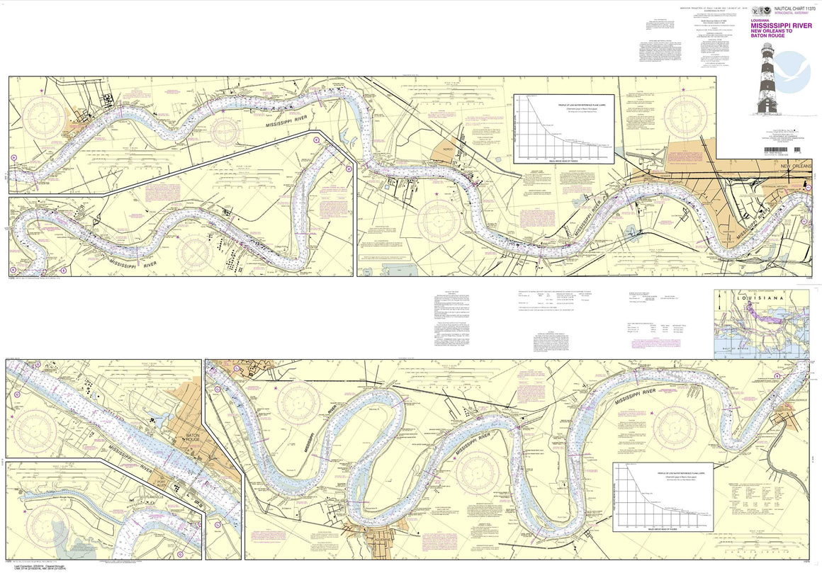
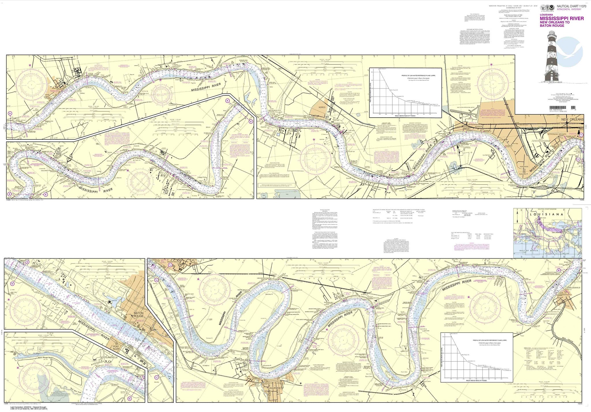
11370
$ 19.95 $ 27.00
Mississippi River-New Orleans to Baton Rouge These popular NOAA small craft charts are printed front and back. By default we ship them rolled on our heavy, durable, cruising paper with...


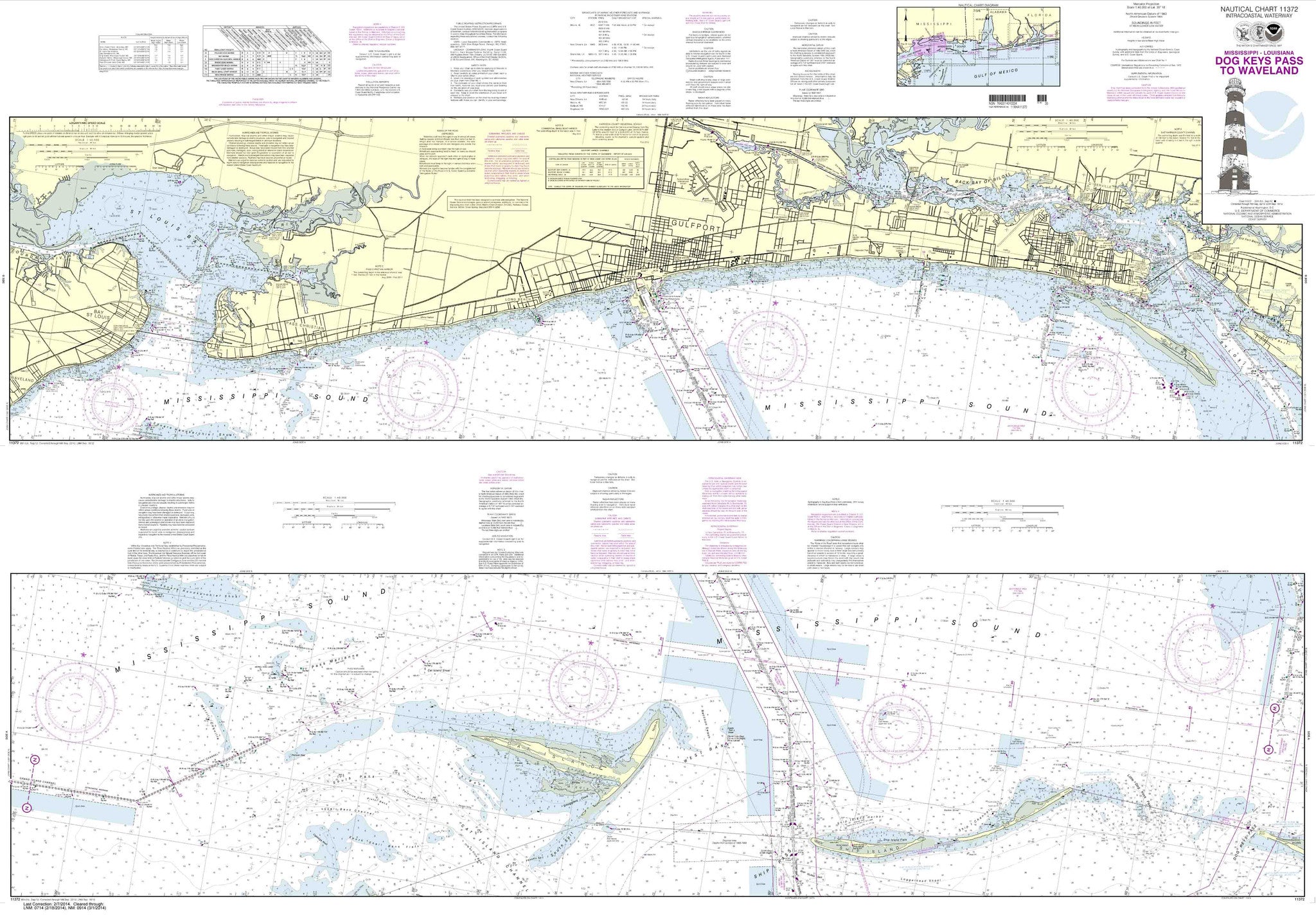
11372
$ 19.95 $ 27.00
Intracoastal Waterway Dog Keys Pass to Waveland These popular NOAA small craft charts are printed front and back. By default we ship them rolled on our heavy, durable, cruising paper...

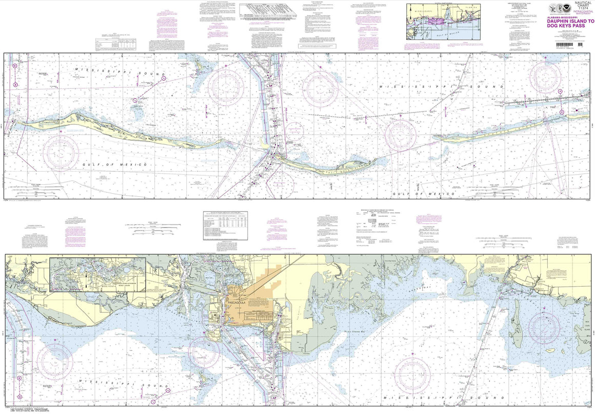
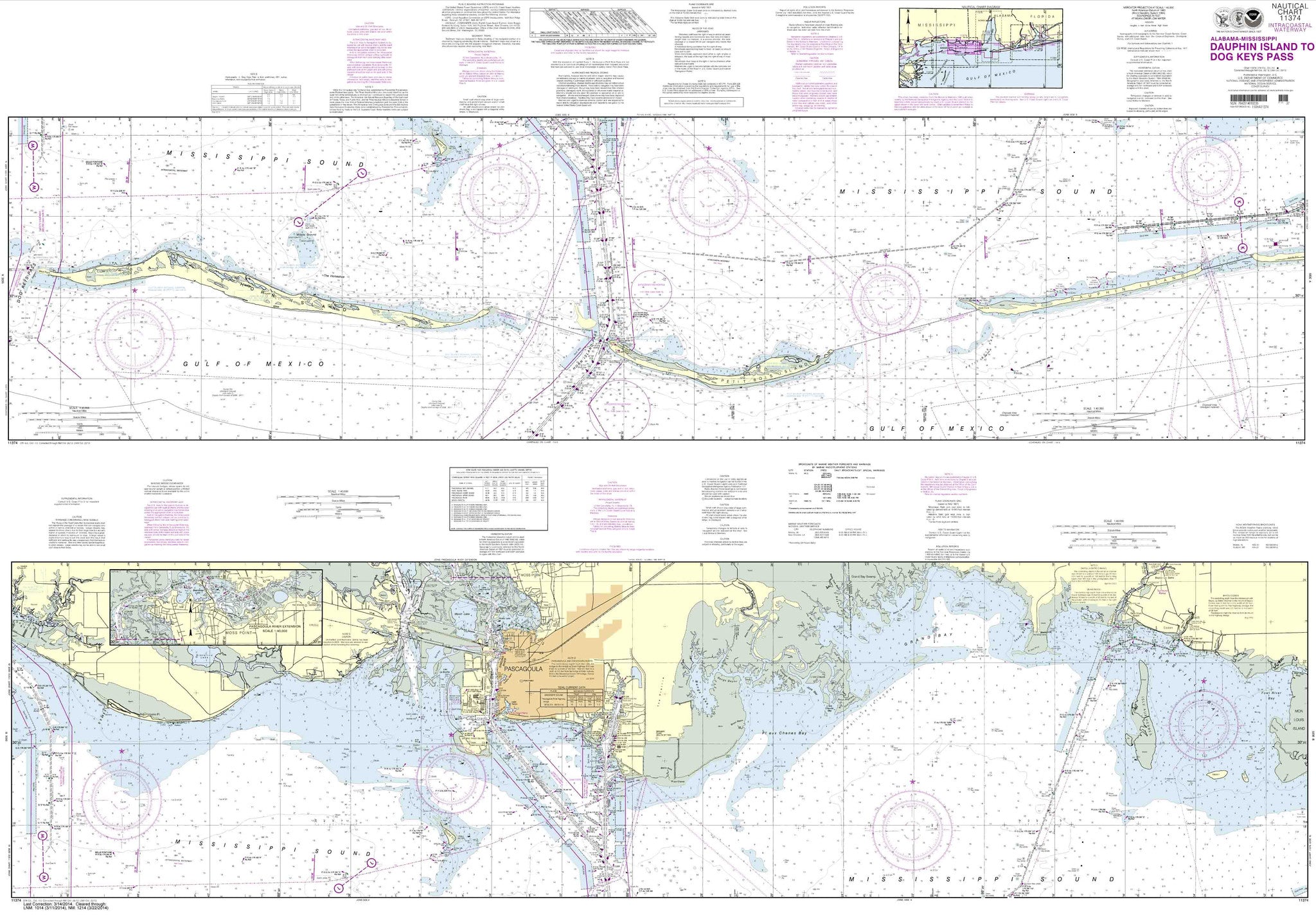
11374
$ 19.95 $ 27.00
Intracoastal Waterway Dauphin Island to Dog Keys Pass These popular NOAA small craft charts are printed front and back. By default we ship them rolled on our heavy, durable, cruising...


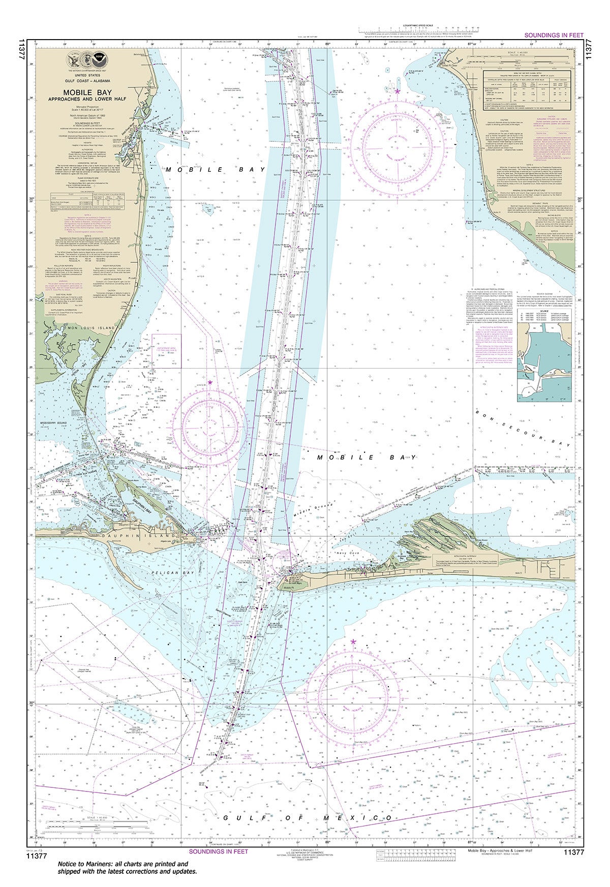
11377
$ 18.95 $ 27.00
Official NOAA Chart: Mobile Bay Approaches and Lower Half Standard size: 33" wide by 49" tall If you would prefer a smaller, lighter and less bulky format for navigating, you...


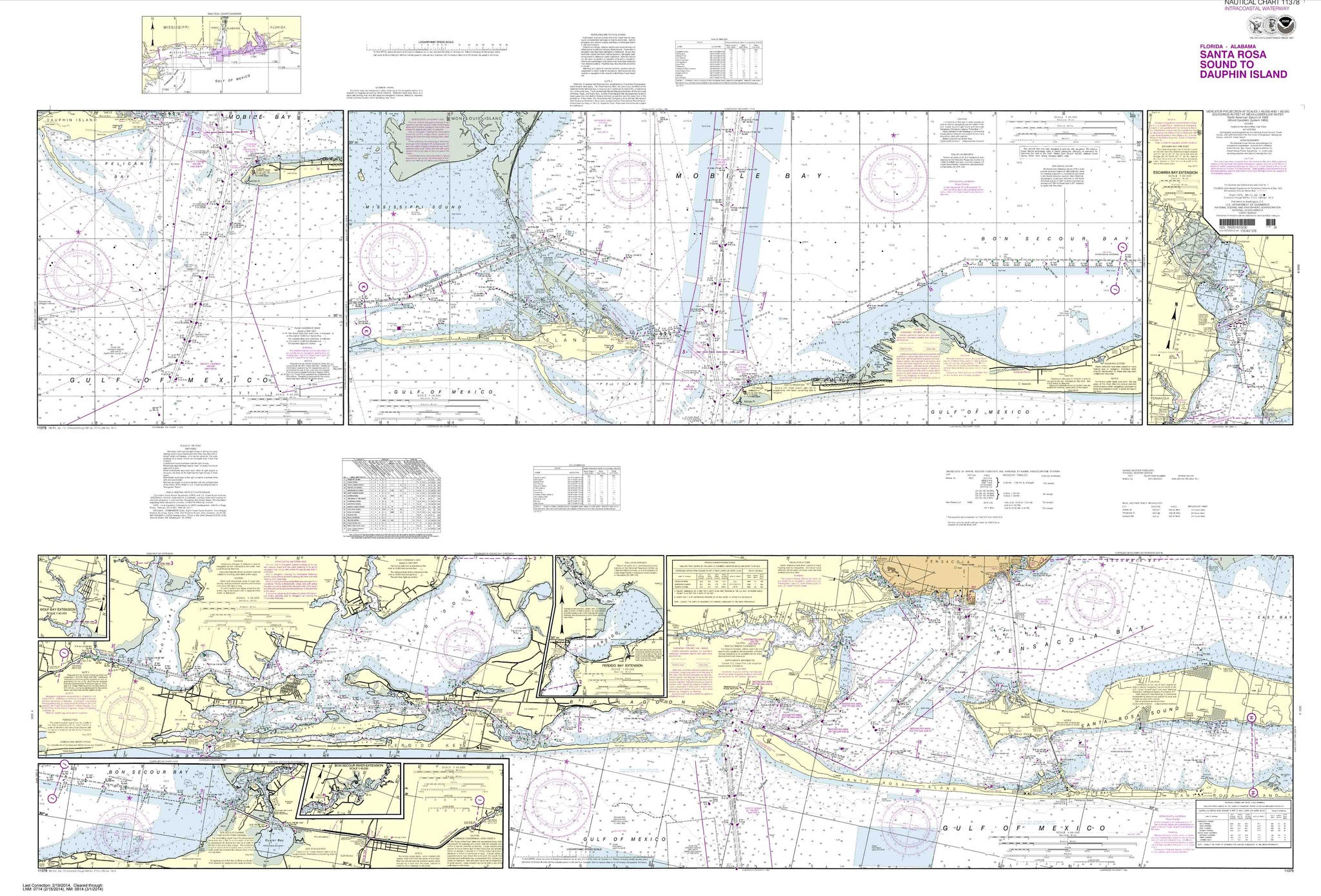
11378
$ 19.95 $ 27.00
Intracoastal Waterway Santa Rosa Sound to Dauphin Island These popular NOAA small craft charts are printed front and back. By default we ship them rolled on our heavy, durable, cruising...

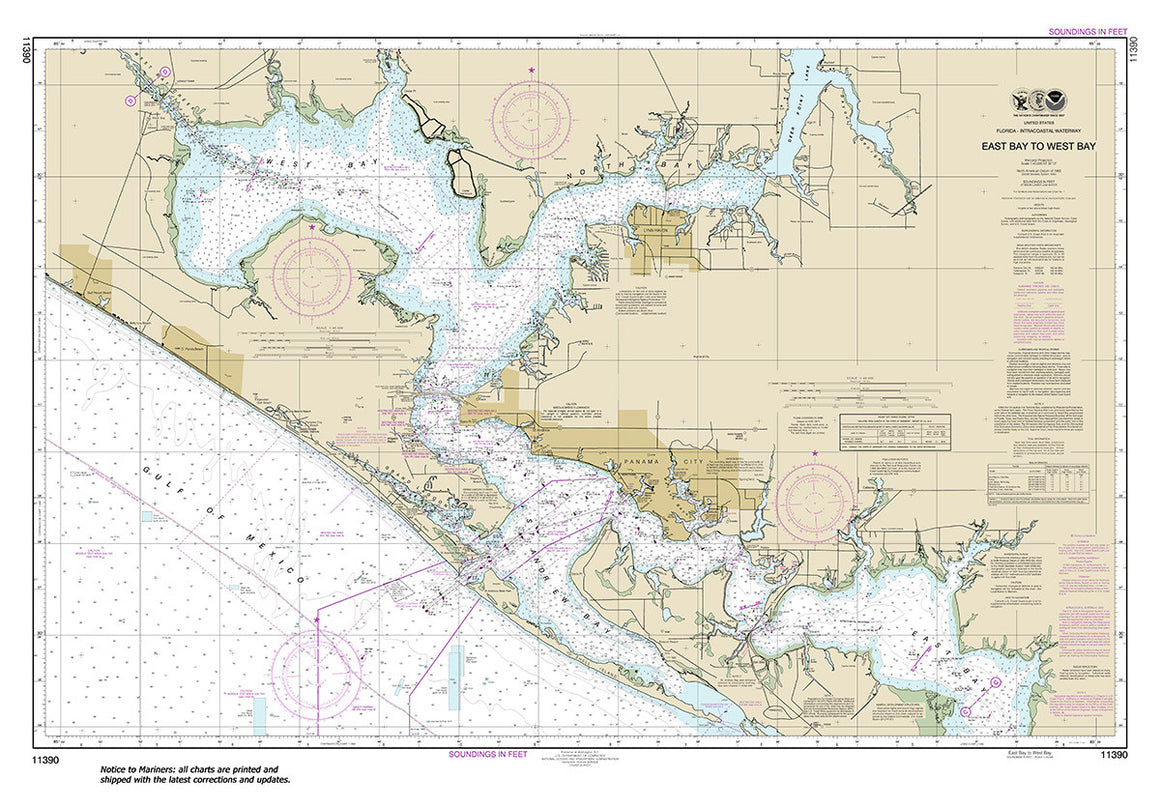
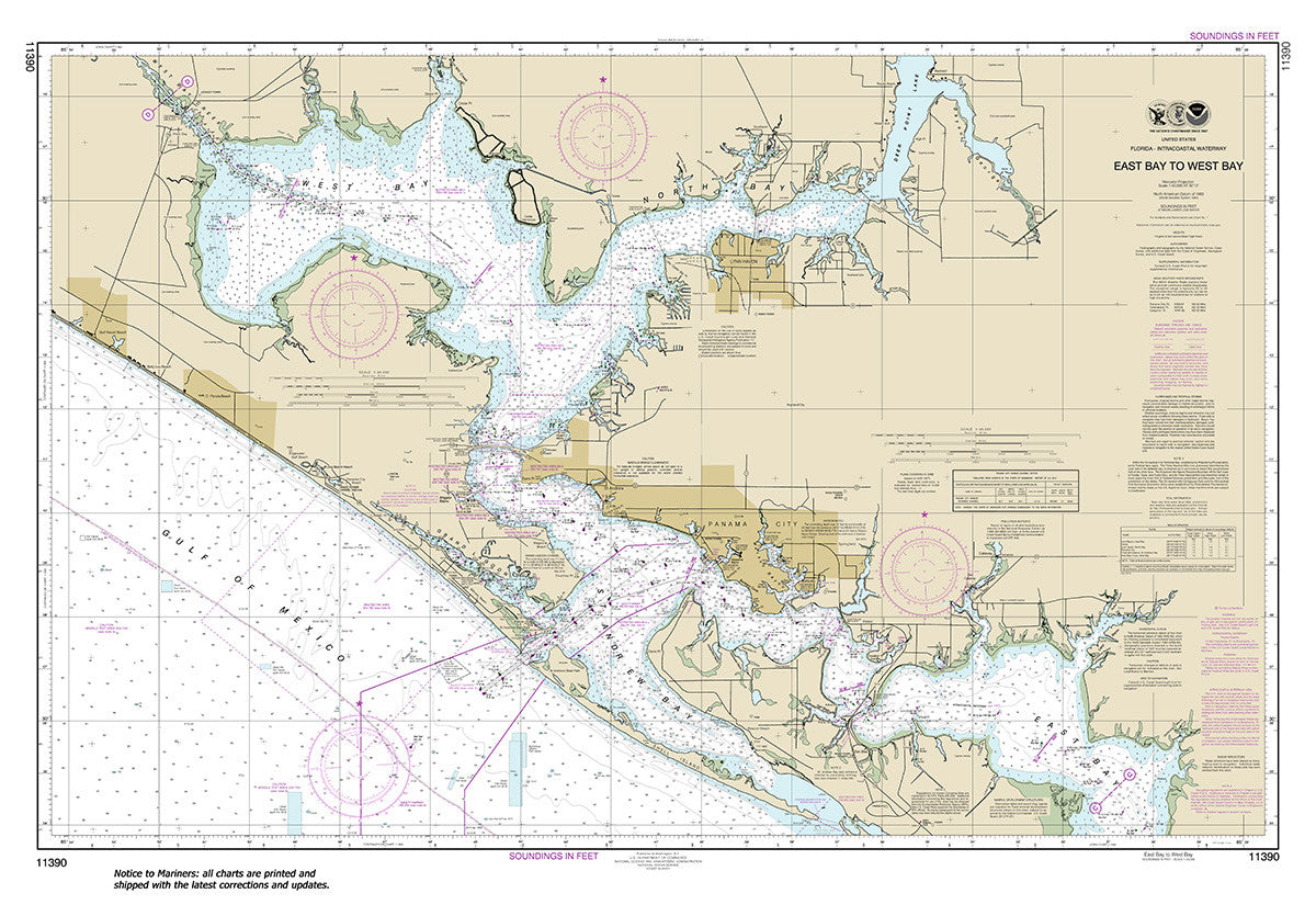
11390
$ 18.95 $ 27.00
Official NOAA Chart: Intracoastal Waterway East Bay to West Bay Standard size: 46" wide by 32" tall If you would prefer a smaller, lighter and less bulky format for navigating,...


11393
$ 18.95 $ 27.00
Official NOAA Chart: Intracoastal Waterway Lake Wimico to East Bay To see adjacent charts in this area please explore our Gulf Coast Catalog Standard Size: 60" wide by 34" tall...


11402
$ 18.95 $ 27.00
Intracoastal Waterway Apalachicola Bay to Lake Wimico Standard size: 46" wide by 32" tall If you would prefer a smaller, lighter and less bulky format for navigating, you may want...


11404
$ 18.95 $ 27.00
Intracoastal Waterway Carrabelle to Apalachicola Bay; Carrabelle River Standard size: 46" wide by 32" tall If you would prefer a smaller, lighter and less bulky format for navigating, you may...


11411
$ 19.95 $ 27.00
Intracoastal Waterway Tampa Bay to Port Richey These popular NOAA small craft charts are printed front and back. By default we ship them rolled on our heavy, durable, cruising paper...
© 2024 FrugalNavigator.com. POS and Ecommerce by Shopify