AK5 | NOAA Chart Catalog for Alaska: Kenai Peninsula and Cook Inlet


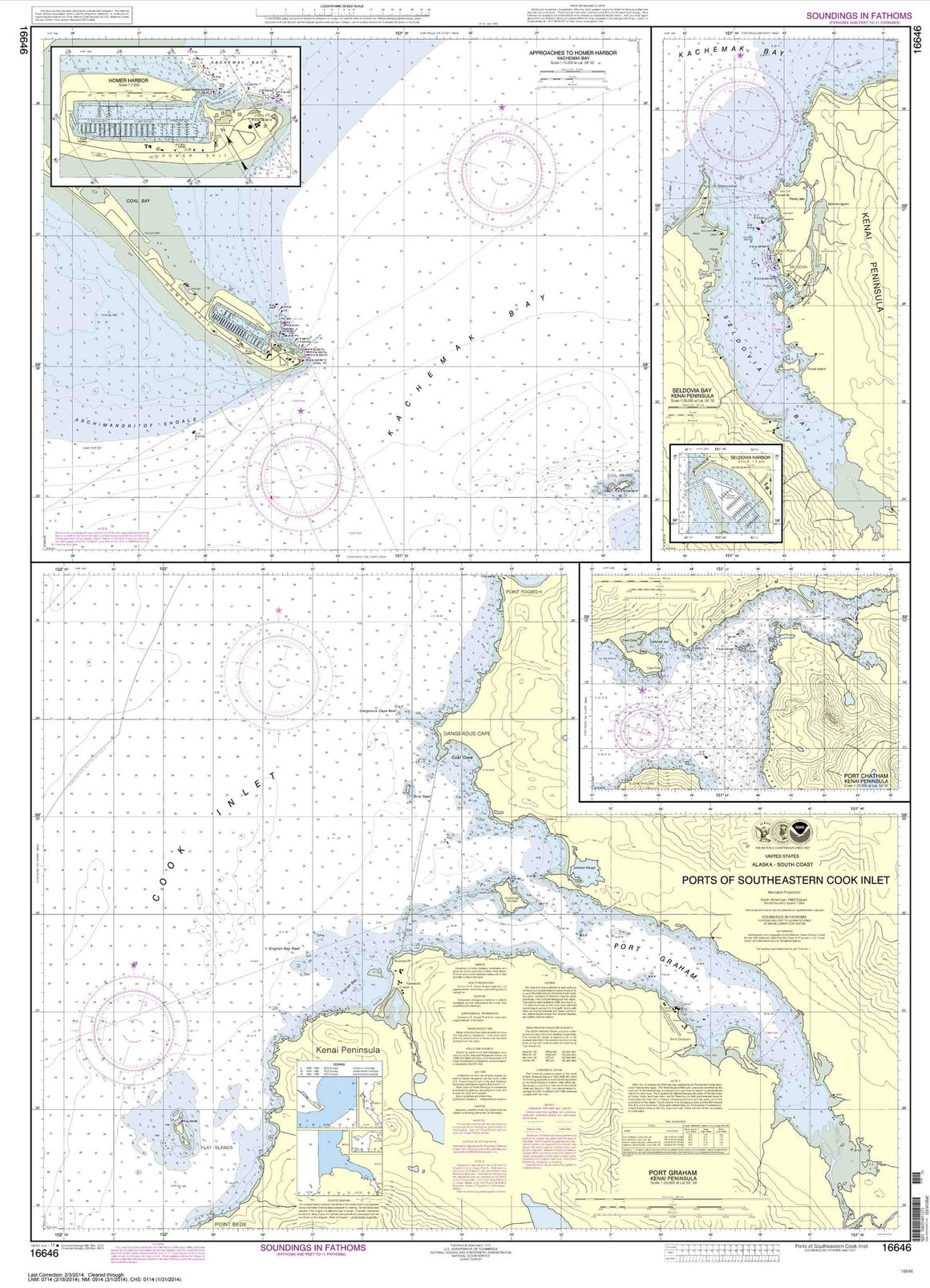

16646
$ 18.95 $ 27.00
Ports of Southeastern Cook Inlet Port Chatham;Port Graham;Seldovia Bay;Seldovia Harbor;Approaches to Homer Hbr;Homer Harbor


16661
$ 18.95 $ 27.00
Cook Inlet-Anchor Point to Kalgin Island;Ninilchik Harbor


16663
$ 18.95 $ 27.00
Cook Inlet-East Foreland to Anchorage;North Foreland


16682
$ 18.95 $ 27.00
Cape Resurrection to Two Arm Bay with an inset of Seward


16700
$ 18.95 $ 27.00
Official NOAA Chart for Alaska's Prince William Sound Standard Chart : 36" wide by 48" tall If you would prefer a smaller, lighter and less bulky format for navigating, you...


16706
$ 18.95 $ 27.00
Passage Canal incl. Port of Whittier;Port of Whittier


16711
$ 18.95 $ 27.00
Port Wells, including College Fiord and Harriman Fiord


© 2025 FrugalNavigator.com. POS and Ecommerce by Shopify