Gulf Coast Catalog #2 | Freeport to Lake Arthur
High Quality NOAA Charts at a Low Price : Most starting at $15.95 with FREE Shipping
Click on Marker Pins to view chart details:


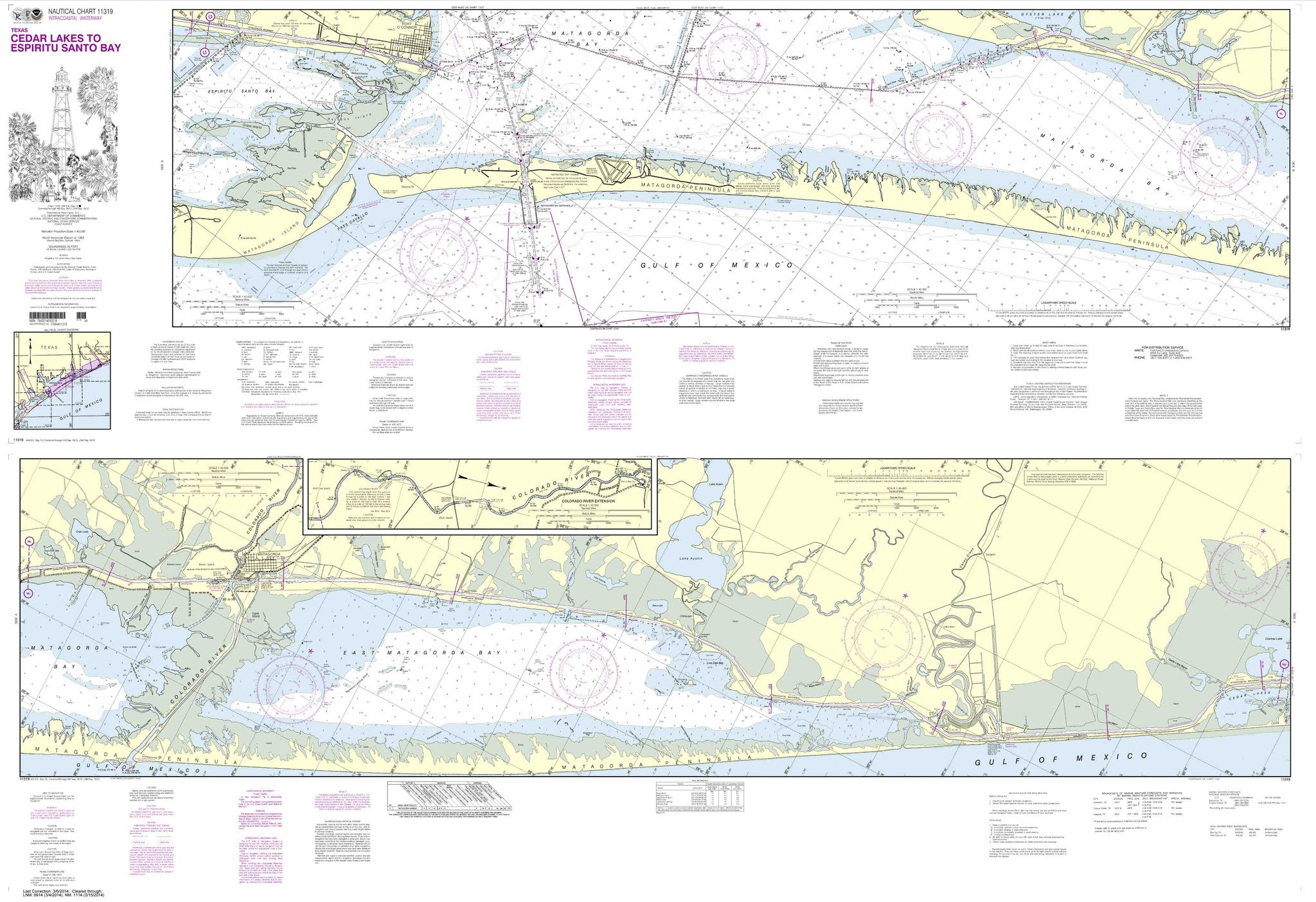
11319
Sold Out $ 27.00
Intracoastal Waterway Cedar Lakes to Espiritu Santo Bay These popular NOAA small craft charts are printed front and back. By default we ship them rolled on our heavy, durable, cruising...

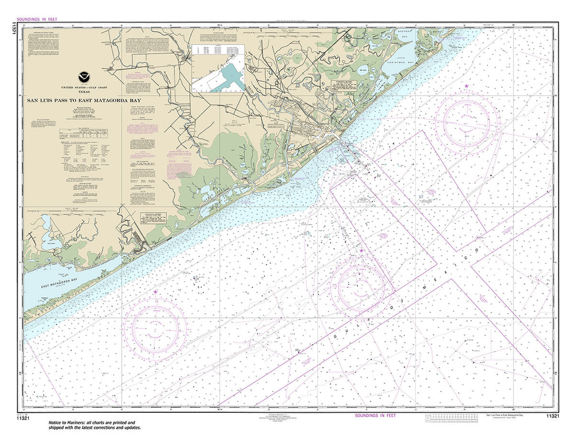
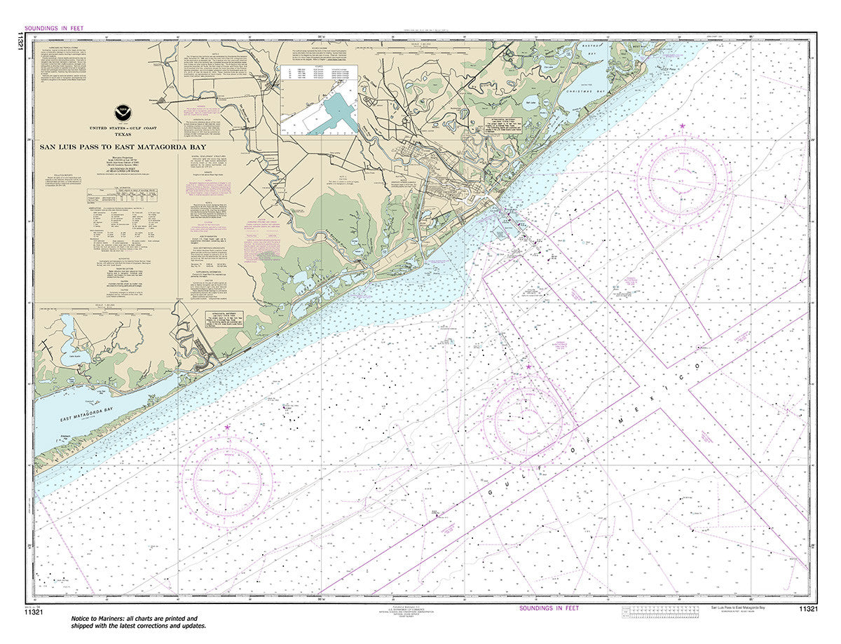
11321
$ 18.95 $ 27.00
Official NOAA Chart: San Luis Pass to East Matagorda Bay Standard size: 47" wide by 36" tall If you would prefer a smaller, lighter and less bulky format for navigating,...


11322
$ 46.95
Official NOAA Chart covering the Intracoastal Waterway : Galveston Bay to Cedar Lakes. The charts in this set are printed from the most recent ENC data. Small Craft Folio :...

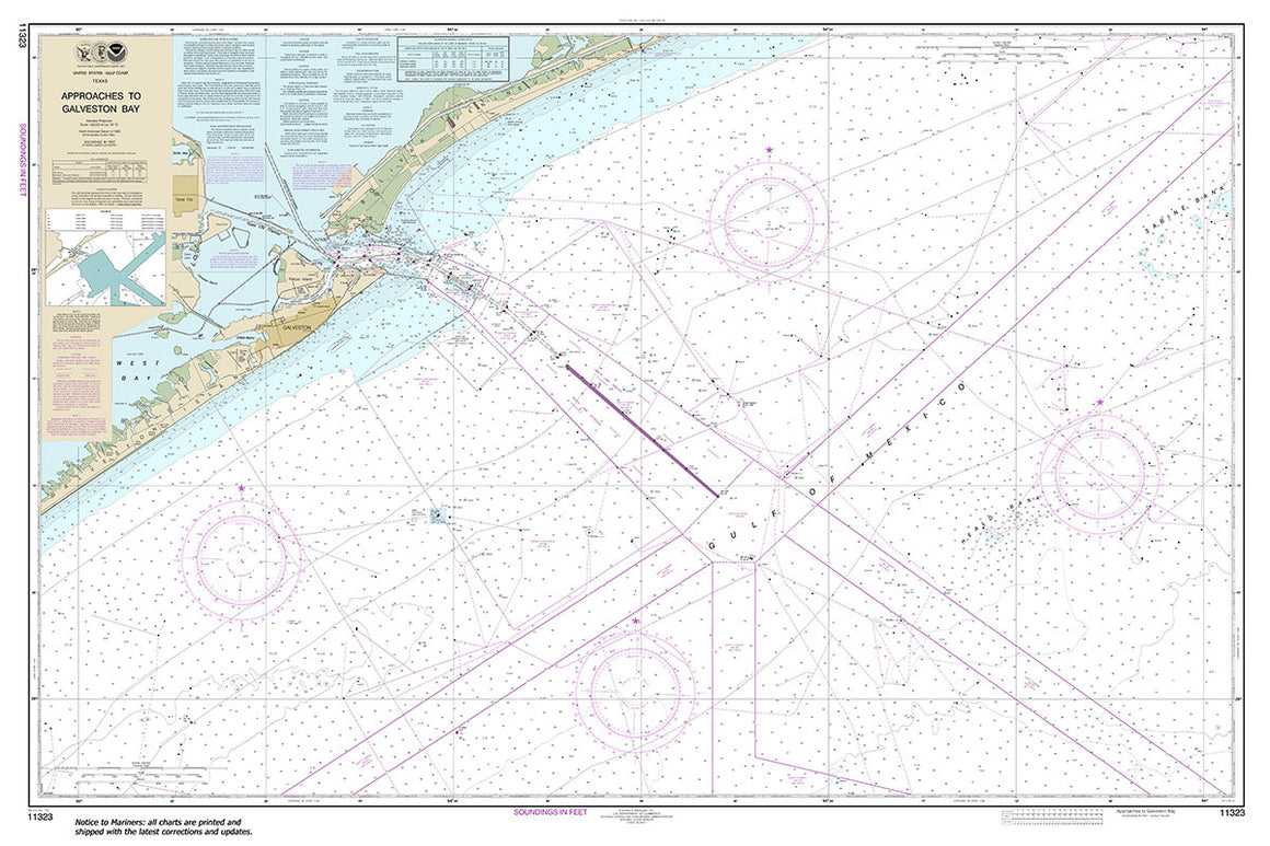
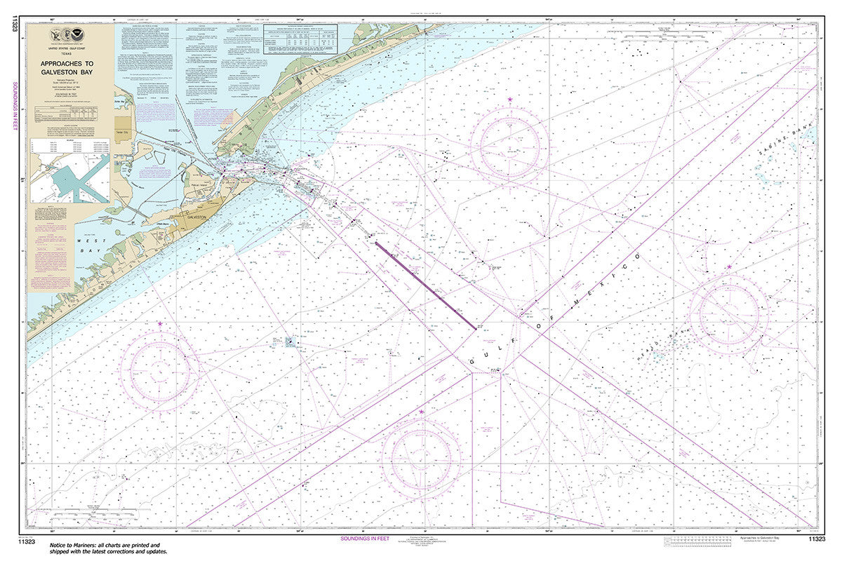
11323
$ 18.95 $ 27.00
Official NOAA Chart: Approaches to Galveston Bay Standard size: 54" wide by 36" tall If you would prefer a smaller, lighter and less bulky format for navigating, you may want...


11324
$ 18.95 $ 27.00
Official NOAA Chart: Galveston Bay Entrance Galveston and Texas City Harbors Standard size: 53" wide by 36" tall This Chart meets the requirements for mandatory carriage of nautical charts established...


11325
$ 18.95 $ 27.00
Official NOAA Chart: Houston Ship Channel Carpenters Bayou to Houston Standard size: 46" wide by 36" tall If you would prefer a smaller, lighter and less bulky format for navigating,...


11326
$ 37.95
Official NOAA Galveston Bay : Intracoastal Waterway Small Craft Folio Chart. The charts in this set are printed from the most recent ENC data. Small Craft Folio : a six chart...


11327
$ 18.95 $ 27.00
Official NOAA Chart: Upper Galveston Bay-Houston Ship Channel-Dollar Pt. to Atkinson Standard size: 36" wide by 50" tall If you would prefer a smaller, lighter and less bulky format for...


11328
$ 18.95 $ 27.00
Official NOAA Chart: Houston Ship Channel Atkinson Island to Alexander Island Standard size: 50" wide by 36" tall If you would prefer a smaller, lighter and less bulky format for...


11329
$ 18.95 $ 27.00
Official NOAA Chart: Houston Ship Channel Alexander Island to Carpenters Bayou; San Jacinto and Old Rivers Standard size: 36" wide by 36" tall If you would prefer a smaller, lighter...


11331
$ 46.95
Official NOAA Chart covering the Intracoastal Waterway from Ellender to Galveston Bay. The charts in this set are printed from the most recent ENC data. Small Craft Folio: Each of...


11339
$ 18.95 $ 27.00
Official NOAA Chart: Calcasieu River and Approaches 36" wide by 59" tall If you would prefer a smaller, lighter and less bulky format for navigating, you may want to choose...


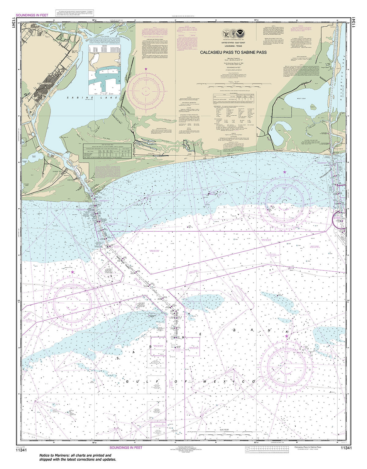
11341
$ 18.95 $ 27.00
Official NOAA Chart: Calcasieu Pass to Sabine Pass Standard size: 36" wide by 46" tall If you would prefer a smaller, lighter and less bulky format for navigating, you may...

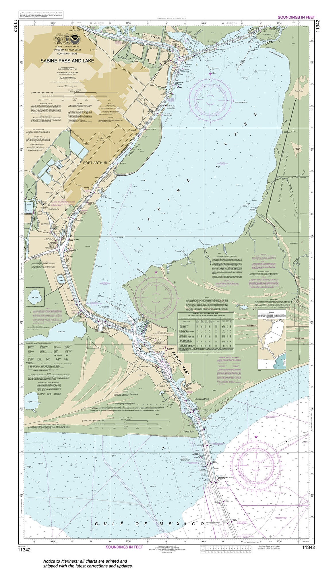

11342
$ 18.95 $ 27.00
Official NOAA Chart: Sabine Pass and Lake Standard size: 28" wide by 49" tall If you would prefer a smaller, lighter and less bulky format for navigating, you may want...

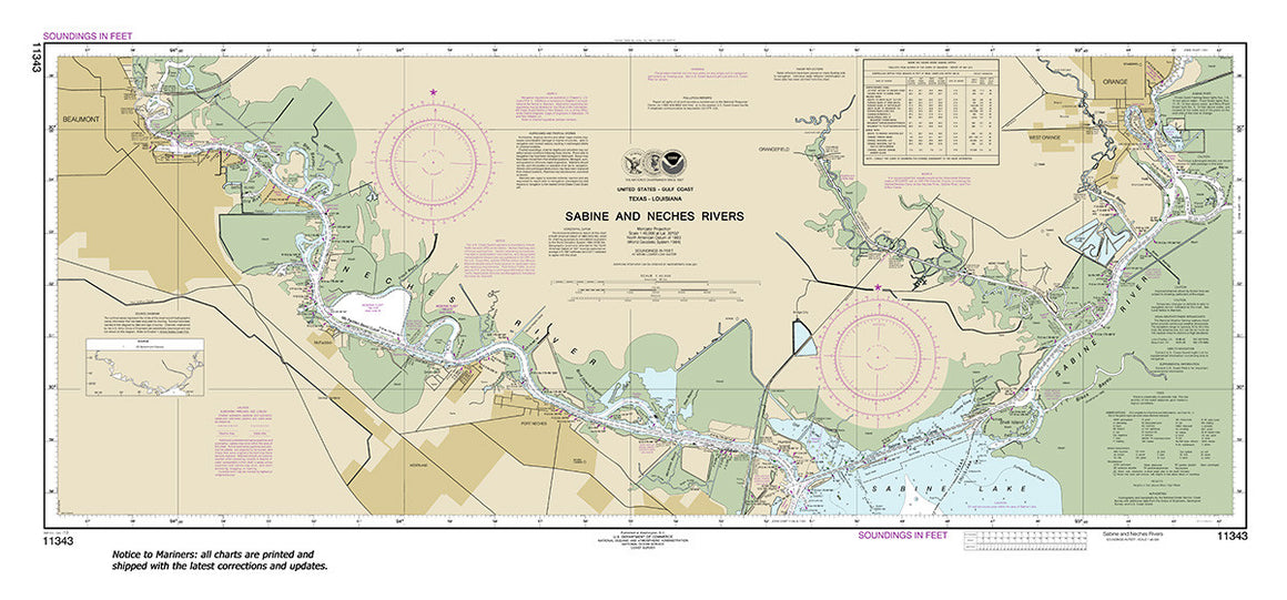
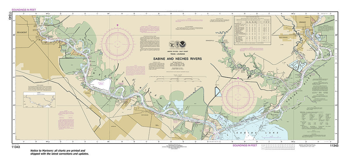
11343
$ 18.95 $ 27.00
Official NOAA Chart: Sabine and Neches Rivers Standard size: 45" wide by 21" tall If you would prefer a smaller, lighter and less bulky format for navigating, you may want...

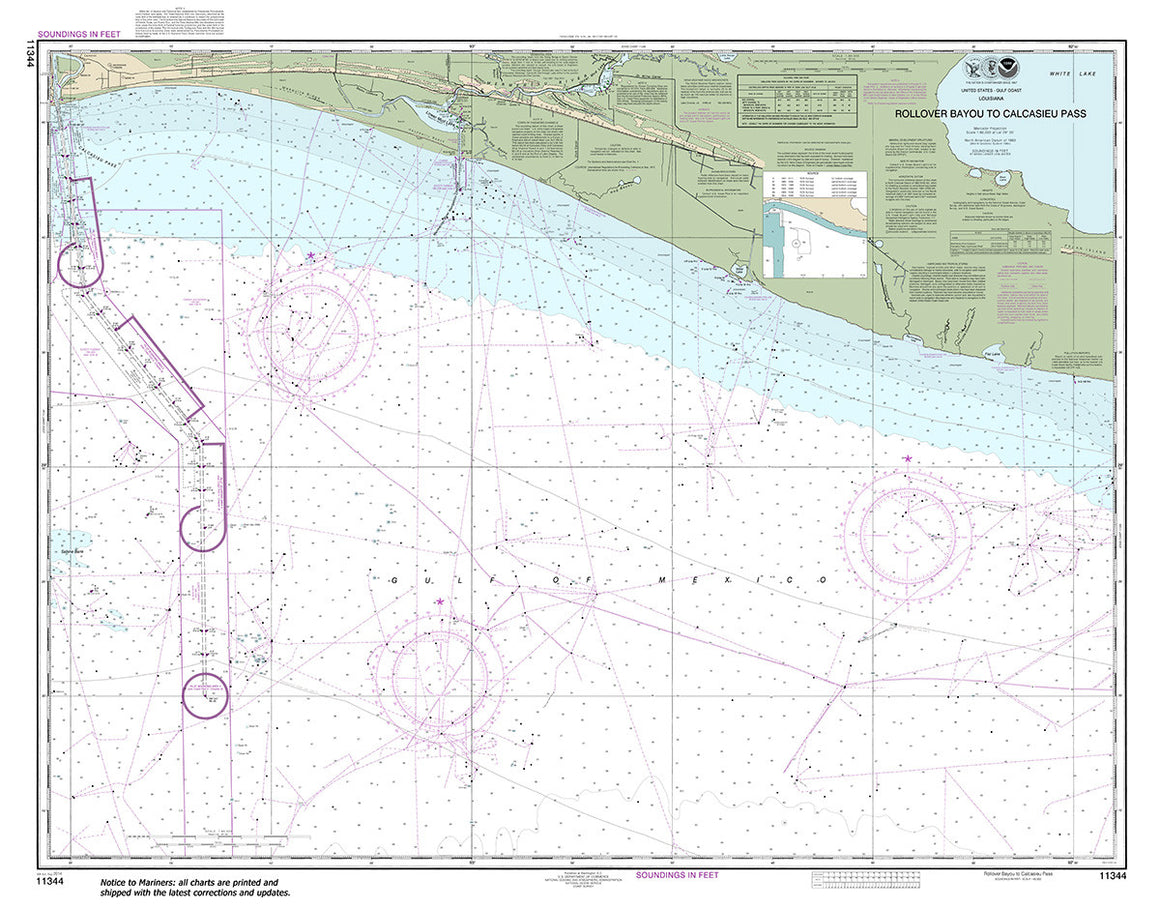
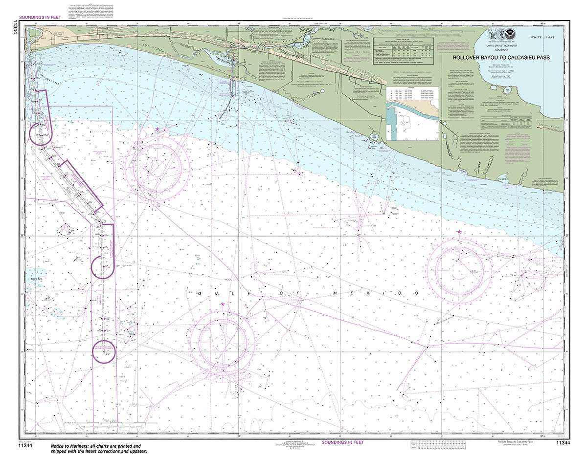
11344
$ 18.95 $ 27.00
Official NOAA Chart: Rollover Bayou to Calcasieu Pass Standard size: 46" wide by 36" tall If you would prefer a smaller, lighter and less bulky format for navigating, you may...

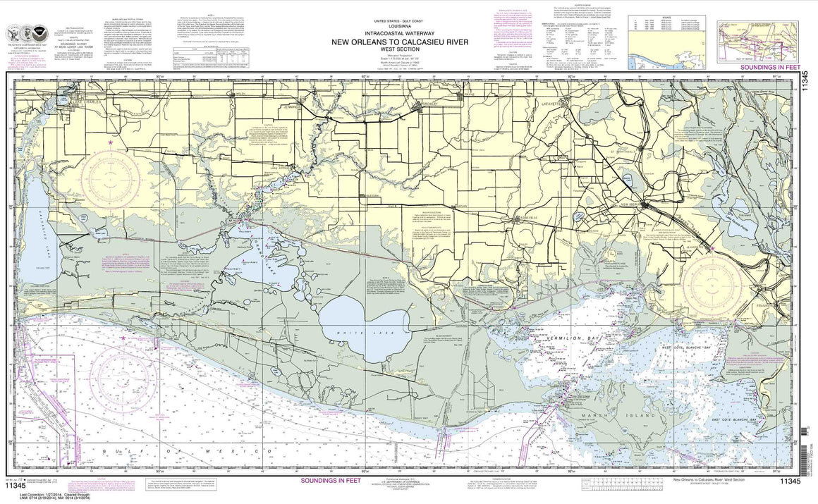
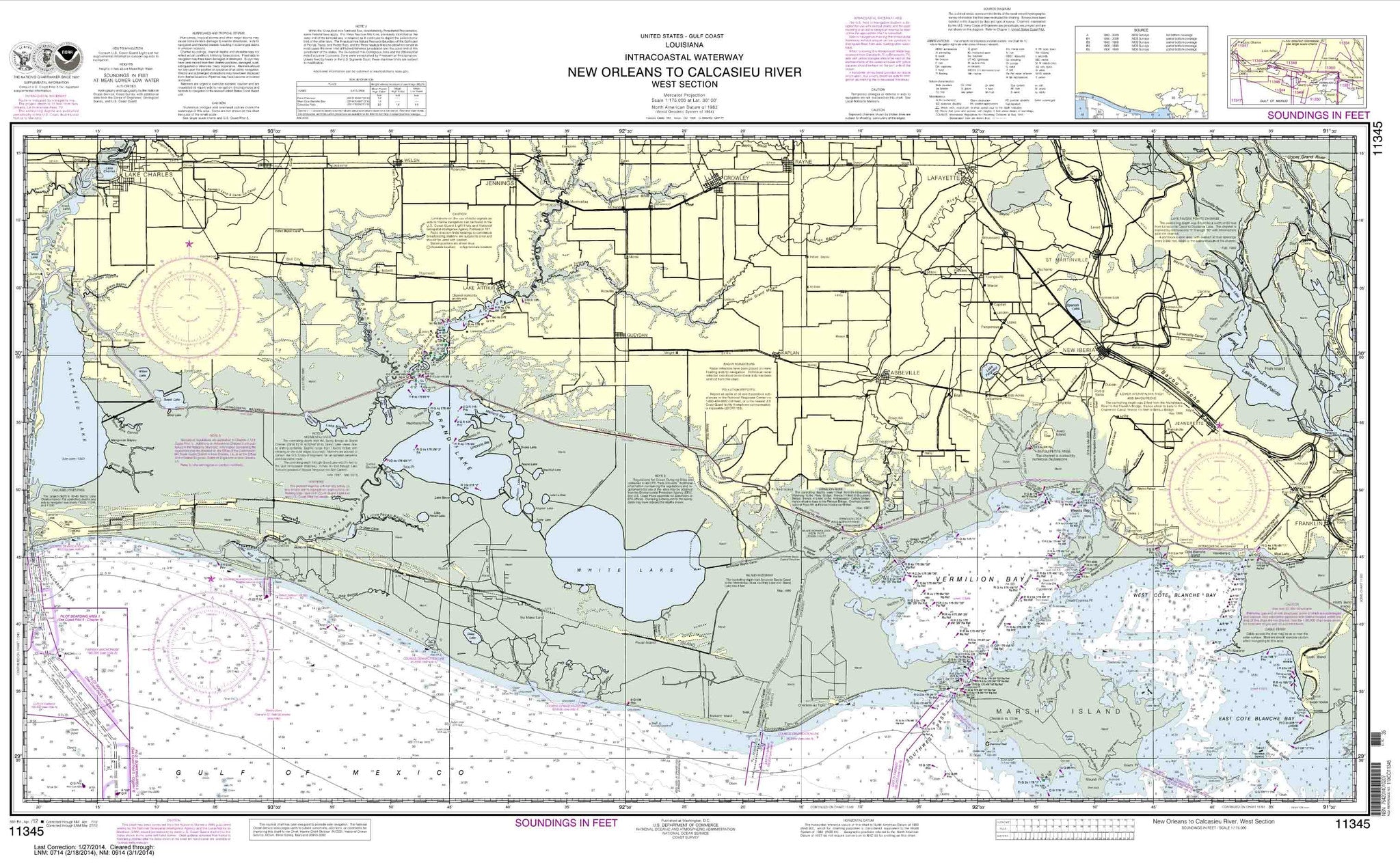
11345
$ 18.95 $ 27.00
Intracoastal Waterway New Orleans to Calcasieu River West Section


11347
Sold Out $ 27.00
Calcasieu River and Lake These popular NOAA small craft charts are printed front and back. By default we ship them rolled on our heavy, durable, cruising paper with waterproof ink. ...


11348
$ 58.95
Official NOAA Chart for the Intracoastal Waterway : Forked Island to Ellender, including the Mermantau River, Grand Lake and White Lake. This set off nautical charts is printed from the...


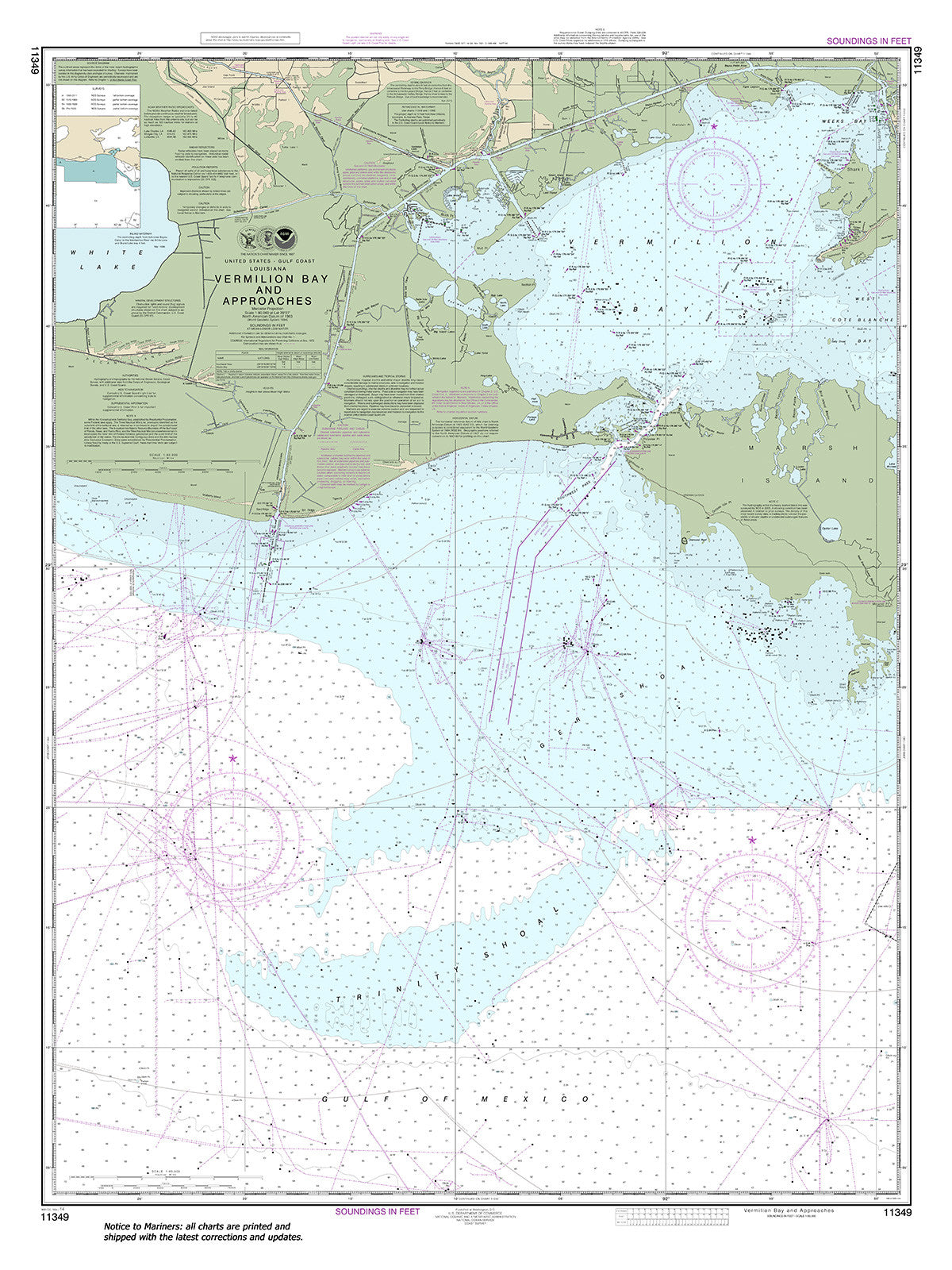
11349
$ 18.95 $ 27.00
Official NOAA Chart: Vermilion Bay and approaches Standard Size: 36" wide by 48" tall If you would prefer a smaller, lighter and less bulky format for navigating, you may want...
© 2025 FrugalNavigator.com. POS and Ecommerce by Shopify