Gulf Coast Catalog #3 | from Freshwater Bayou to Mississippi Sound
High Quality NOAA Charts at a Low Price : Most starting at $15.95 with FREE Shipping
Click on Marker Pins to view chart details:


11346
$ 18.95 $ 27.00
Official NOAA Chart: Port Fourchon and Approaches Standard Size: 33" wide by 53" tall If you would prefer a smaller, lighter and less bulky format for navigating, you may want...


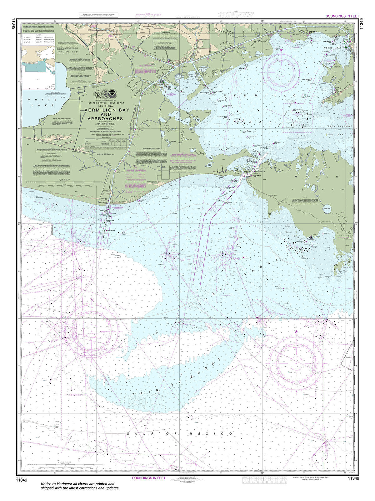
11349
$ 18.95 $ 27.00
Official NOAA Chart: Vermilion Bay and approaches Standard Size: 36" wide by 48" tall If you would prefer a smaller, lighter and less bulky format for navigating, you may want...


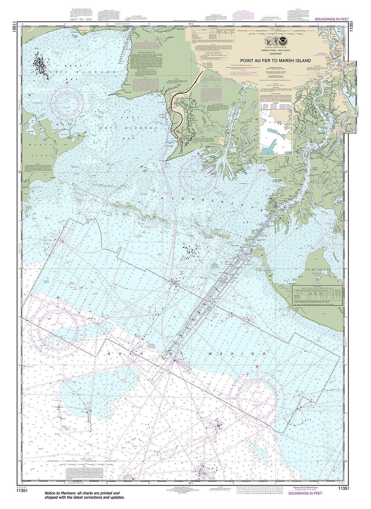
11351
$ 18.95 $ 27.00
Official NOAA Chart: Point au Fer to Marsh Island Standard size: 35" wide by 48" tall If you would prefer a smaller, lighter and less bulky format for navigating, you...


11352
$ 18.95 $ 27.00
Official NOAA Chart: Intracoastal Waterway New Orleans to Calcasieu River East Section Standard size: 40" wide by 36" tall If you would prefer a smaller, lighter and less bulky format...


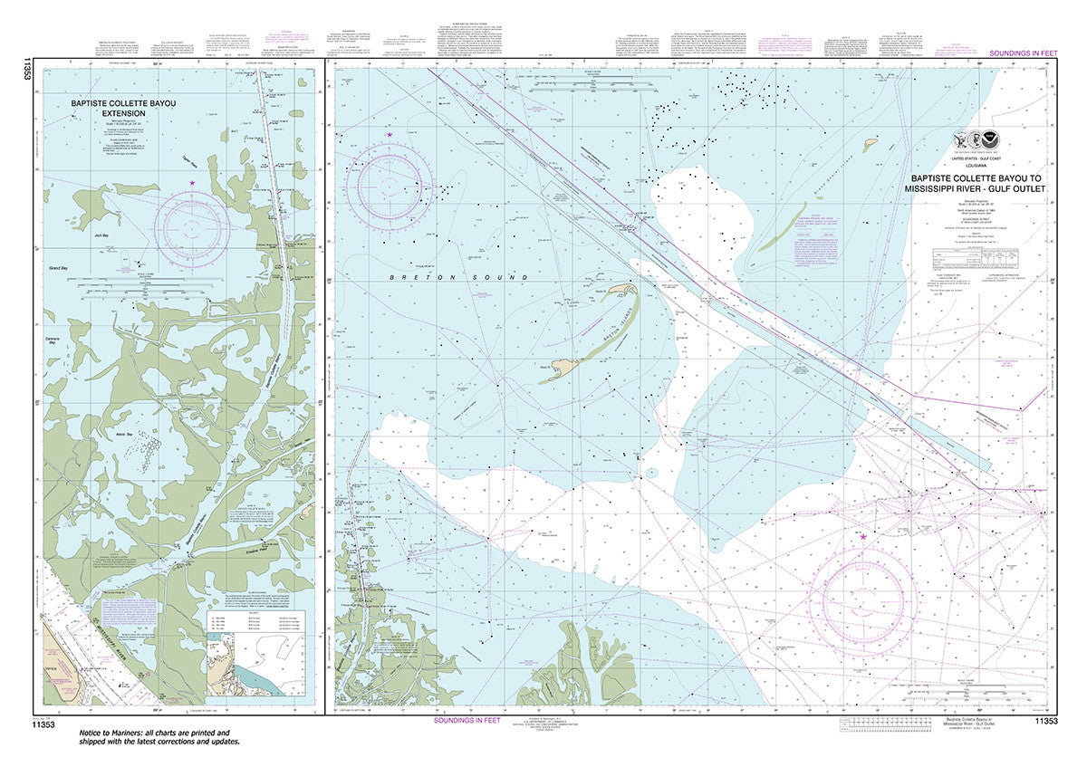
11353
$ 18.95 $ 27.00
Official NOAA Chart: Baptiste Collette Bayou to Mississippi River Gulf Outlet; Baptiste Collette Bayou Extension Standard size: 51" wide by 36" tall If you would prefer a smaller, lighter and...


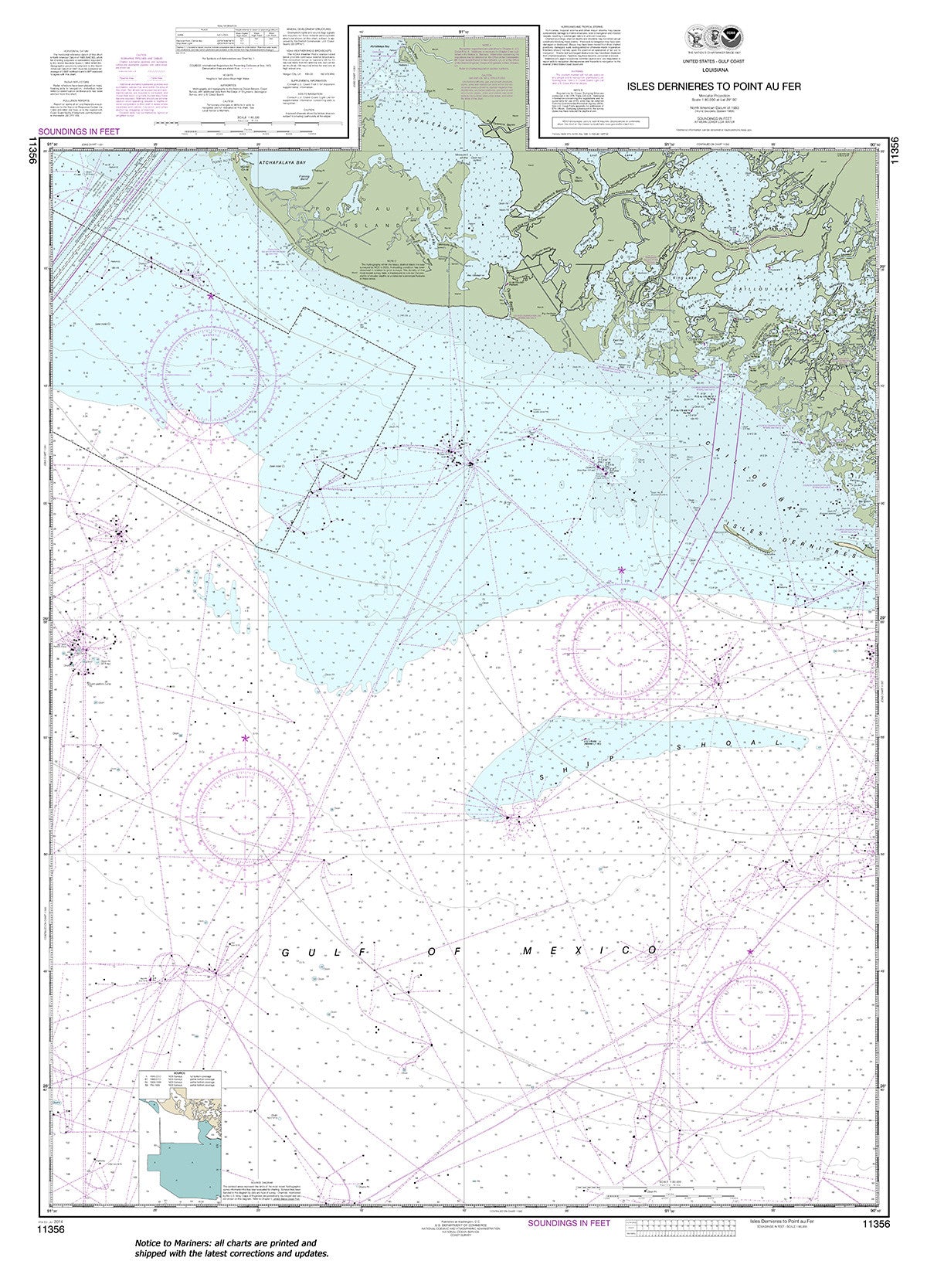
11356
$ 18.95 $ 27.00
Official NOAA Chart: Isles Dernieres to Point au Fer Standard size: 36" wide by 51" tall If you would prefer a smaller, lighter and less bulky format for navigating, you...


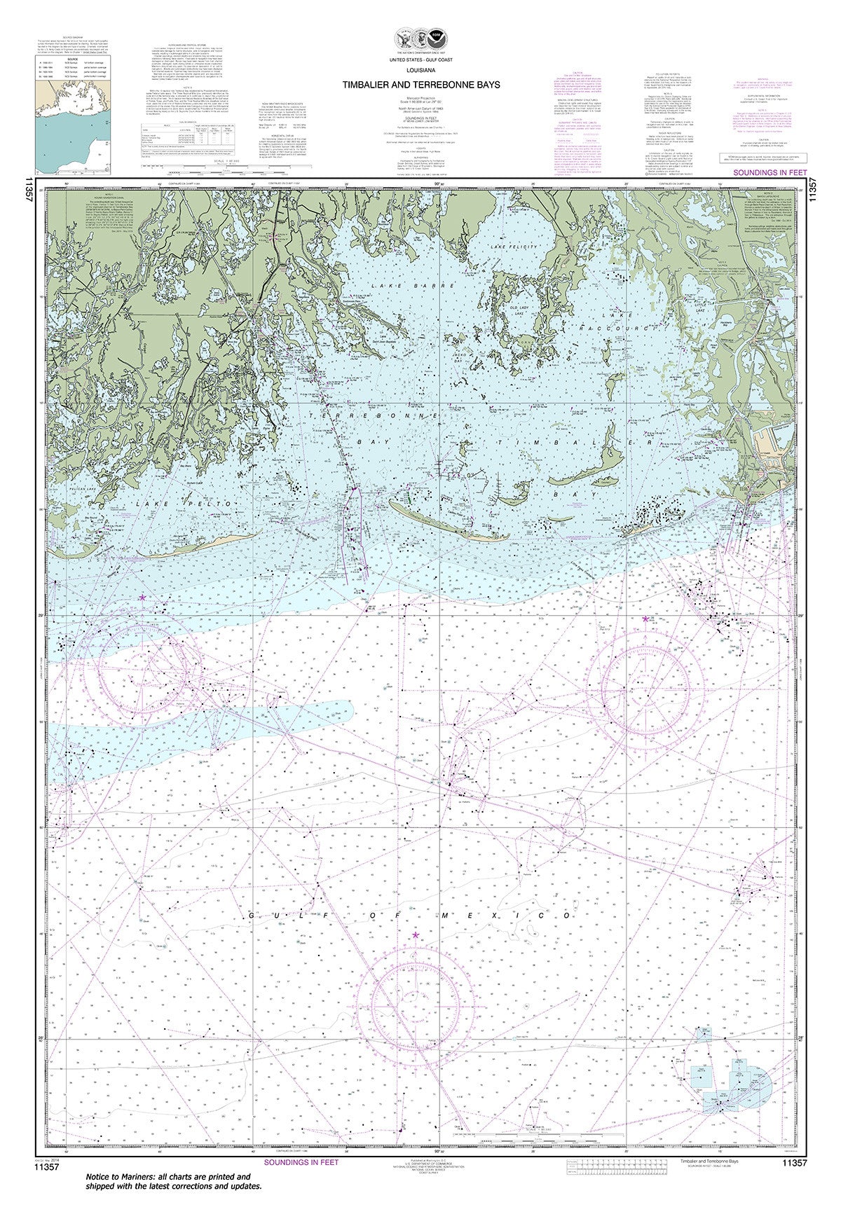
11357
$ 18.95 $ 27.00
Official NOAA Chart: Timbalier and Terrebonne Bays Standard size: 36" wide by 52" tall If you would prefer a smaller, lighter and less bulky format for navigating, you may want...


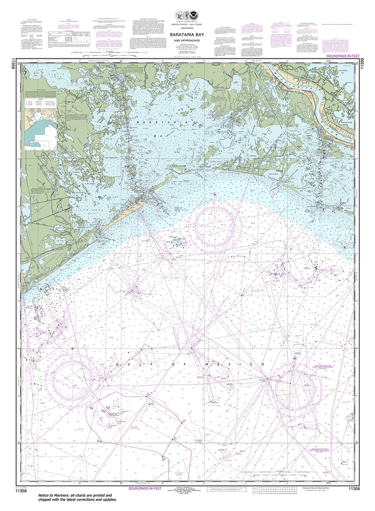
11358
$ 18.95 $ 27.00
Official NOAA Chart: Barataria Bay and approaches Standard Size: 36" wide by 39" tall If you would prefer a smaller, lighter and less bulky format for navigating, you may want...


11359
$ 18.95 $ 27.00
Official NOAA Chart: Loop Deepwater Port Louisiana Offshore Oil Port Standard size: 33" wide by 49" tall If you would prefer a smaller, lighter and less bulky format for navigating,...

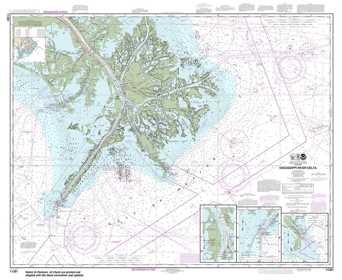
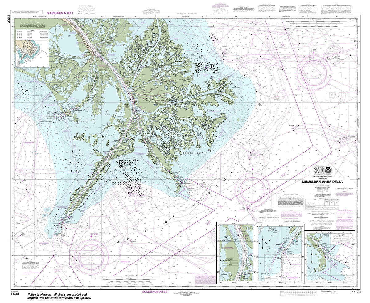
11361
$ 18.95 $ 27.00
Official NOAA Chart: Mississippi River Delta; Southwest Pass; South Pass; Head of Passes Standard size: 44" wide by 36" tall If you would prefer a smaller, lighter and less bulky...


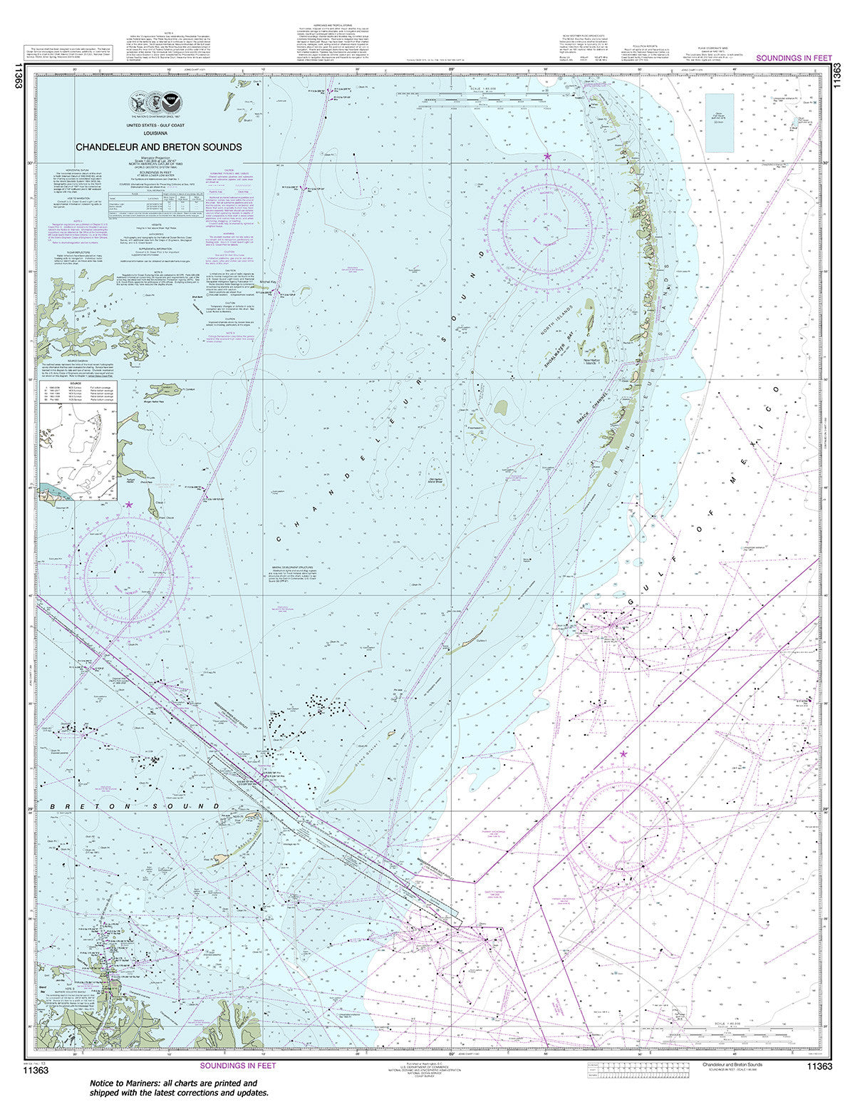
11363
$ 18.95 $ 27.00
Official NOAA Chart: Chandeleur and Breton Sounds Standard size: 36" wide by 47" tall If you would prefer a smaller, lighter and less bulky format for navigating, you may want...

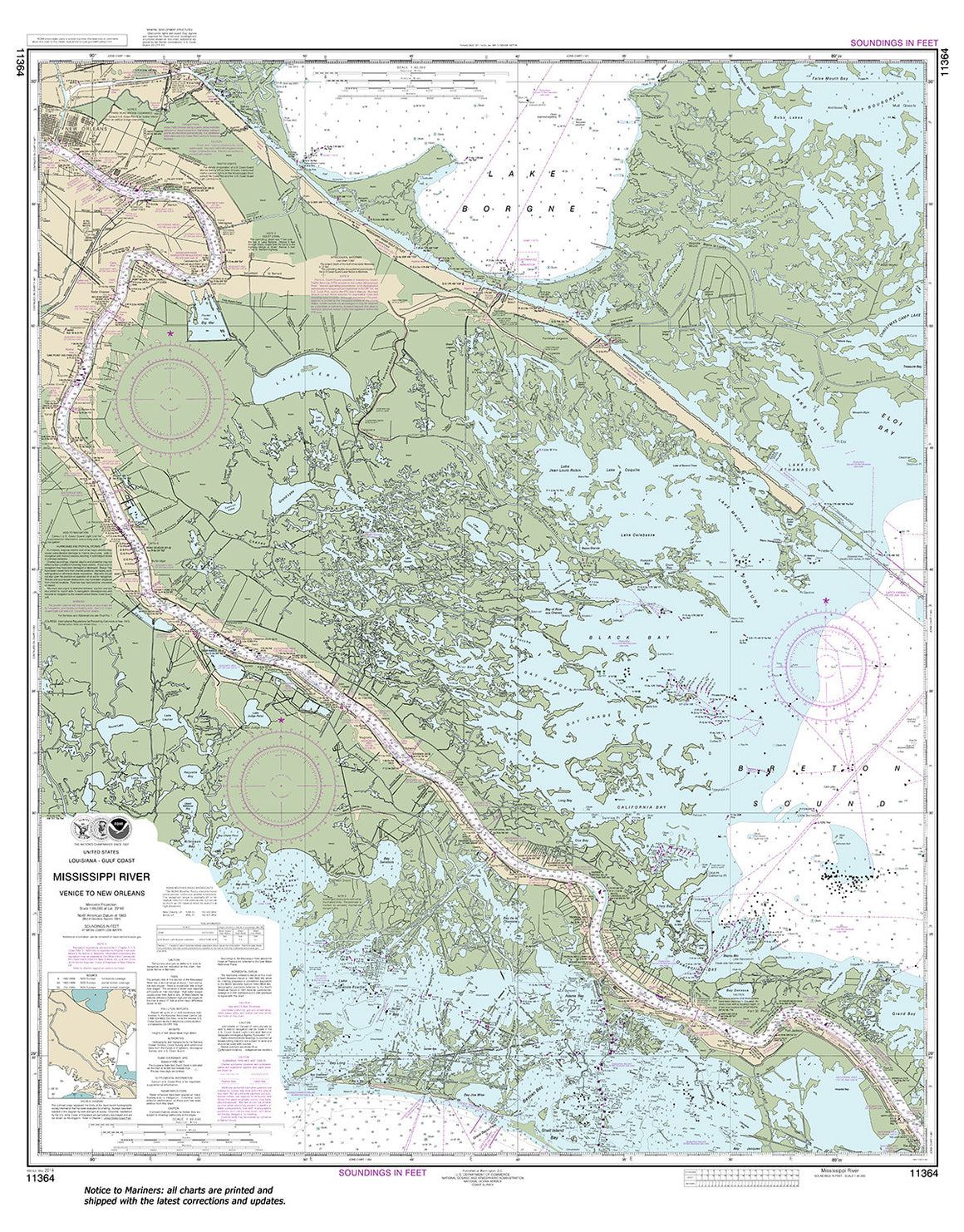
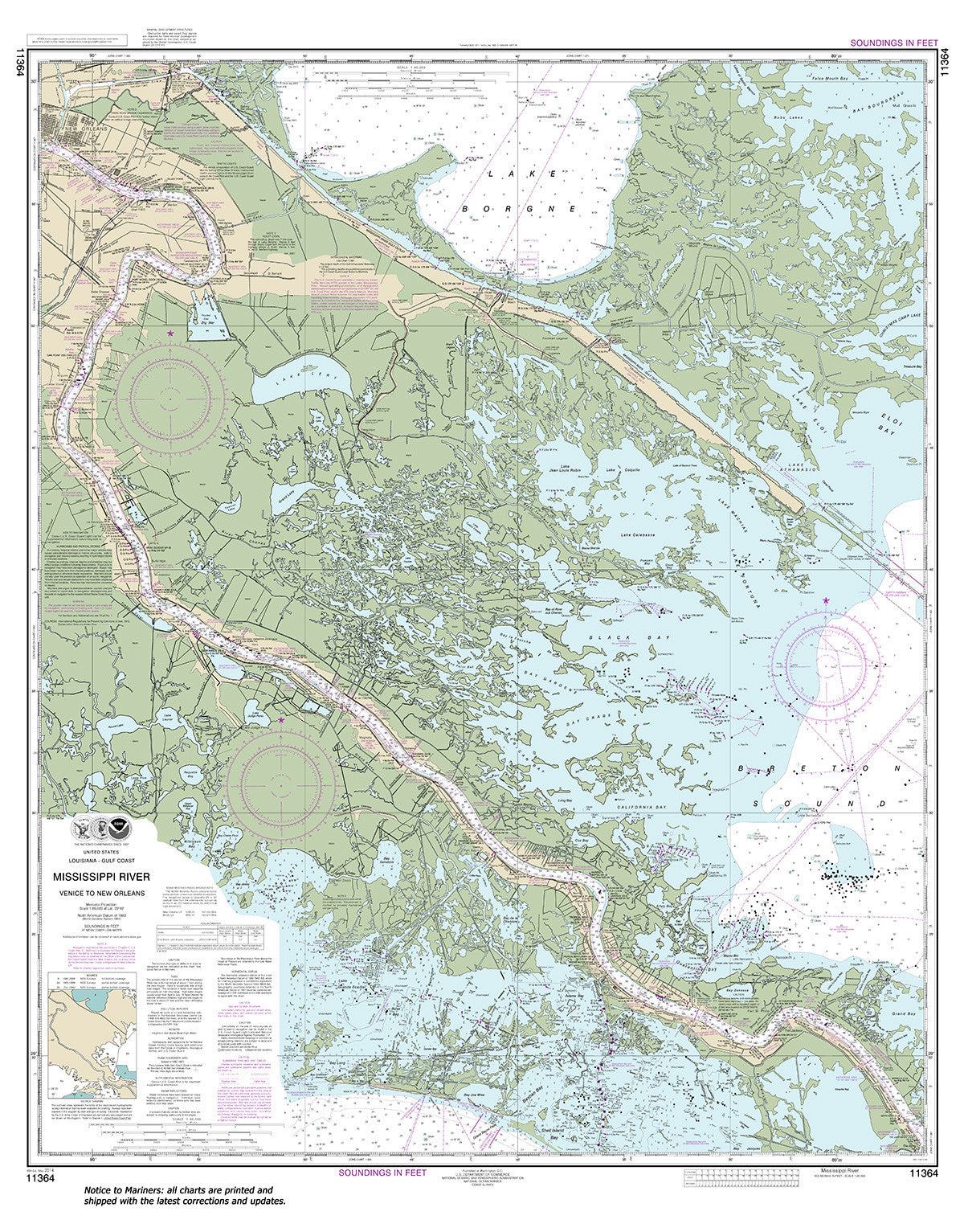
11364
$ 18.95 $ 27.00
Official NOAA Chart: Mississippi River-Venice to New Orleans Standard Size: 36" wide by 46" tall If you would prefer a smaller, lighter and less bulky format for navigating, you may...


11368
$ 18.95 $ 27.00
Official NOAA Chart: New Orleans Harbor Chalmette Slip to Southport Standard size: 44" wide by 36" tall If you would prefer a smaller, lighter and less bulky format for navigating,...


11369
$ 18.95 $ 27.00
Official NOAA Chart of Lakes Pontchartrain and Maurepas. This nautical chart is printed from the most recent NOAA ENC data. Standard Chart : 46" by 35" Frugal Navigator uses the...

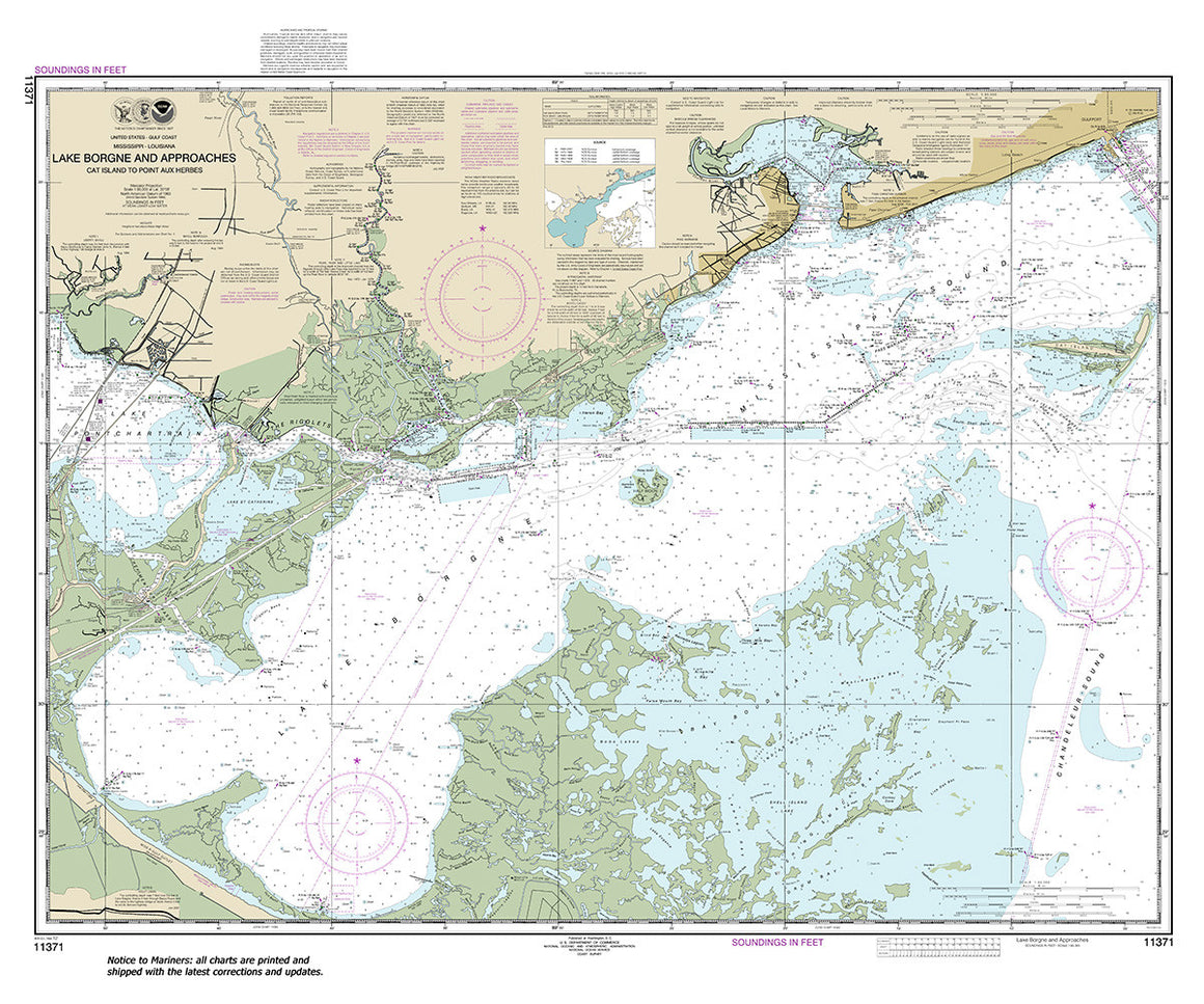

11371
$ 18.95 $ 27.00
Official NOAA Chart: Lake Borgne and approaches Cat Island to Point aux Herbes Standard size: 43" wide by 35" tall If you would prefer a smaller, lighter and less bulky...


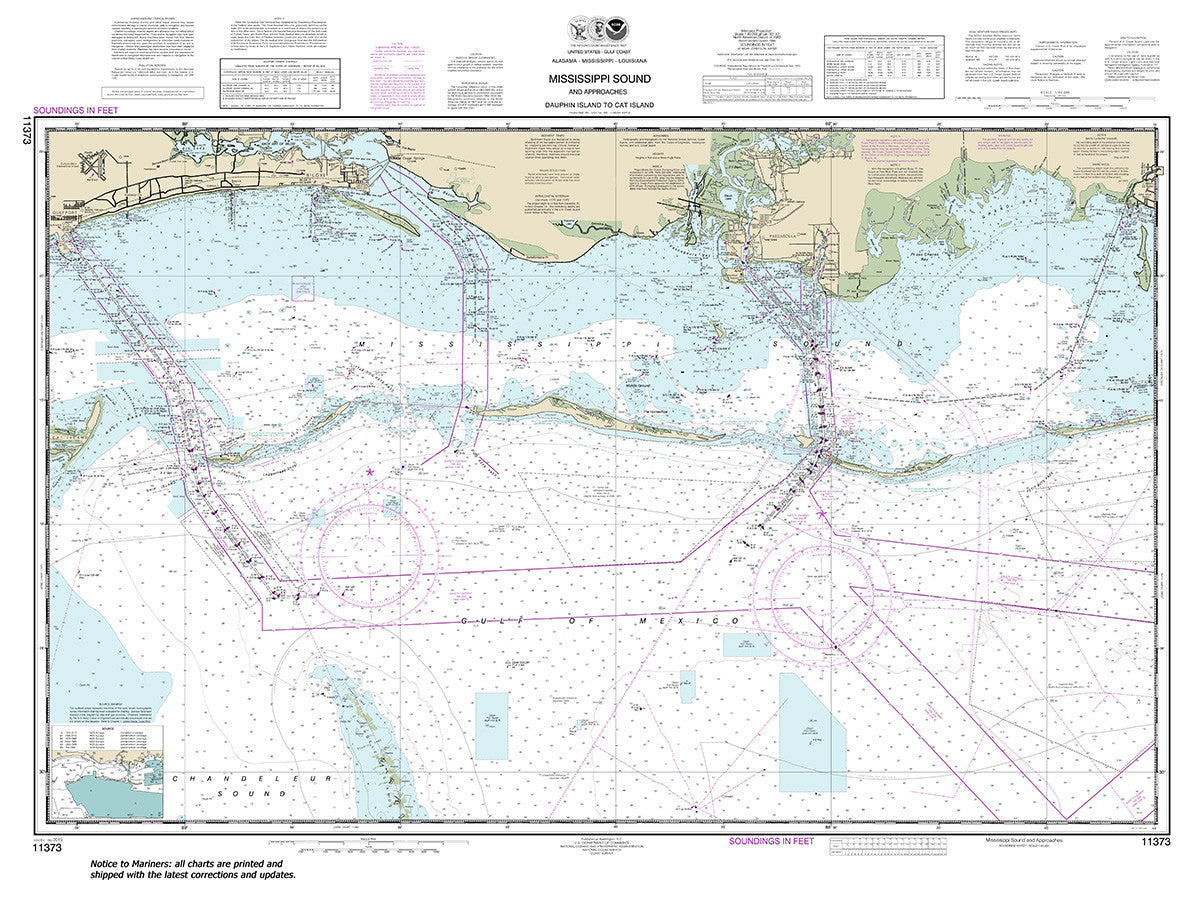
11373
$ 54.95
Official NOAA Chart: Mississippi Sound and approaches Dauphin Island to Cat Island Small Craft Folio


11375
$ 18.95 $ 27.00
Official NOAA Chart: Pascagoula Harbor Standard size: 36" wide by 50" tall If you would prefer a smaller, lighter and less bulky format for navigating, you may want to choose...
© 2025 FrugalNavigator.com. POS and Ecommerce by Shopify