Gulf Coast Catalog #5 | Apalachicola Bay to Sanibel Island
High Quality NOAA Charts at a Low Price : Most starting at $15.95 with FREE Shipping
Click on Marker Pins to view chart details:


11404
$ 18.95 $ 27.00
Intracoastal Waterway Carrabelle to Apalachicola Bay; Carrabelle River Standard size: 46" wide by 32" tall


11405
$ 18.95 $ 27.00
Apalachee Bay Standard size: 46" wide by 36" tall If you would prefer a smaller, lighter and less bulky format for navigating, you may want to choose the SMALL CRAFT...


11406
$ 18.95 $ 27.00
St.Marks River and approaches Standard size: 26" wide by 33" tall If you would prefer a smaller, lighter and less bulky format for navigating, you may want to choose the...


11407
$ 18.95 $ 27.00
Horseshoe Point to Rock Islands; Horseshoe Beach Standard size: 36" wide by 46" tall If you would prefer a smaller, lighter and less bulky format for navigating, you may want...


11408
$ 18.95 $ 27.00
Crystal River to Horseshoe Point; Suwannee River; Cedar Keys Standard size: 47" wide by 36" tall If you would prefer a smaller, lighter and less bulky format for navigating, you...


11409
$ 18.95 $ 27.00
Anclote Keys to Crystal River Standard size: 36" wide by 49" tall If you would prefer a smaller, lighter and less bulky format, you may want to choose the SMALL...


11411
Sold Out $ 27.00
Intracoastal Waterway Tampa Bay to Port Richey These popular NOAA small craft charts are printed front and back. By default we ship them rolled on our heavy, durable, cruising paper...


11412
$ 18.95 $ 27.00
Official NOAA chart covering Tampa Bay and St. Joseph Sound in Florida. This chart is printed from the most recent ENC data. Standard size: 36" by 56" (scale 1:60,000) Small...


11412 Training Chart
$ 9.95
Wall Chart of Tampa Bay and St Josephs Sound in the Suncoast region of Florida. This traditional NOAA chart has been discontinued and should not be used for navigation. We...


11412 WALL CHART
$ 18.95
Wall Chart of Tampa Bay and St Josephs Sound in the Suncoast region of Florida. This traditional NOAA chart has been discontinued and should not be used for navigation. We...


11415
$ 18.95 $ 27.00
Tampa Bay Entrance; Manatee River Extension Standard size: 52" wide by 36" tall If you would prefer a smaller, lighter and less bulky format, you may want to choose the...


11416
$ 18.95 $ 27.00
Tampa Bay; Safety Harbor; St. Petersburg;Tampa Standard size: 36" wide by 53" tall
11416 Training Chart
$ 9.95 $ 27.00
Tampa Bay; Safety Harbor; St. Petersburg;Tampa Standard size: 36" wide by 53" tall This chart has been discontinued by NOAA we make it available here for classroom use only. It...


11424
$ 18.95 $ 27.00
Lemon Bay to Passage Key Inlet Standard size: 35" wide by 46" tall If you would prefer a smaller, lighter and less bulky format, you may want to choose the...


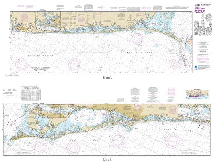
11425
Sold Out $ 27.00
Official NOAA chart for Intracoastal Waterway Charlotte Harbor to Tampa Bay (a two sided chart) These popular NOAA small craft charts are printed front and back. By default we ship...


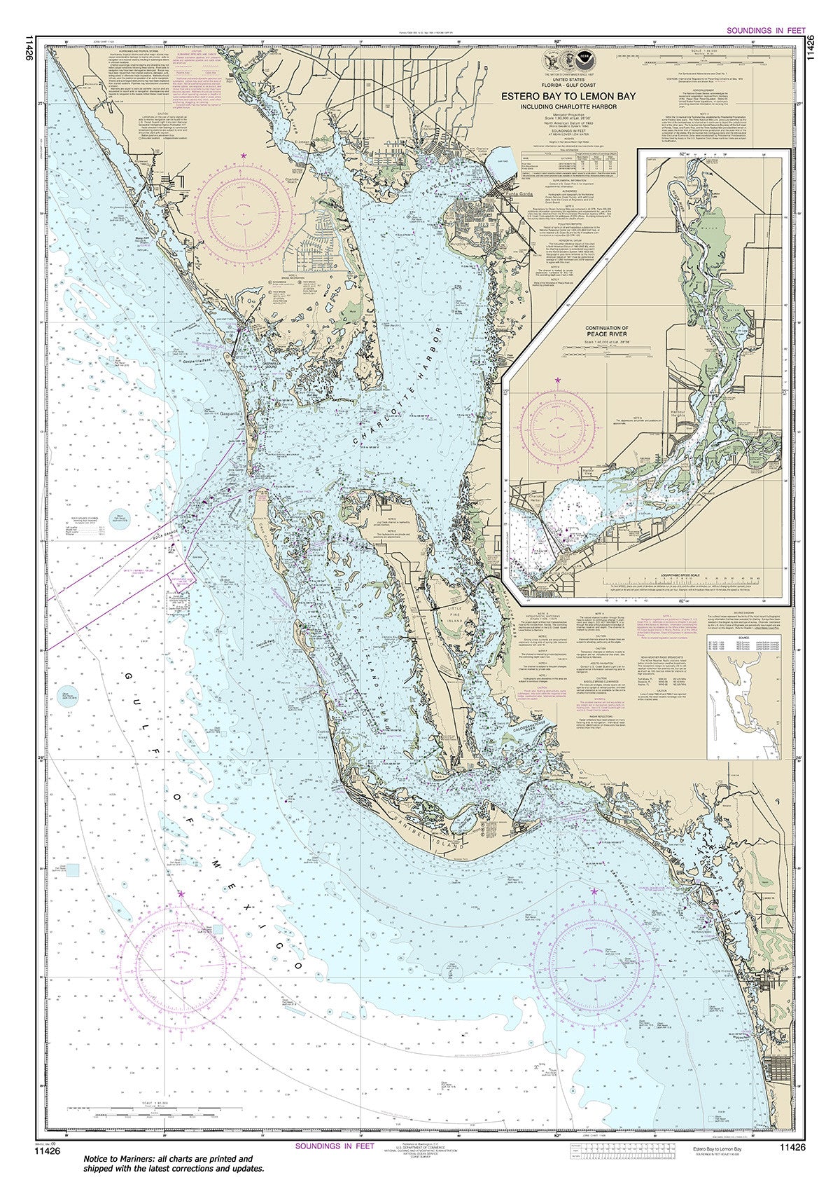
11426
$ 18.95 $ 27.00
Official NOAA chart for Estero Bay to Lemon Bay, including Charlotte Harbor;Continuation of Peace River. Standard size: 35" wide by 50" tall If you plan to use this chart for...


11427
Sold Out $ 27.00
Intracoastal Waterway Fort Myers to Charlotte Harbor and Wiggins Pass These popular NOAA small craft charts are printed front and back. By default we ship them rolled on our heavy,...
© 2025 FrugalNavigator.com. POS and Ecommerce by Shopify