11489
$ 52.95
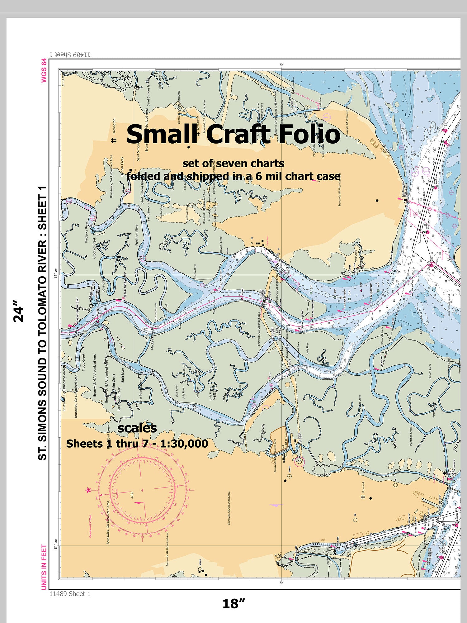
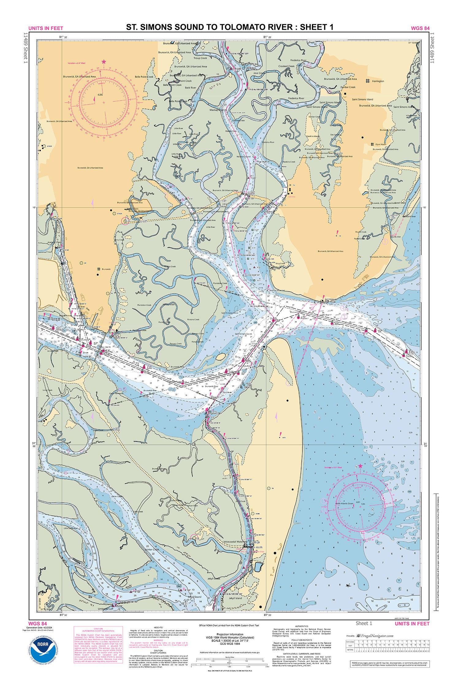
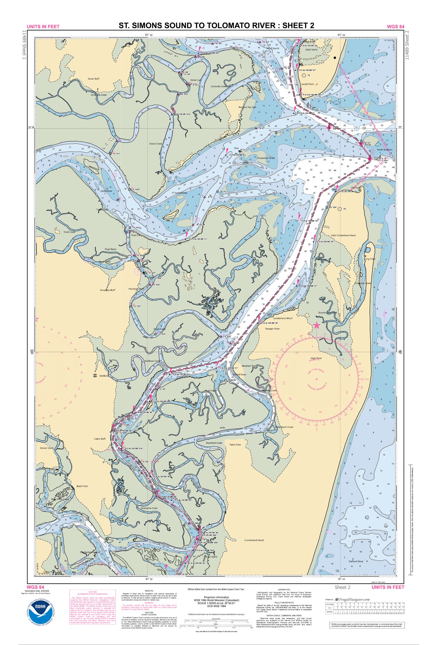
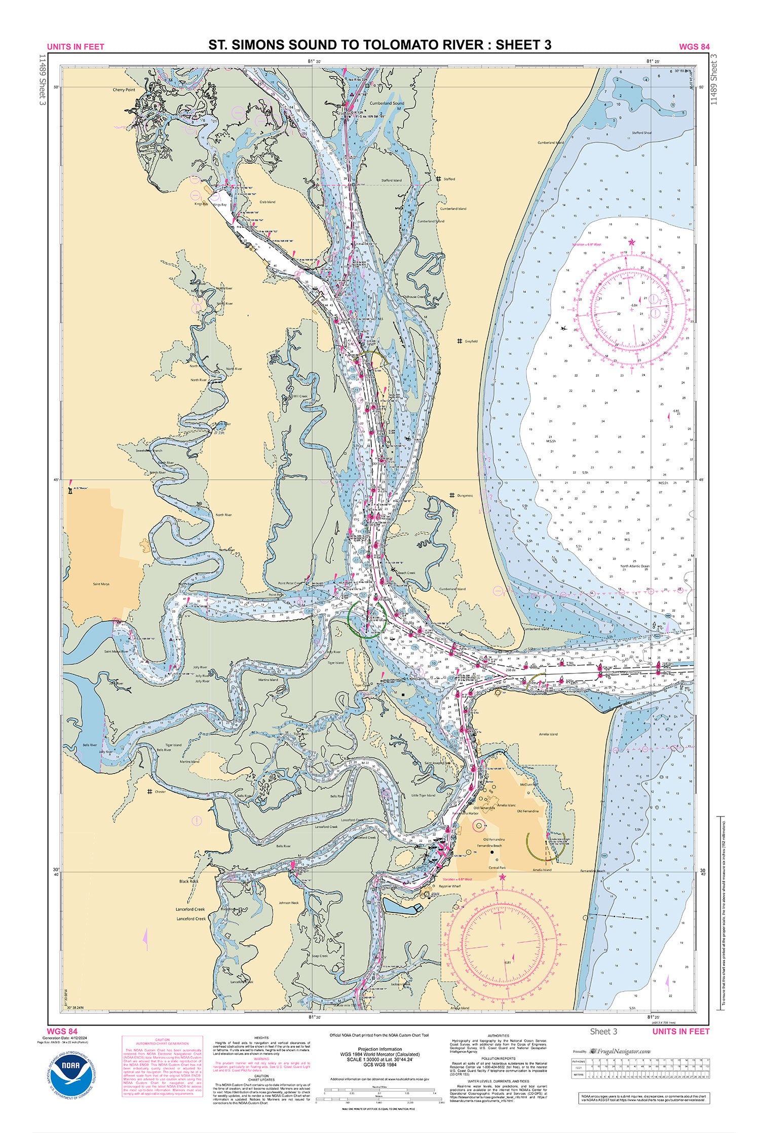
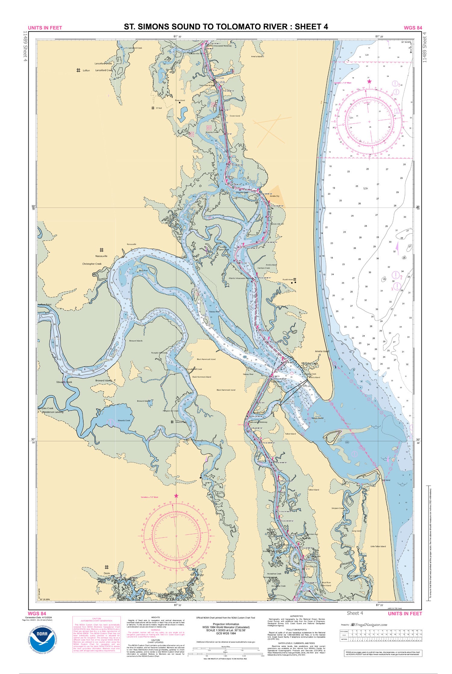
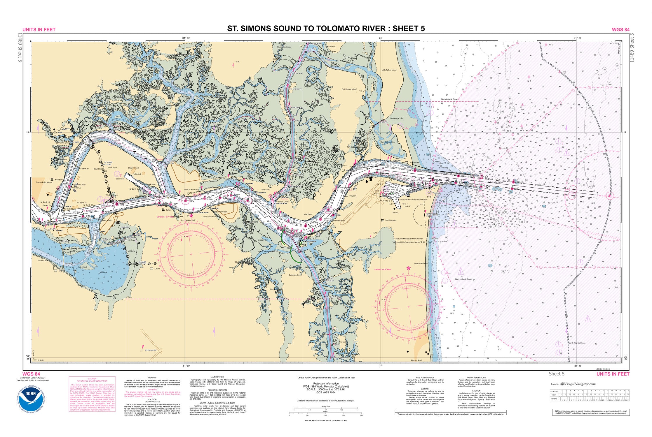
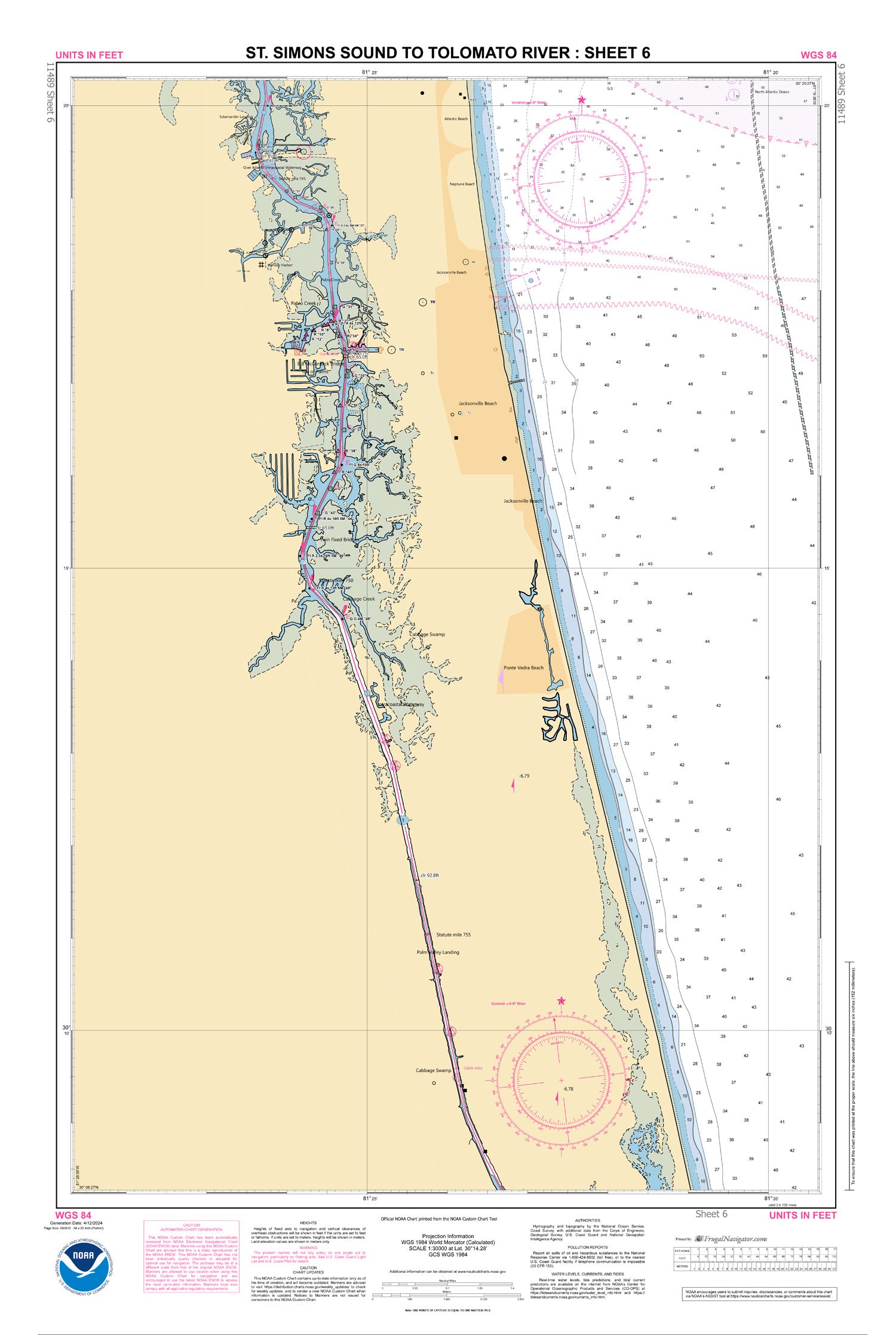
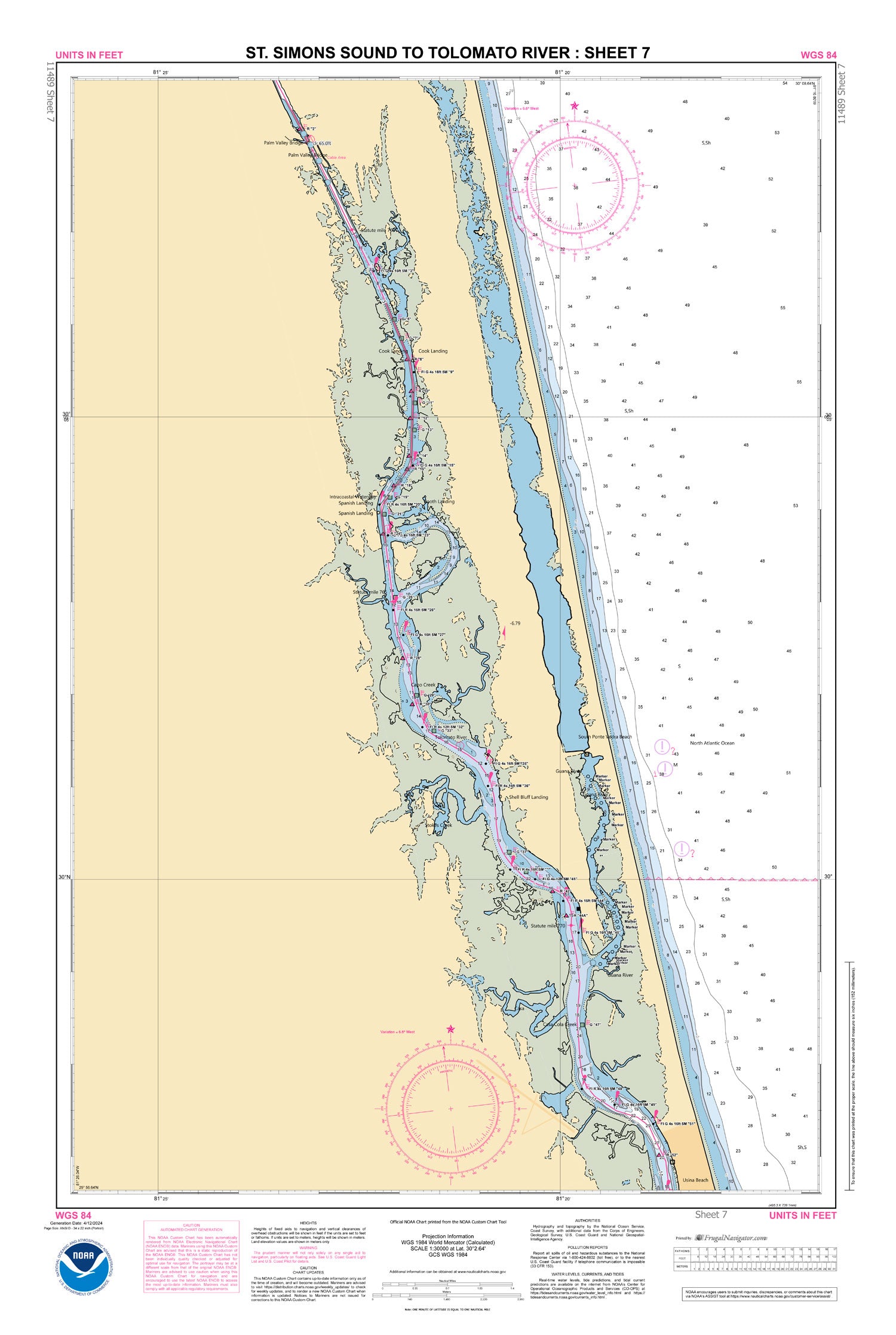
Official NOAA Chart for the Intracoastal Waterway : St. Simons Sound to Tolomato River. This Small Craft Folio Chart is printed from the most recent ENC data and consists of 7 sheets folded in half and shipped in a clear 18" by 24" chart case.
Sheet size : 23.5" by 35"
Frugal Navigator uses the NOAA Custom Chart Tool to create this ENC based paper chart.
© 2025 FrugalNavigator.com. POS and Ecommerce by Shopify