Pacific Coast Catalog #7 | San Francisco Bay including the Sacramento River and Delta
High Quality NOAA Charts at a Low Price : Most starting at $15.95 with FREE Shipping
Click on Marker Pins to view chart details:

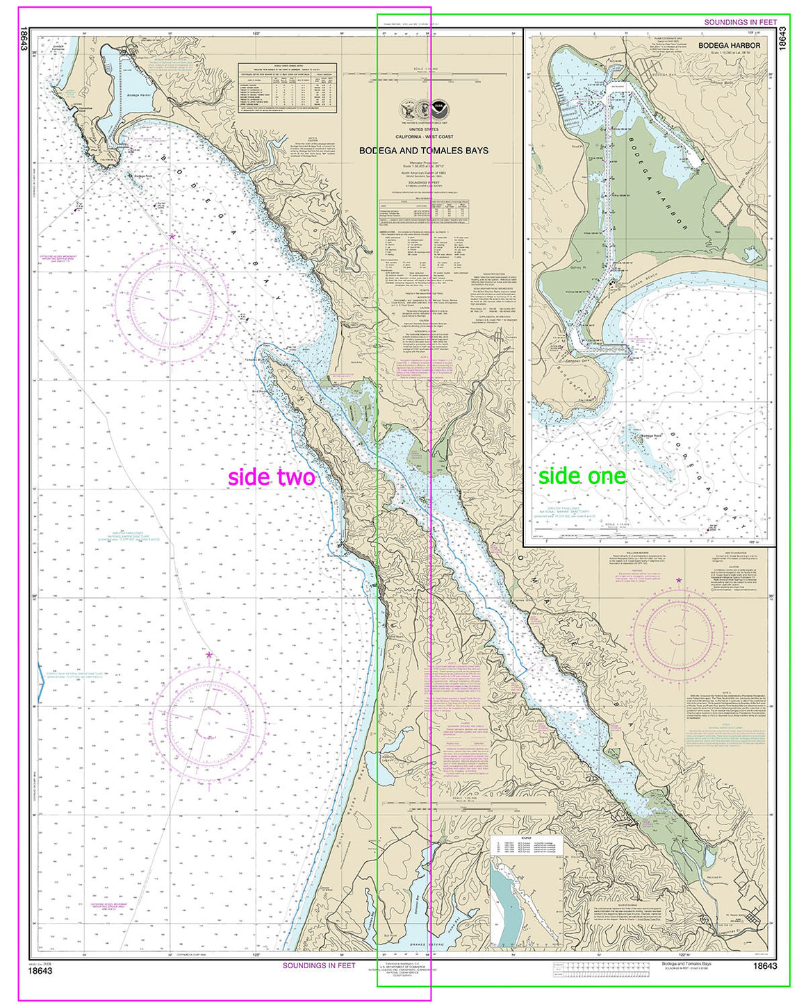
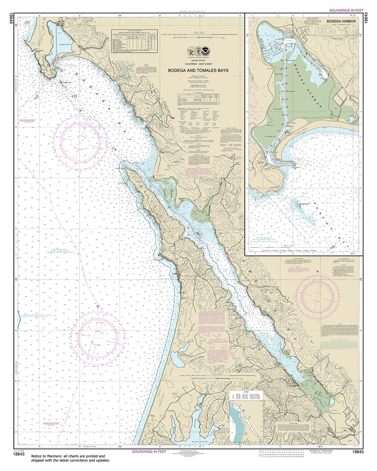
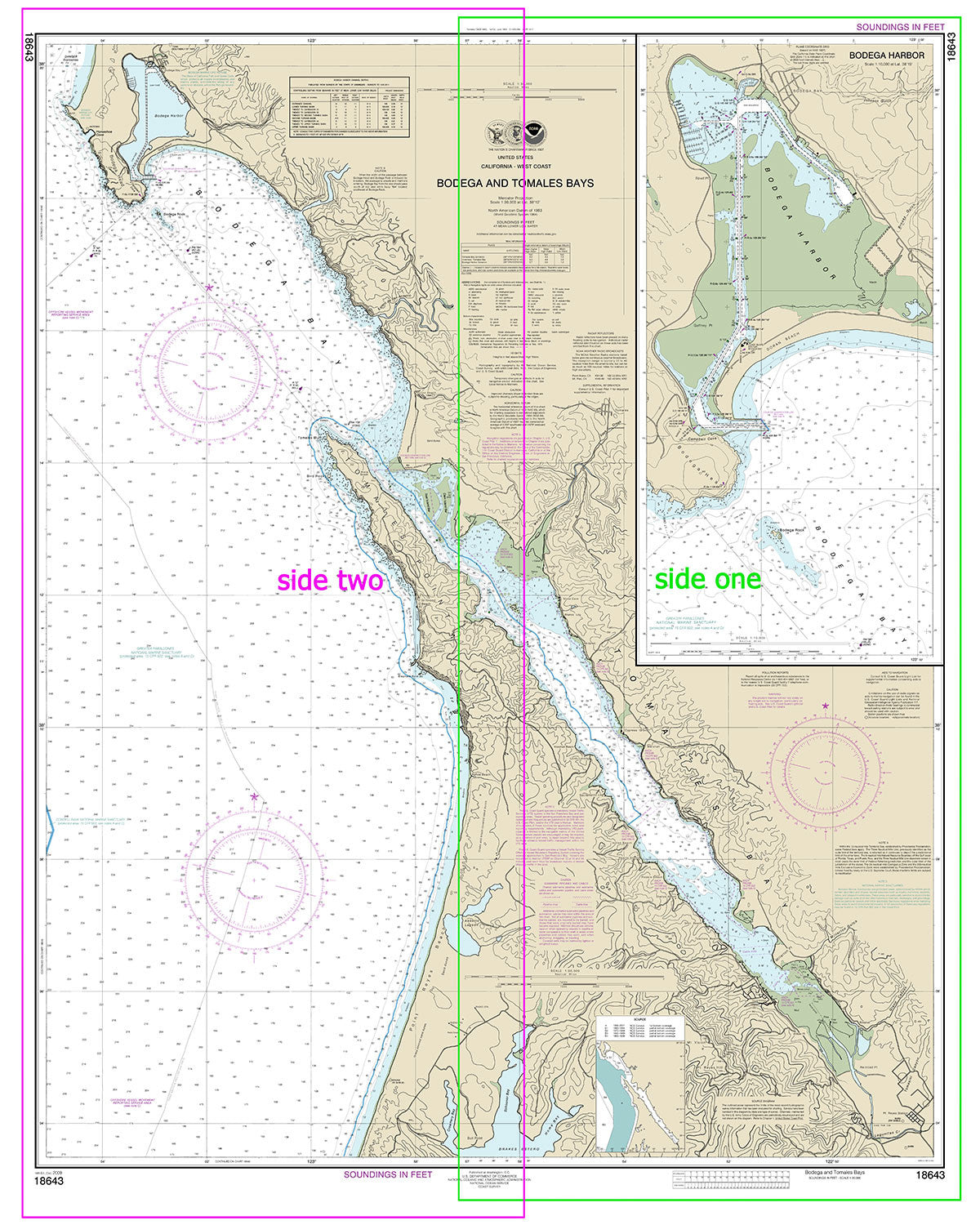
18643
$ 18.95 $ 27.00
Official NOAA Chart: Bodega and Tomales Bays; Bodega Harbor Standard size: 36" wide by 45" tall If you would prefer a smaller, lighter and less bulky format for navigating, you...


18647
$ 18.95 $ 27.00
Official NOAA Chart of Drakes Bay on the California coast. This chart is printed from the most recent NOAA ENC data. Standard size: 34" wide by 44" tall Frugal Navigator uses...


18649
$ 18.95 $ 27.00
Official NOAA Chart: Entrance to San Francisco Bay Standard size: 46" wide by 36" tall If you would prefer a smaller, lighter and less bulky format for navigating, you may...


18650
$ 18.95 $ 27.00
Official NOAA Chart: San Francisco Bay; Candlestick Point to Angel Island Standard size: 47" wide by 36" tall If you would prefer a smaller, lighter and less bulky format...


18651
$ 18.95 $ 27.00
Official NOAA Chart: San Francisco Bay-southern part; Redwood Creek.; Oyster Point Standard size: 44" wide by 36" tall If you would prefer a smaller, lighter and less bulky format for...


18653
$ 18.95 $ 27.00
Official NOAA Chart: San Francisco Bay; Angel Island to Point San Pedro Standard size: 47" wide by 36" tall If you would prefer a smaller, lighter and less bulky format...


18654
$ 18.95 $ 27.00
Official NOAA Chart of San Pablo Bay Standard size: 34" wide by 44" tall If you would prefer a smaller, lighter and less bulky format for navigating, you may want...


18655
$ 18.95 $ 27.00
Official NOAA Chart: Mare Island Strait Standard size: 47" wide by 35" tall If you would prefer a smaller, lighter and less bulky format for navigating, you may want to...


18656
$ 18.95 $ 27.00
Official NOAA Chart of Suisun Bay Standard size: 44" wide by 32" tall If you would prefer a smaller, lighter and less bulky format for navigating, you may want to...


18657
$ 18.95 $ 27.00
Official NOAA Chart for Carquinez Strait Standard size: 47" wide by 34" tall If you would prefer a smaller, lighter and less bulky format for navigating, you may want to...


18658
$ 18.95 $ 27.00
Official NOAA Chart of: SUISUN BAY-Roe Island and vicinity Standard size: 47" wide by 34" tall If you would prefer a smaller, lighter and less bulky format for navigating, you...


18659
$ 18.95 $ 27.00
Official NOAA Chart of Suisun Bay from Mallard Island to Antioch. This chart is printed from the most recent NOAA ENC data. Standard size: 44" wide by 34" tall Frugal Navigator...


18660
$ 18.95 $ 27.00
Official NOAA Chart: San Joaquin River, Stockton Deep Water: Channel Antioch to Medford Island Standard size: 33" wide by 49" tall If you would prefer a smaller, lighter and less...


18663
$ 18.95 $ 27.00
Official NOAA Chart: San Joaquin River, Stockton Deep Water Channel: Medford Island to Stockton Standard size: 44" wide by 35" tall If you would prefer a smaller, lighter and less...


18666
$ 18.95 $ 27.00
Official NOAA Chart: Suisun Bay Middle Ground to New York Slough To see adjacent charts in this area please explore our Pacific Coast Catalog Standard size: 46" wide by 32"...


18682
$ 8.95 $ 27.00
Official NOAA Chart of Half Moon Bay, California. This chart is printed from the most recent NOAA ENC data. Standard size: 22" wide by 17" tall Frugal Navigator uses the NOAA...
© 2025 FrugalNavigator.com. POS and Ecommerce by Shopify