Pacific Coast Catalog #9 | Charted Lakes of the West
High Quality NOAA Charts at a Low Price : Most starting at $15.95 with FREE Shipping
Click on Marker Pins to view chart details:


18551
$ 18.95 $ 27.00
Official NOAA Chart of FRANKLIN D. ROOSEVELT LAKE Southern part Standard Chart : 47" wide by 36" tall If you would prefer a smaller, lighter and less bulky format for...


18554
$ 18.95 $ 27.00
Official NOAA Chart of Lake Pend Oreille Standard Chart : 27" wide by 43" tall If you would prefer a smaller, lighter and less bulky format for navigating, you may...


18665
$ 18.95 $ 27.00
Official NOAA Chart of Lake Tahoe printed from the most recent NOAA ENC data Standard Chart : 31" wide by 47" tall If you would prefer a smaller, lighter and...

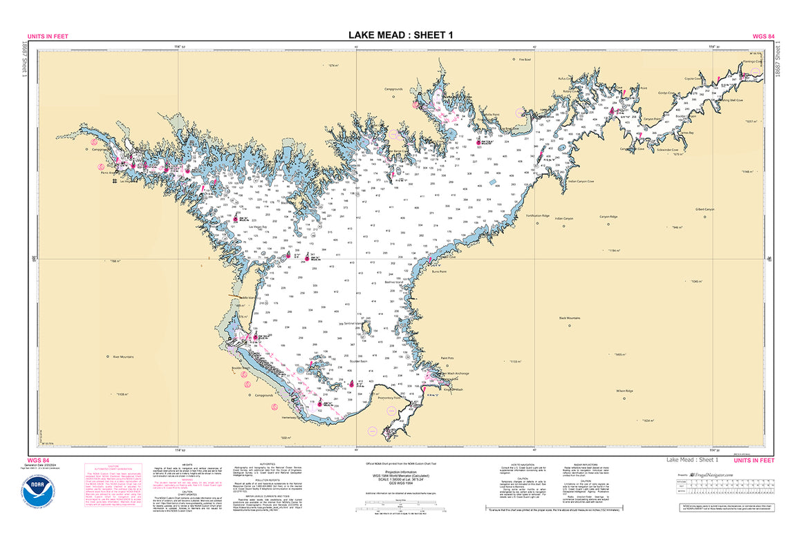
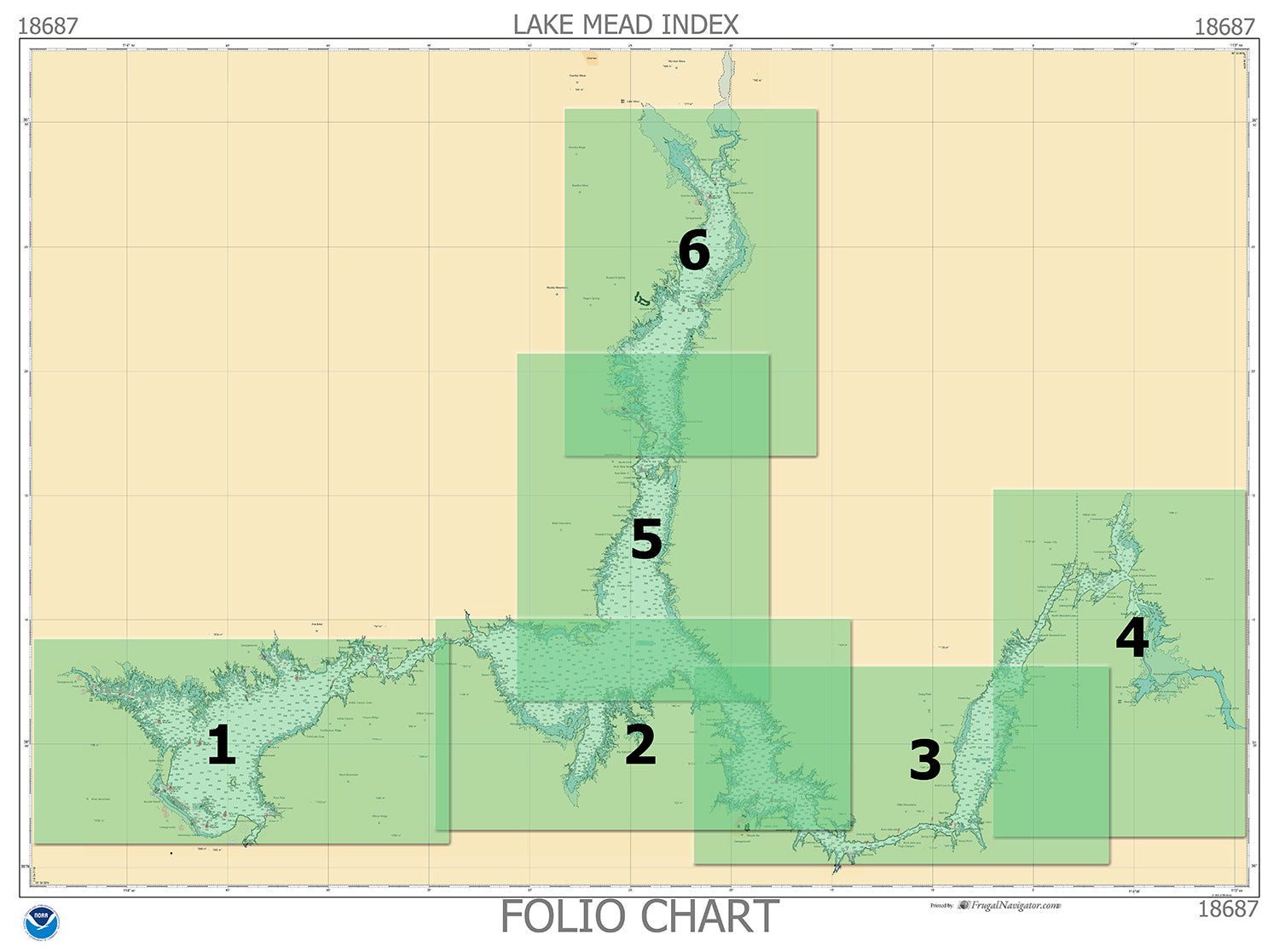

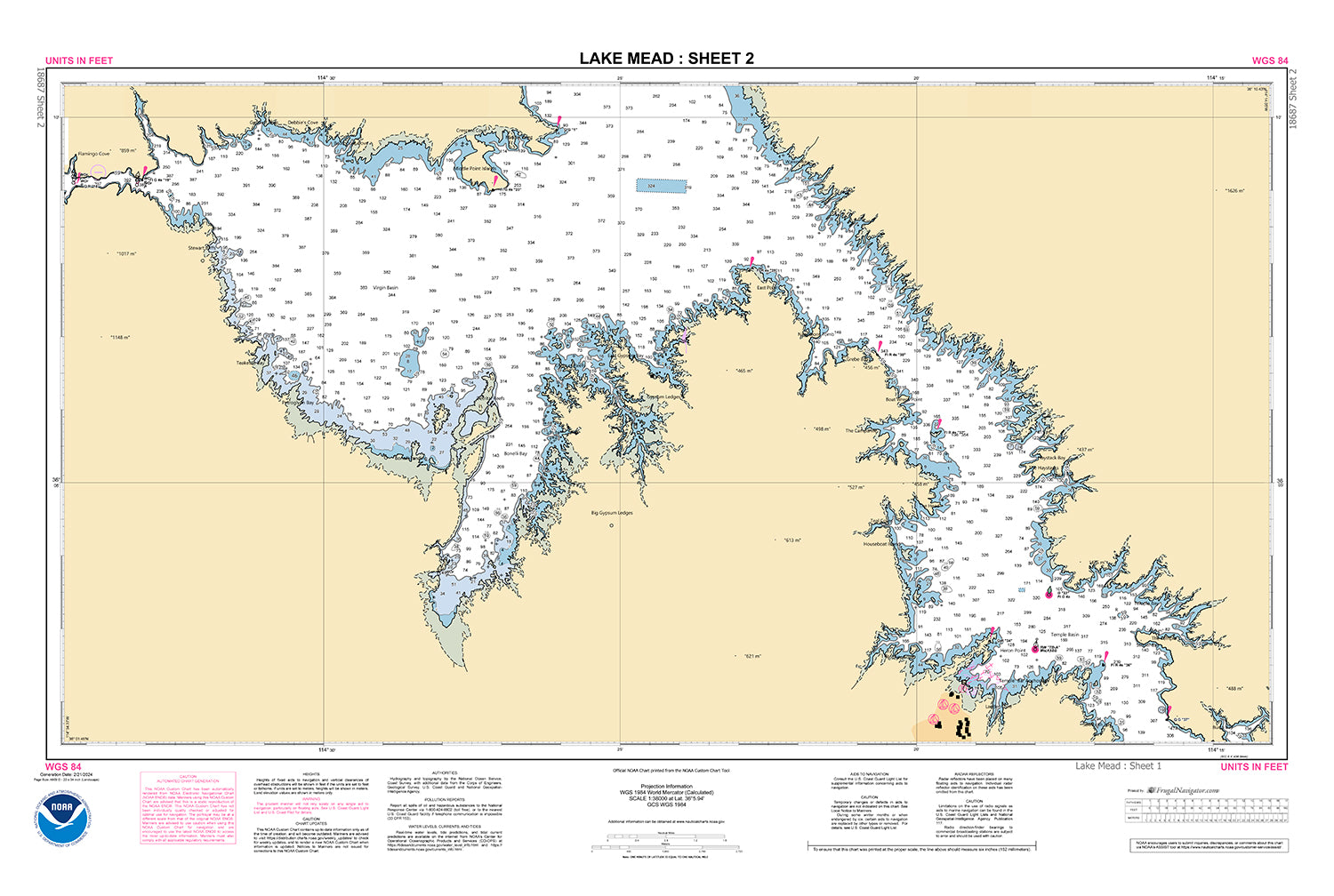
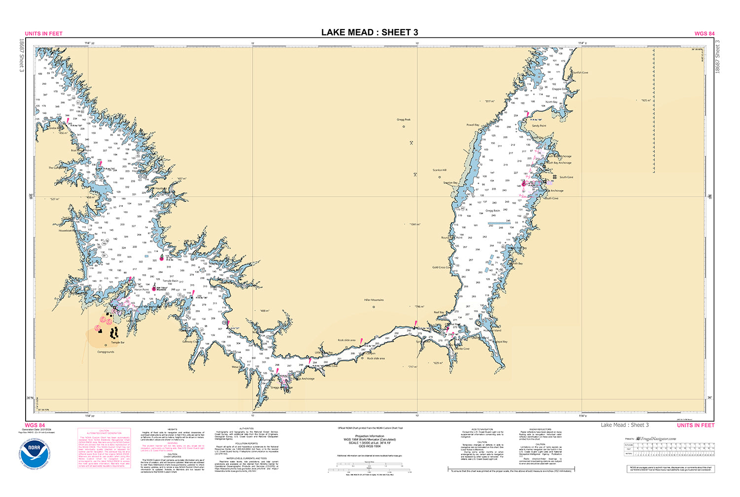
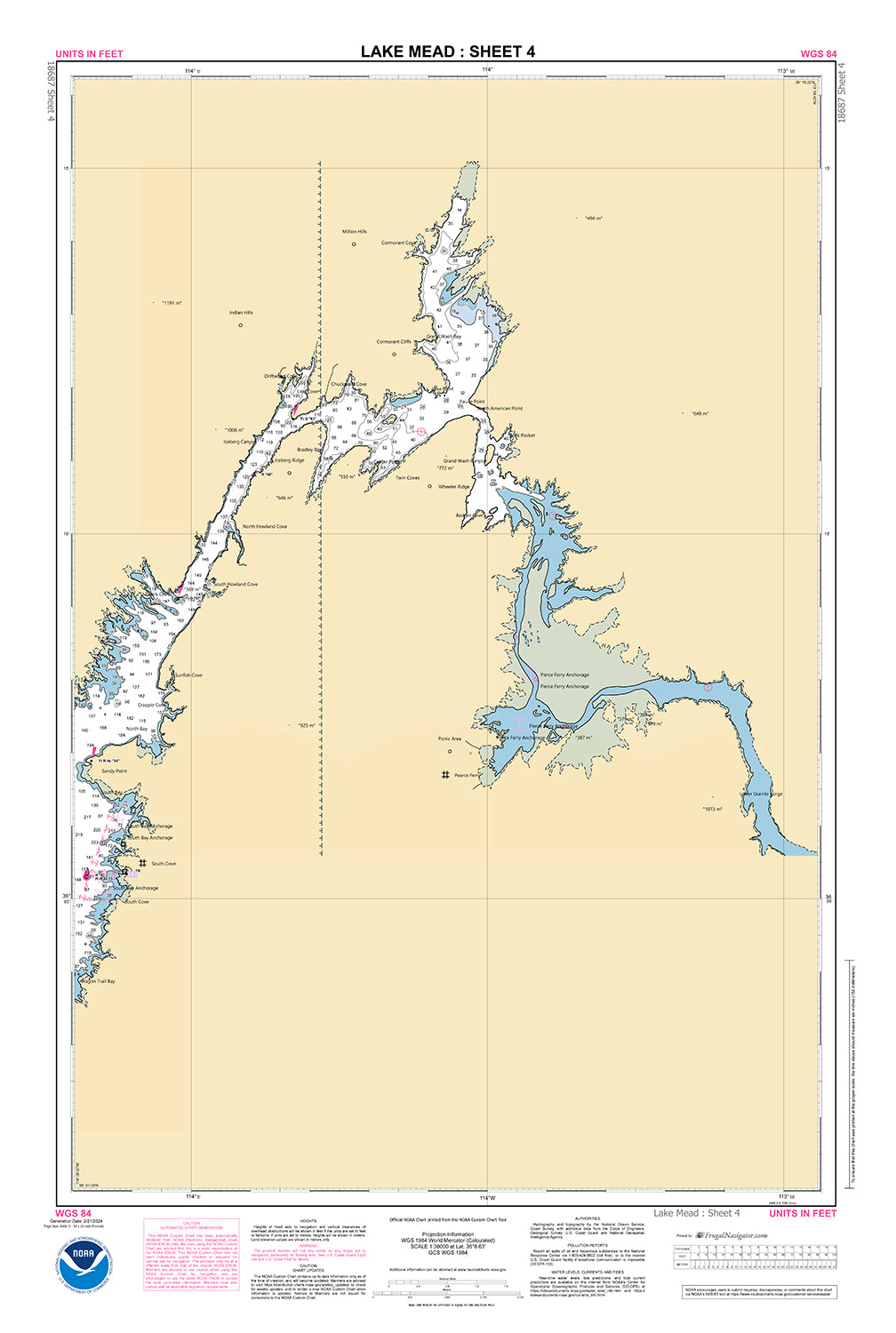
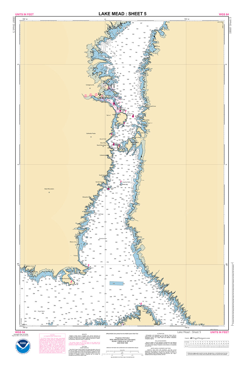
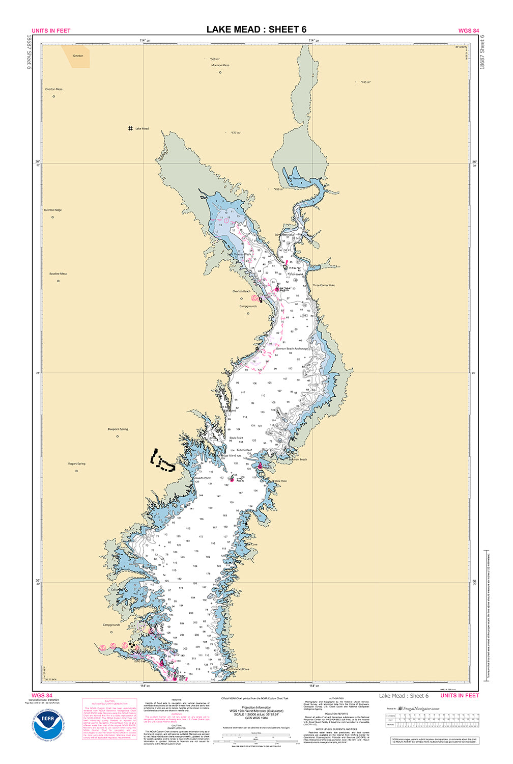
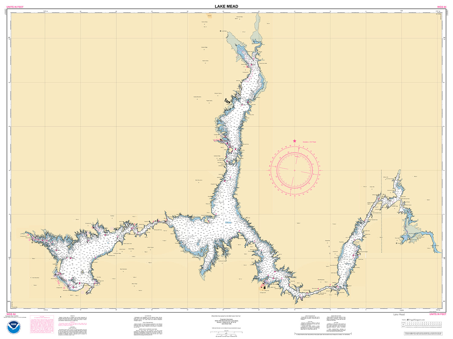
18687
$ 18.95 $ 27.00
Official NOAA Chart of Lake Mead. Available as a standard (single sheet) chart 56" wide by 36" tall. Scale 1: 78,000 Also available as a Folio Chart made up of...
© 2025 FrugalNavigator.com. POS and Ecommerce by Shopify