Pacific Islands P3


19016
$ 18.95 $ 27.00
Official NOAA Chart covering Ni'ihau to French Frigate Shoals. This chart is printed from the most recent NOAA ENC data. Standard size: 44" wide by 34" tall Frugal Navigator uses the...


19019
$ 18.95 $ 27.00
Official NOAA Chart covering from French Frigate Shoals to Laysan Island. This chart is printed from the most recent NOAA ENC data. Standard size: 44" wide by 34" tall Frugal Navigator...


19022
$ 18.95 $ 27.00
Official NOAA Chart covering from Laysan Island to Kure Atoll. This chart is printed from the most recent NOAA ENC data. Standard size: 44" wide by 34" tall Frugal Navigator uses...


19442
$ 18.95 $ 27.00
Lisianski and Laysan Island;West Coast of Laysan Island


19480
$ 18.95 $ 27.00
Gambia Shoal to Kure Atoll including approaches to the Midway Islands


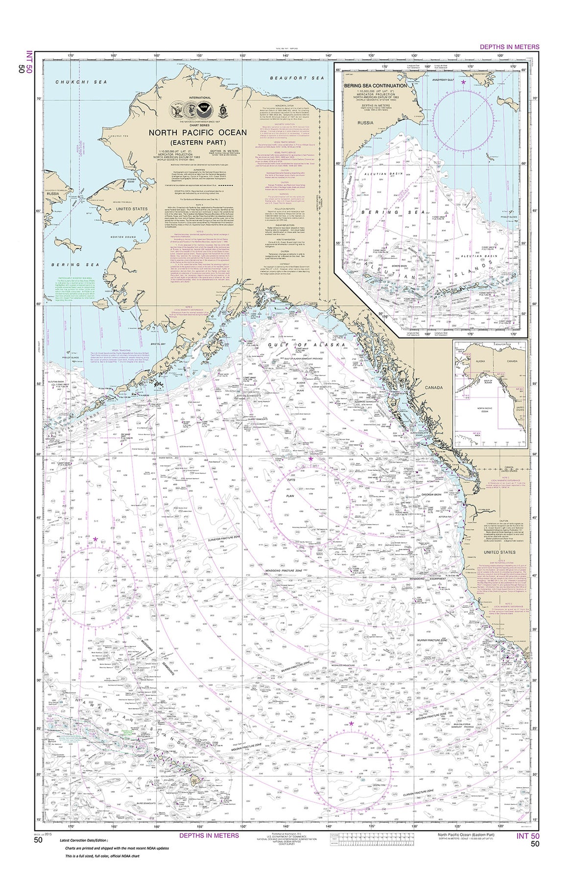

50
$ 18.95 $ 27.00
Official NOAA chart for the North Pacific Ocean (eastern part) Bering Sea Continuation This chart meets the requirements for mandatory carriage of nautical charts established by the U.S. Coast Guard...


530
$ 18.95 $ 27.00
North America West Coast San Diego to Aleutian Islands and Hawaiæian Islands


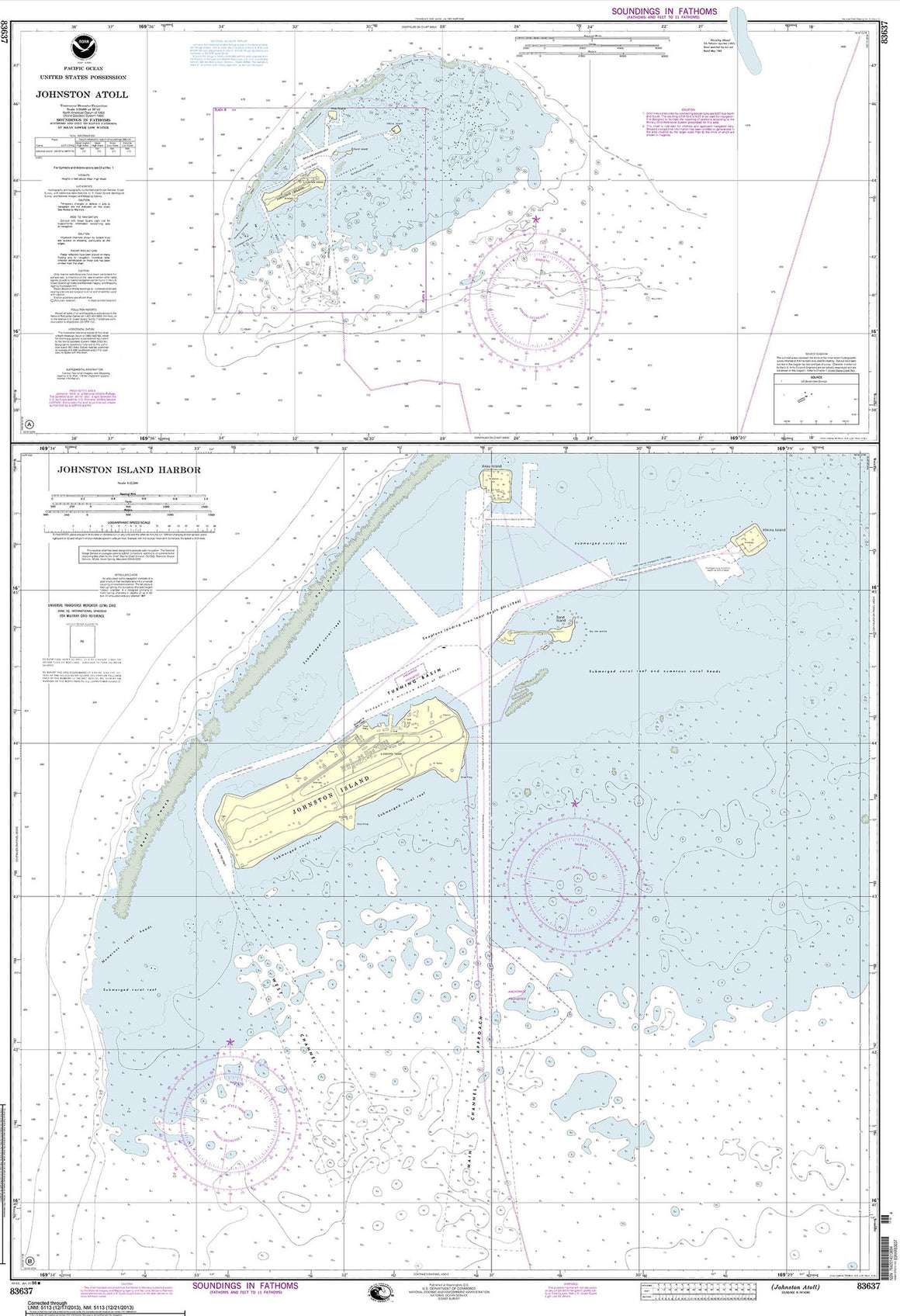
83633
$ 18.95 $ 27.00
United States Possession Approaches to Johnston Atoll


© 2025 FrugalNavigator.com. POS and Ecommerce by Shopify