1 to 80000

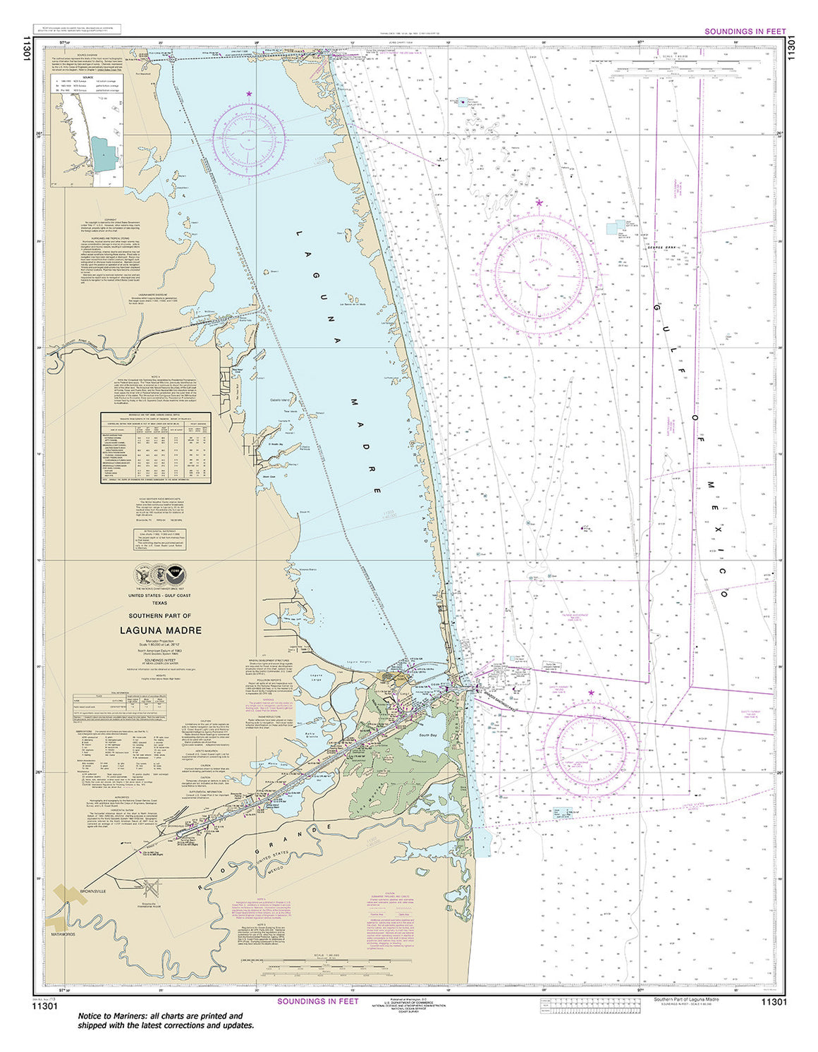

11301
$ 18.95 $ 27.00
Official NOAA Chart: Southern part of Laguna Madre Standard size: 35" wide by 45" tall If you would prefer a smaller, lighter and less bulky format for navigating, you may...

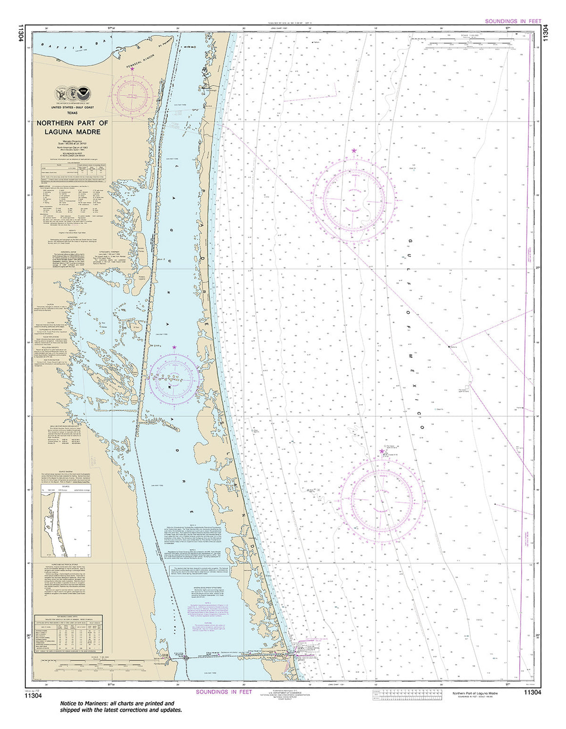
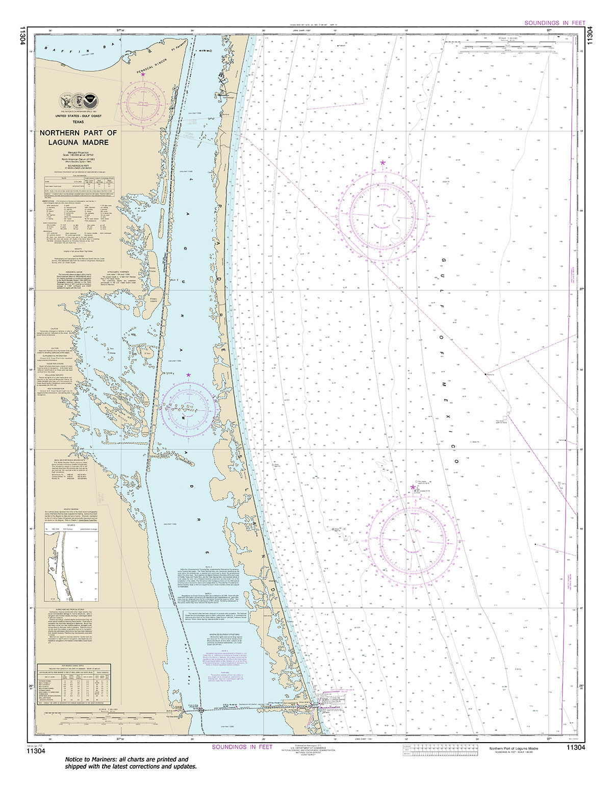
11304
$ 18.95 $ 27.00
Official NOAA Chart: Northern part of Laguna Madre Standard size: 35" wide by 45" tall If you would prefer a smaller, lighter and less bulky format for navigating, you may...

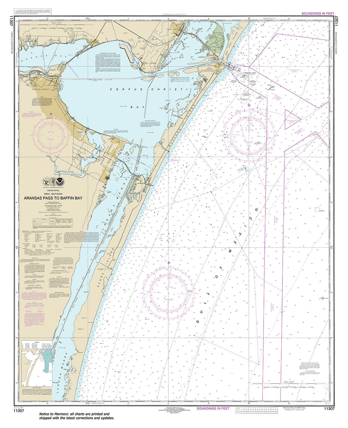

11307
$ 18.95 $ 27.00
Official NOAA Chart: Aransas Pass to Baffin Bay Standard size: 35" wide by 43" If you would prefer a smaller, lighter and less bulky format for navigating, you may want...

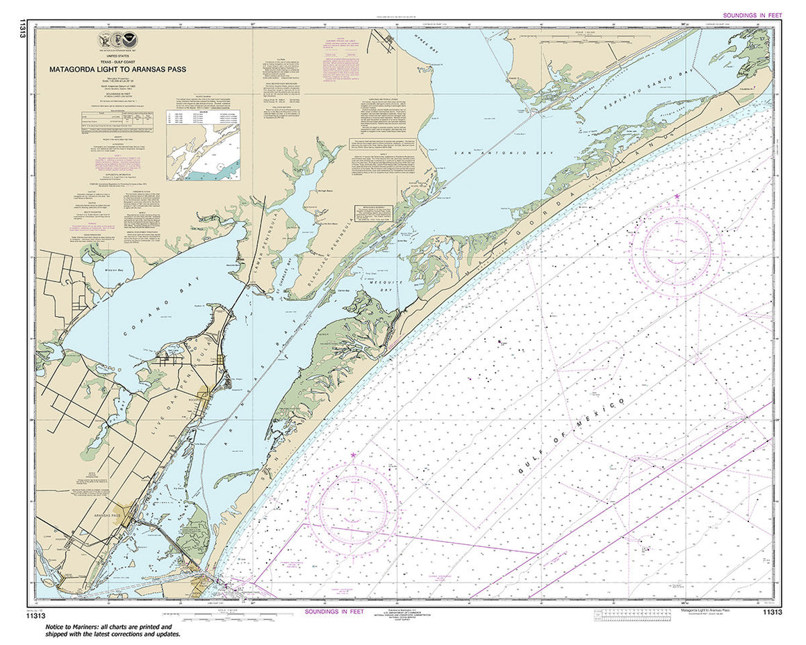

11313
$ 18.95 $ 27.00
Official NOAA Chart: Matagorda Light to Aransas Pass Standard size: 45" wide by 36" tall If you would prefer a smaller, lighter and less bulky format for navigating, you may...

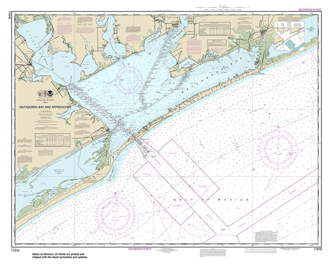

11316
$ 18.95 $ 27.00
Official NOAA Chart: Matagorda Bay and approaches Standard size: 45" wide by 36" tall If you would prefer a smaller, lighter and less bulky format for navigating, you may want...

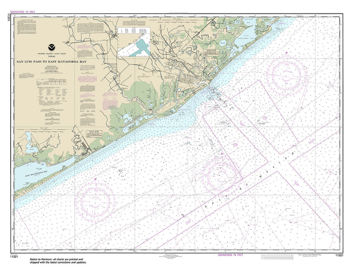
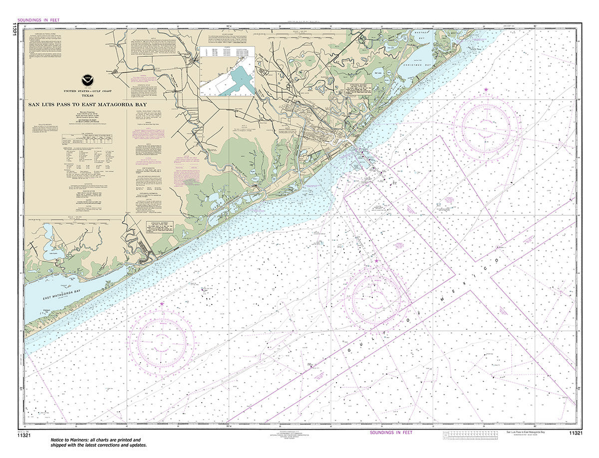
11321
$ 18.95 $ 27.00
Official NOAA Chart: San Luis Pass to East Matagorda Bay Standard size: 47" wide by 36" tall If you would prefer a smaller, lighter and less bulky format for navigating,...

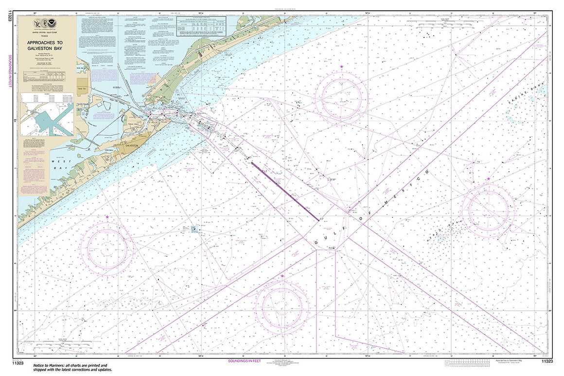
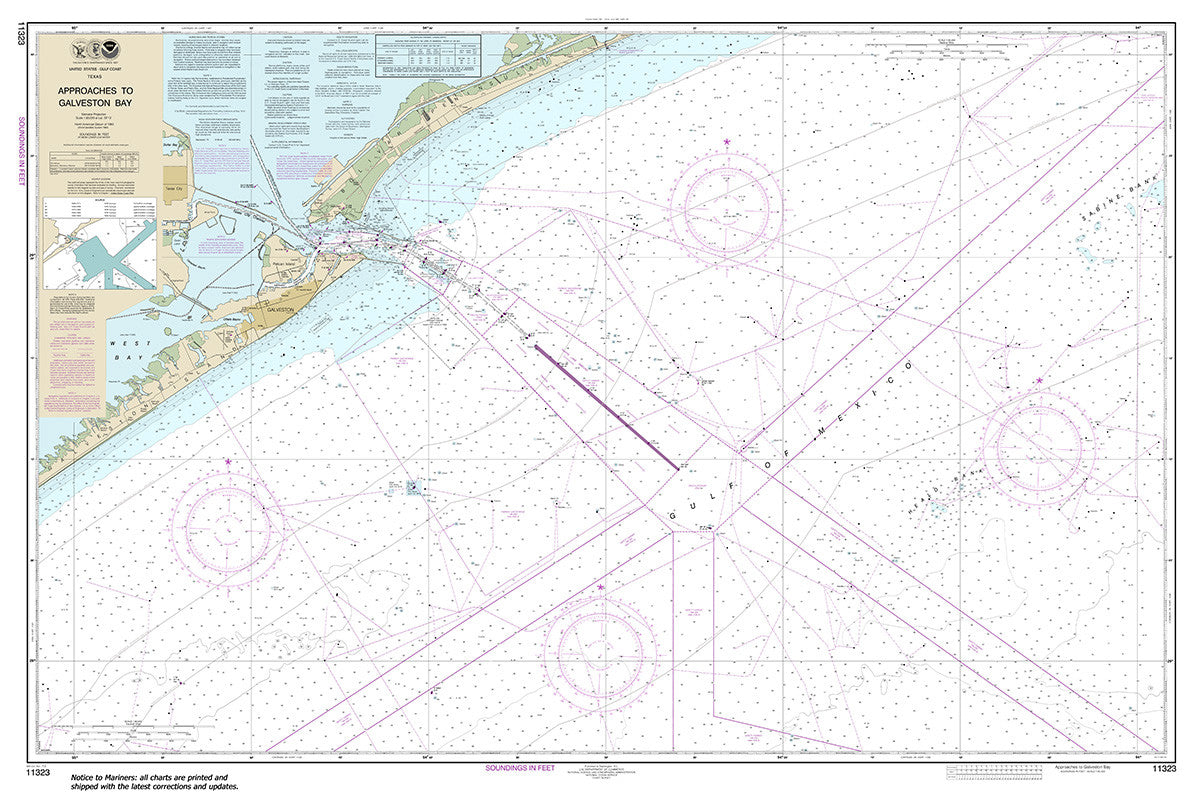
11323
$ 18.95 $ 27.00
Official NOAA Chart: Approaches to Galveston Bay Standard size: 54" wide by 36" tall If you would prefer a smaller, lighter and less bulky format for navigating, you may want...

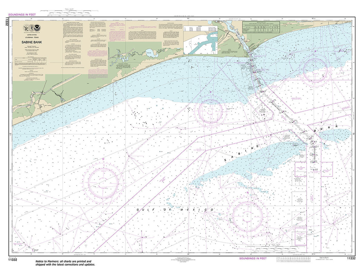

11332
$ 18.95 $ 27.00
Official NOAA Chart: Sabine Bank Standard size: 46" wide by 35" tall If you would prefer a smaller, lighter and less bulky format for navigating, you may want to choose...


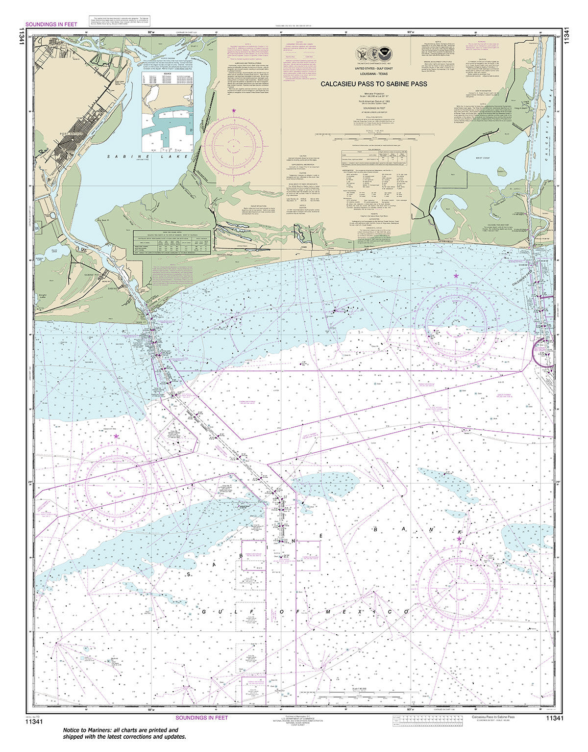
11341
$ 18.95 $ 27.00
Official NOAA Chart: Calcasieu Pass to Sabine Pass Standard size: 36" wide by 46" tall If you would prefer a smaller, lighter and less bulky format for navigating, you may...

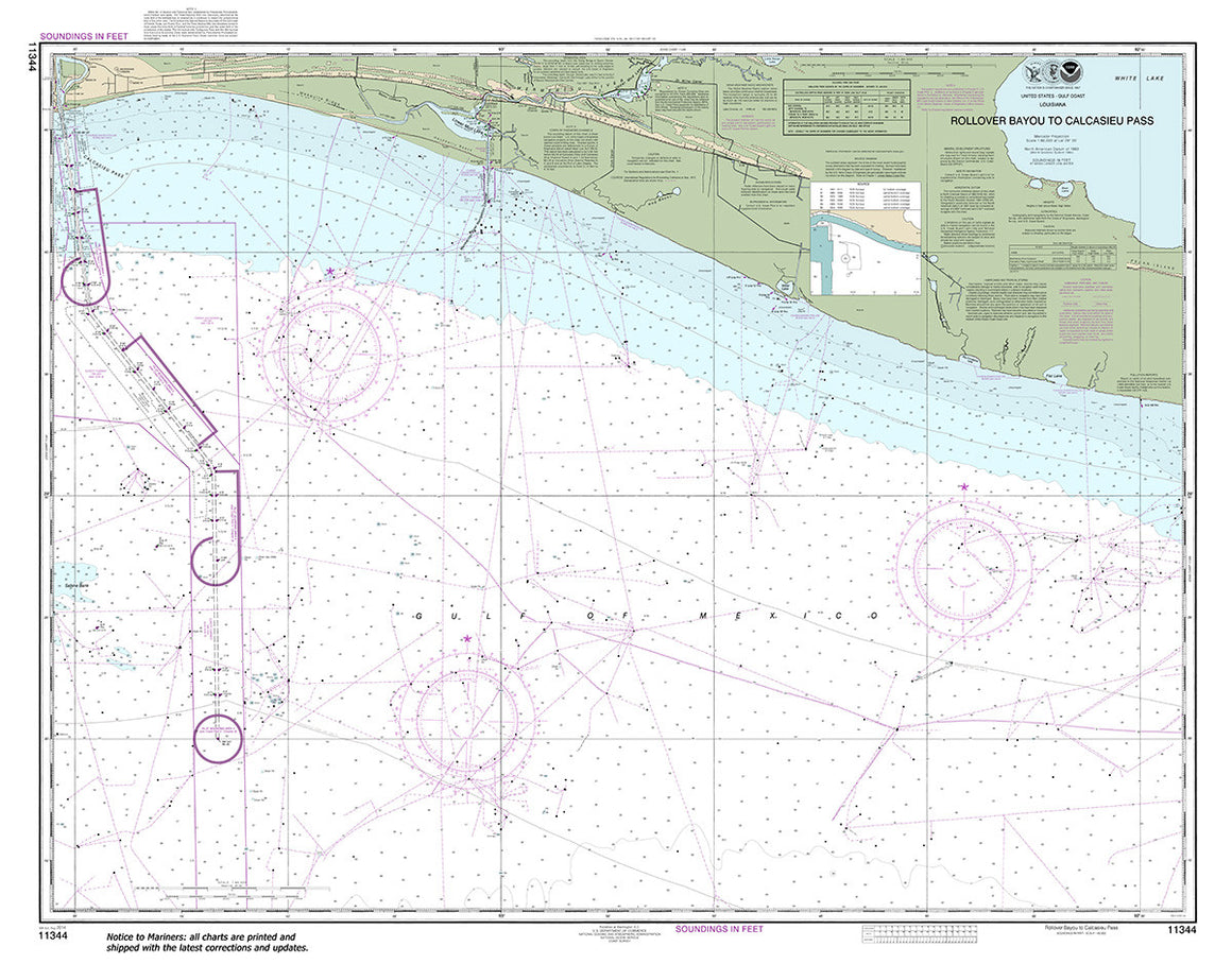
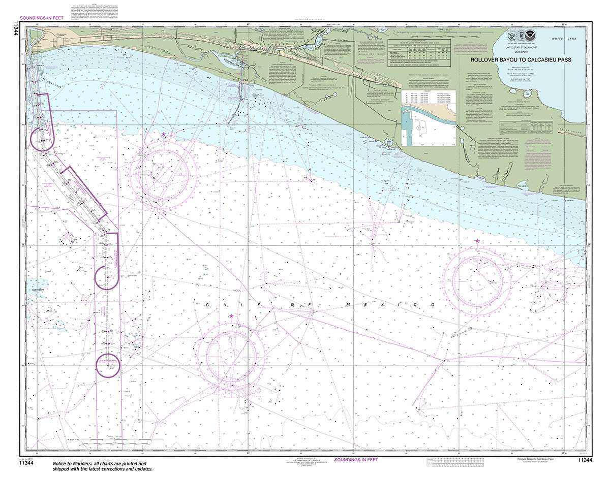
11344
$ 18.95 $ 27.00
Official NOAA Chart: Rollover Bayou to Calcasieu Pass Standard size: 46" wide by 36" tall If you would prefer a smaller, lighter and less bulky format for navigating, you may...


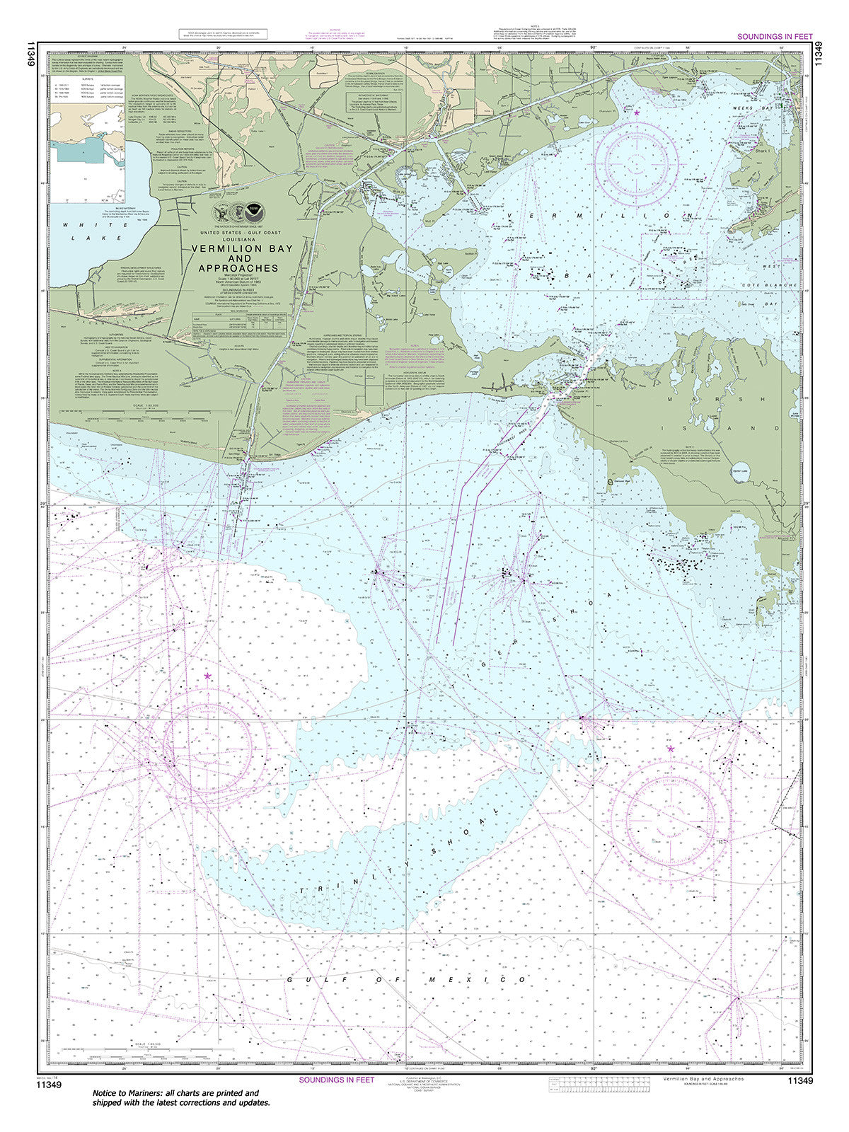
11349
$ 18.95 $ 27.00
Official NOAA Chart: Vermilion Bay and approaches Standard Size: 36" wide by 48" tall If you would prefer a smaller, lighter and less bulky format for navigating, you may want...


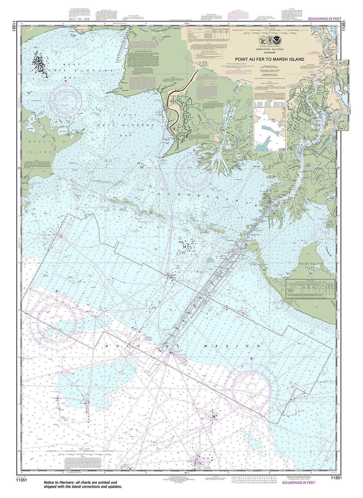
11351
$ 18.95 $ 27.00
Official NOAA Chart: Point au Fer to Marsh Island Standard size: 35" wide by 48" tall If you would prefer a smaller, lighter and less bulky format for navigating, you...


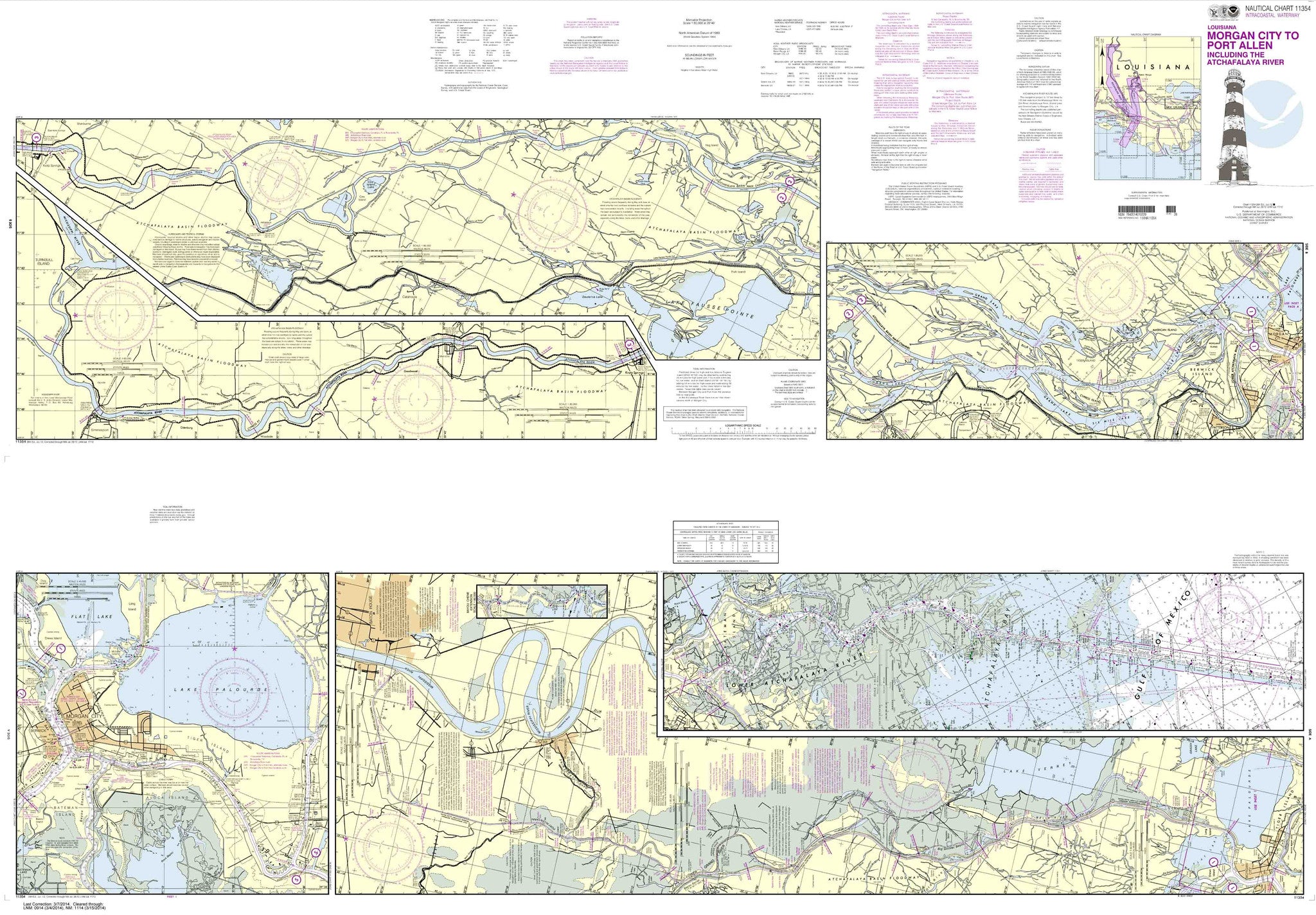
11354
Sold Out $ 27.00
Intracoastal Waterway Morgan City to Port Allen, including the Atchafalaya River These popular NOAA small craft charts are printed front and back. By default we ship them rolled on our...


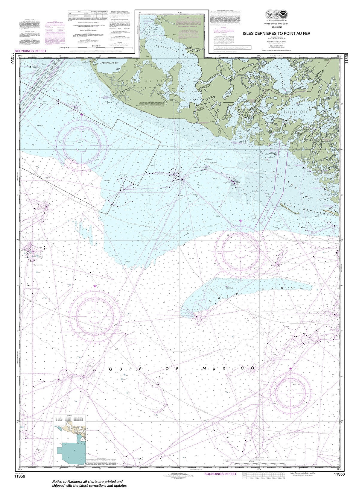
11356
$ 18.95 $ 27.00
Official NOAA Chart: Isles Dernieres to Point au Fer Standard size: 36" wide by 51" tall If you would prefer a smaller, lighter and less bulky format for navigating, you...


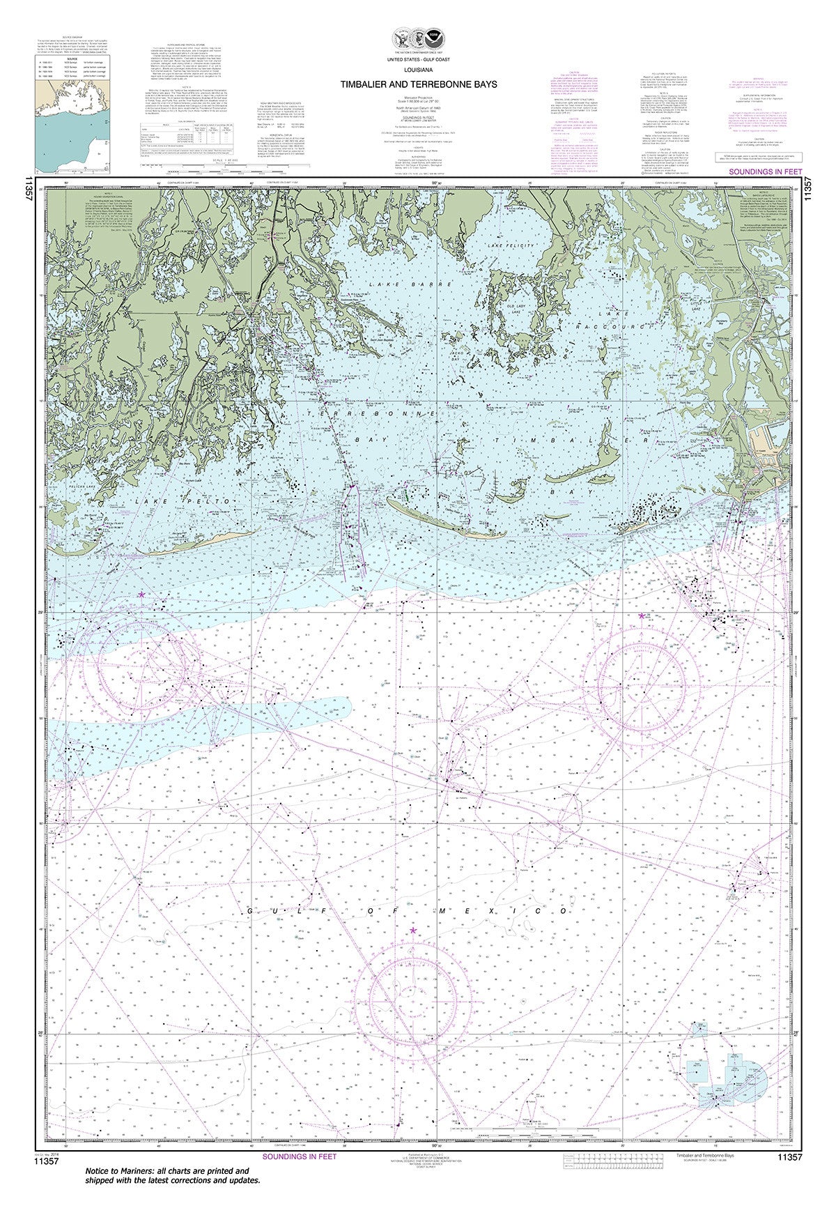
11357
$ 18.95 $ 27.00
Official NOAA Chart: Timbalier and Terrebonne Bays Standard size: 36" wide by 52" tall If you would prefer a smaller, lighter and less bulky format for navigating, you may want...


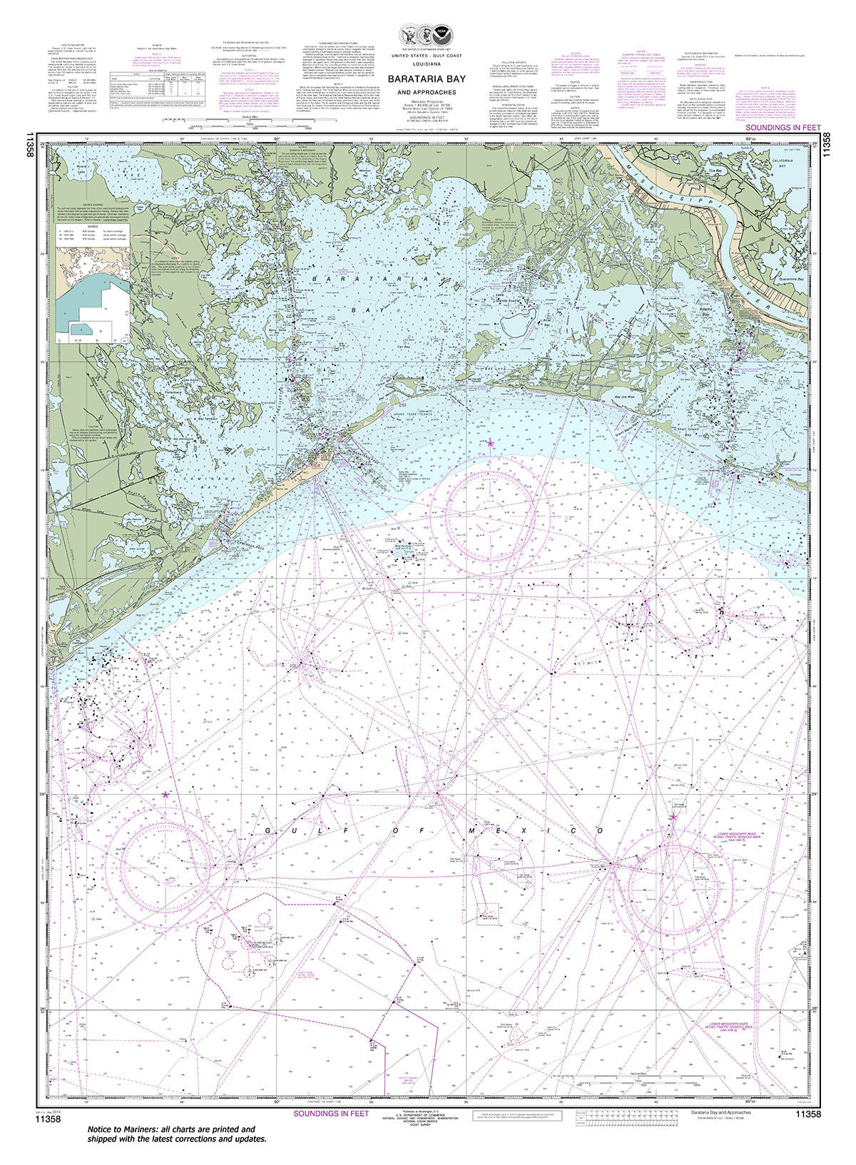
11358
$ 18.95 $ 27.00
Official NOAA Chart: Barataria Bay and approaches Standard Size: 36" wide by 39" tall If you would prefer a smaller, lighter and less bulky format for navigating, you may want...

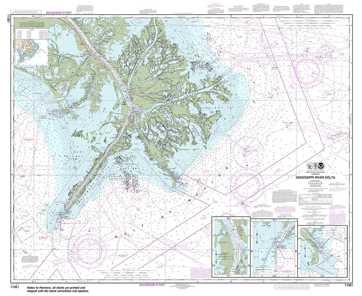
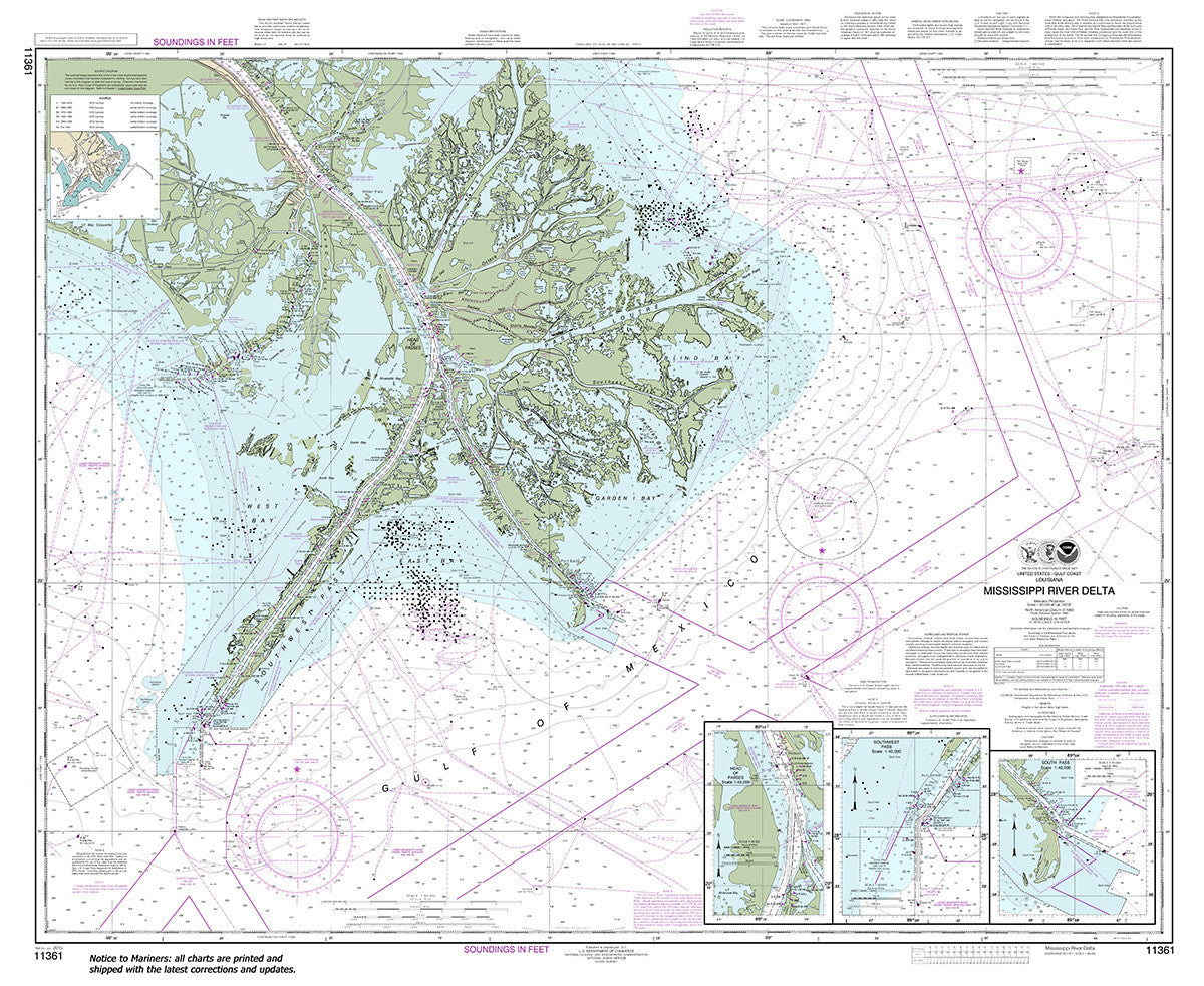
11361
$ 18.95 $ 27.00
Official NOAA Chart: Mississippi River Delta; Southwest Pass; South Pass; Head of Passes Standard size: 44" wide by 36" tall If you would prefer a smaller, lighter and less bulky...


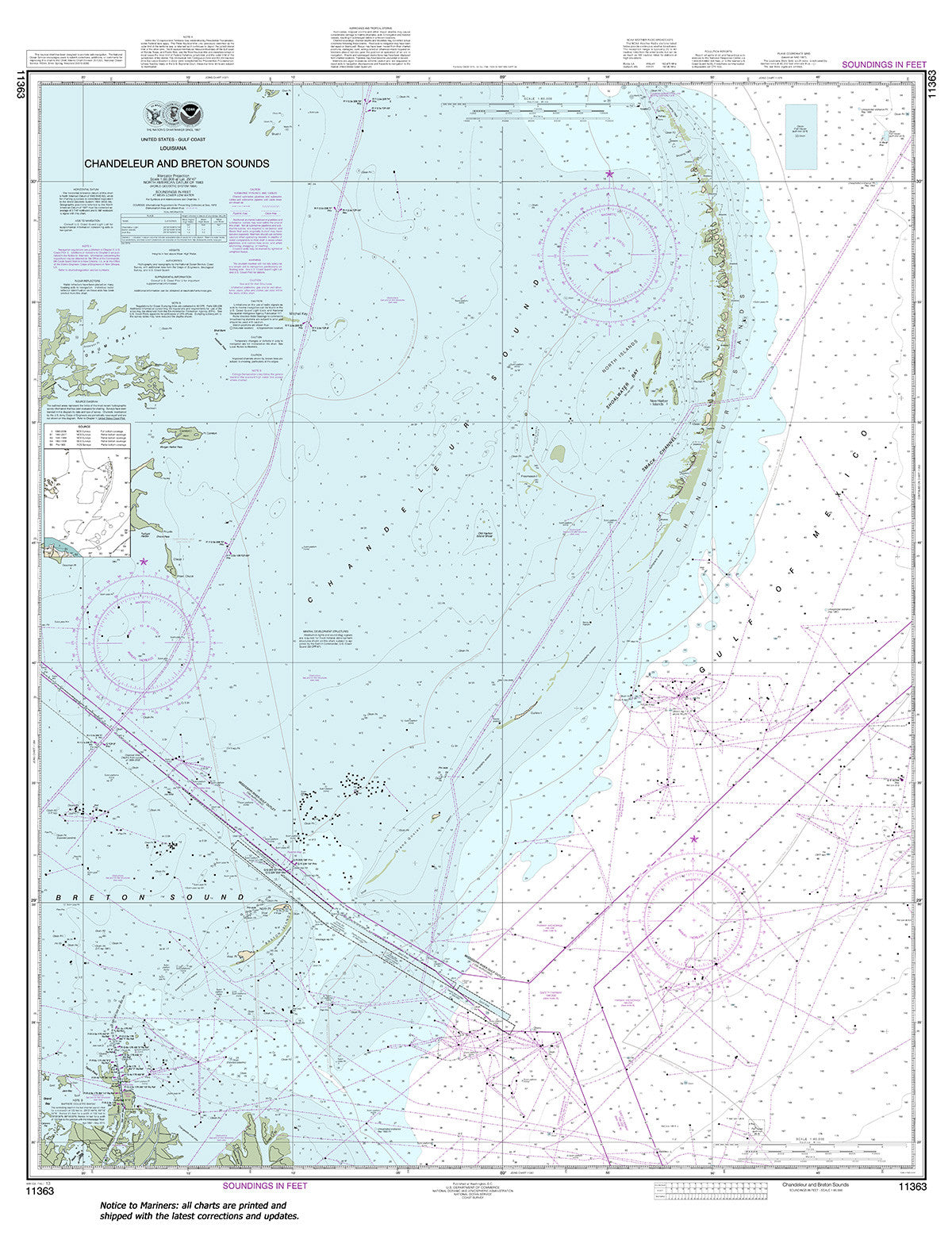
11363
$ 18.95 $ 27.00
Official NOAA Chart: Chandeleur and Breton Sounds Standard size: 36" wide by 47" tall If you would prefer a smaller, lighter and less bulky format for navigating, you may want...

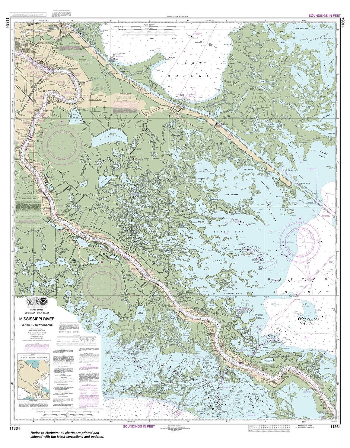
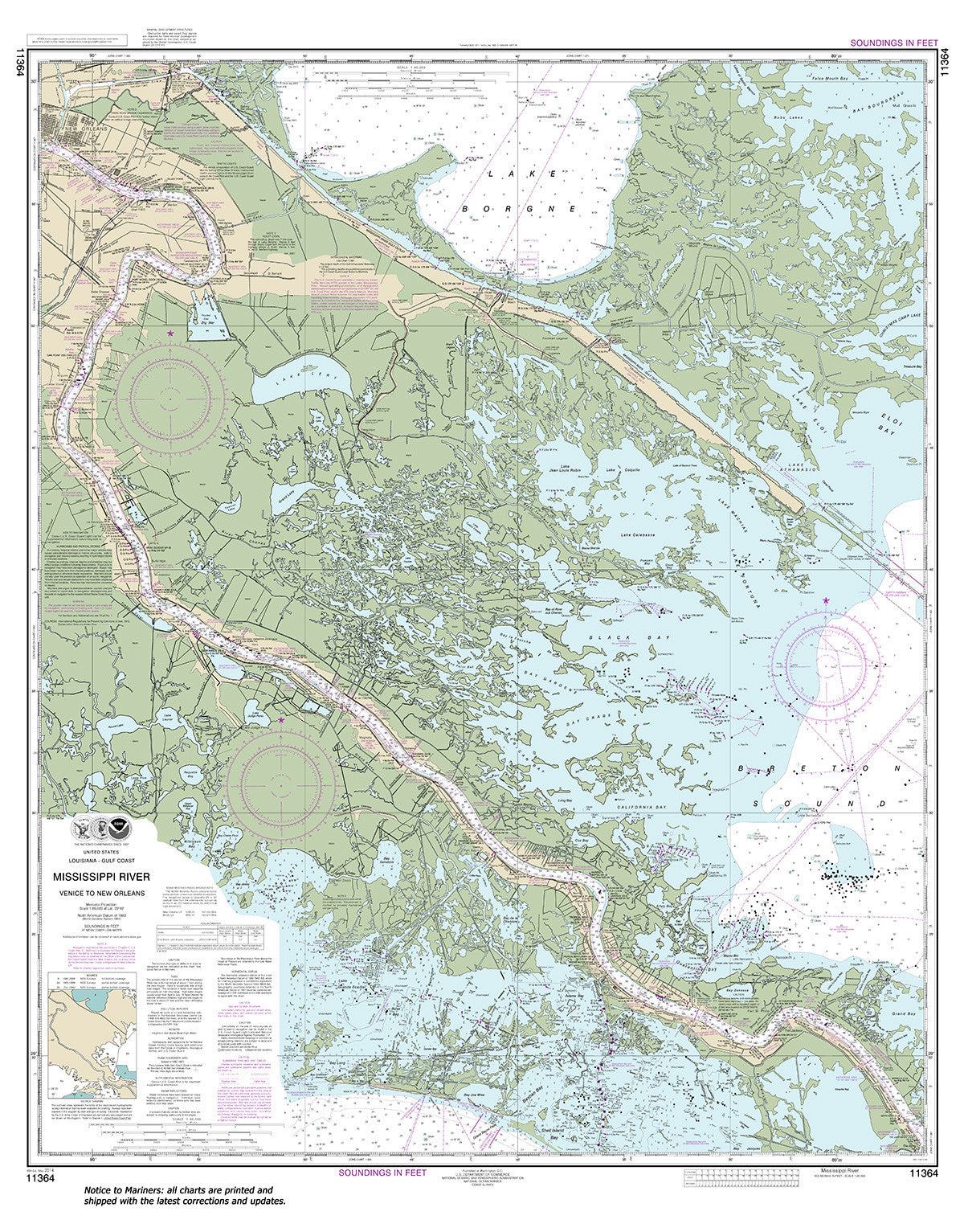
11364
$ 18.95 $ 27.00
Official NOAA Chart: Mississippi River-Venice to New Orleans Standard Size: 36" wide by 46" tall If you would prefer a smaller, lighter and less bulky format for navigating, you may...


11369
$ 18.95 $ 27.00
Official NOAA Chart of Lakes Pontchartrain and Maurepas. This nautical chart is printed from the most recent NOAA ENC data. Standard Chart : 46" by 35" Frugal Navigator uses the...

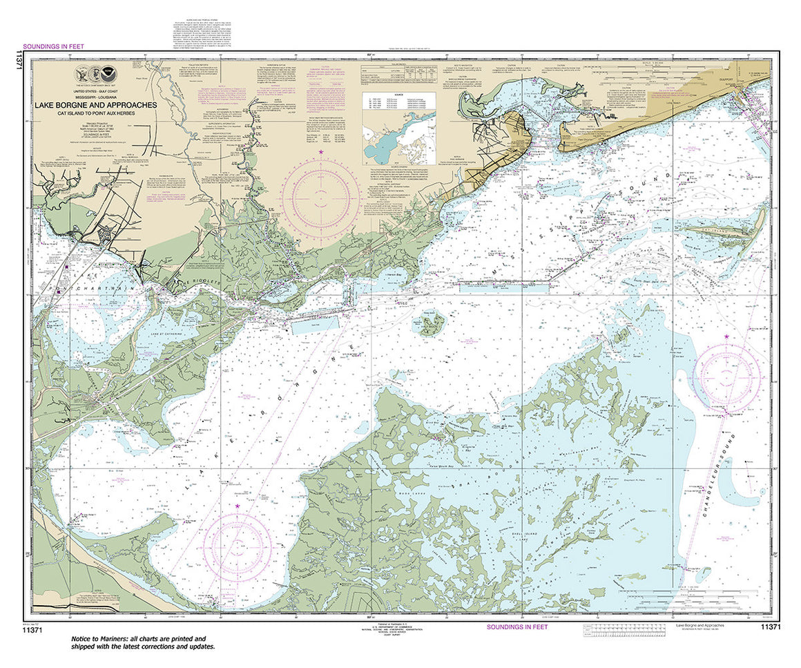

11371
$ 18.95 $ 27.00
Official NOAA Chart: Lake Borgne and approaches Cat Island to Point aux Herbes Standard size: 43" wide by 35" tall If you would prefer a smaller, lighter and less bulky...


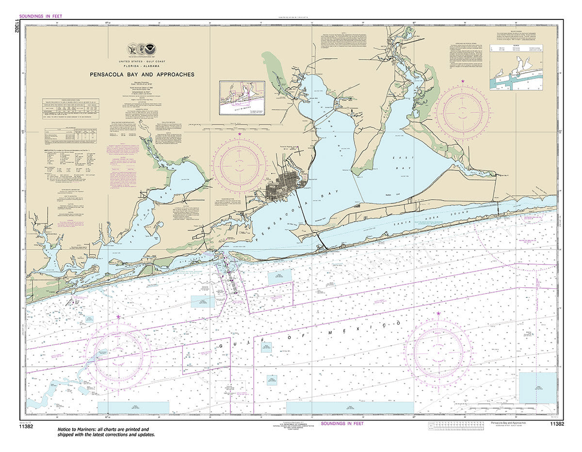
11382
$ 18.95 $ 27.00
Official NOAA Chart: Pensacola Bay and approaches Standard size: 45" wide by 35" tall If you would prefer a smaller, lighter and less bulky format for navigating, you may want...

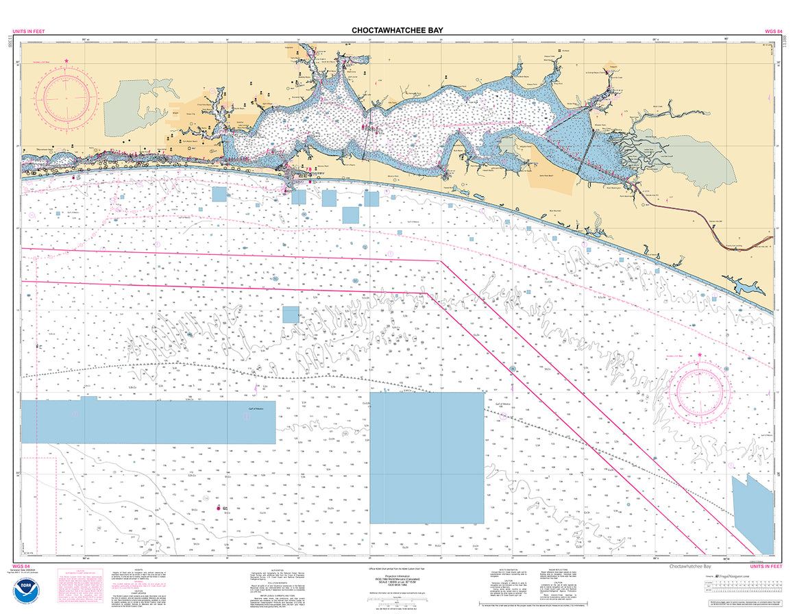
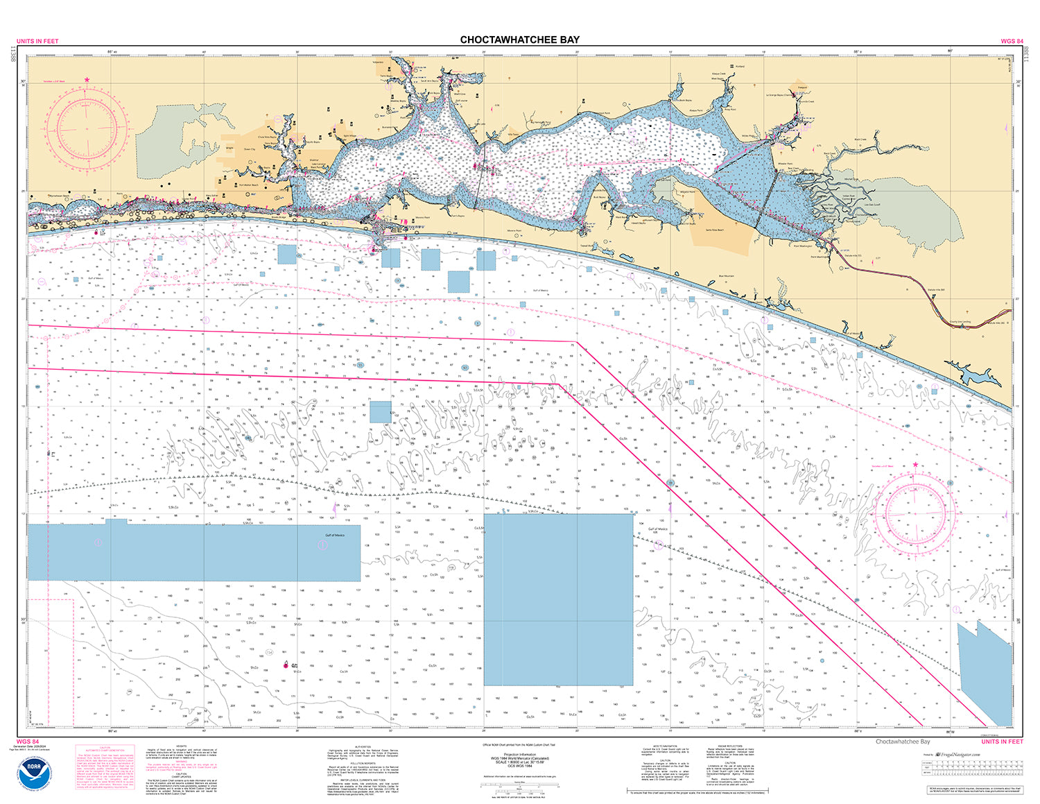
11388
$ 18.95 $ 27.00
Official NOAA Chart: Choctawhatchee Bay in Florida. This chart is printed from the most recent NOAA ENC data. Standard size: 34" wide by 44" Frugal Navigator uses the NOAA Custom...


11389
$ 18.95 $ 27.00
Official NOAA Chart of St Joseph and St Andrew Bays To see adjacent charts in this area please explore our Gulf Coast Catalog Standard size: 35" wide by 47" tall...
© 2025 FrugalNavigator.com. POS and Ecommerce by Shopify